Pasha elevation
Pasha (Leningradskaya Oblast'), Russia elevation is 9 meters and Pasha elevation in feet is 30 ft above sea level [src 1]. Pasha is a populated place (feature code) with elevation that is 190 meters (623 ft) smaller than average city elevation in Russia.
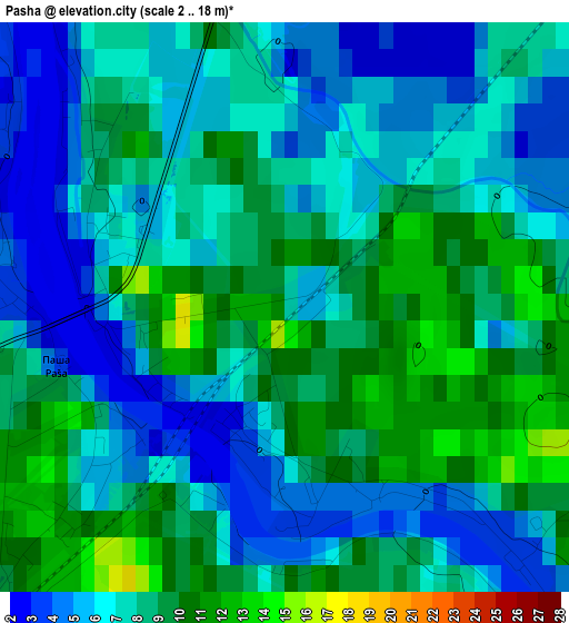
Below is the Elevation map of Pasha, which displays elevation range with different colors. Scale of the first map is from 2 to 18 m (7 to 59 ft) with average elevation of 7.2 meters (=24 ft) [note 1]
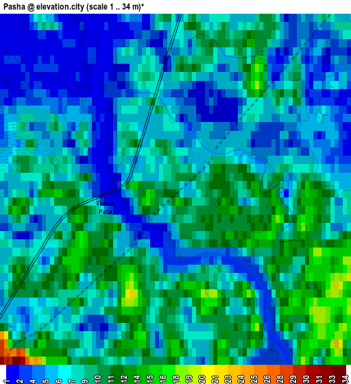
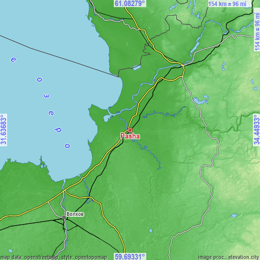
These maps also provides idea of topography and contour of this city, they are displayed at different zoom levels. More info about maps, scale and edge coordinates you can find below images.
| \ | Map #1 | Map #2 | Topo.Map |
| Scale [m] | 2..18 m | 1..34 m | × |
| Scale [ft] | 7..59 ft | 3..112 ft | × |
| Average | 7.2 m = 24 ft | 7.6 m = 25 ft | × |
| Width | 4.83 km = 3 mi | 9.66 km = 6 mi | 154.5 km = 96 mi |
| Height | 4.83 km = 3 mi | 9.66 km = 6 mi | 154.5 km = 96 mi |
| ↑Max Latitude | 60.417162° | 60.43885° | 61.08279° |
| Latitude at center | 60.39546° | 60.39546° | 60.39546° |
| ↓Min Latitude | 60.373743° | 60.352012° | 59.69331° |
| ← Min Longitude | 32.999135° | 32.955189° | 31.63683° |
| Longitude center | 33.04308° | 33.04308° | 33.04308° |
| →Max Longitude | 33.087025° | 33.130971° | 34.44933° |
Nearby cities:
Cities around Pasha sort by population:
• Volkhov elevation 35 m
65.2 km,  216°
216°
• Lodeynoye Pole 21 m
46.1 km,  37°
37°
• Podporozh’ye 56 m
84 km,  46°
46°
• Syas’stroy 9 m
38.9 km, 222°
• Olonets 15 m
65.6 km,  356°
356°
• Novaya Ladoga 13 m
52.3 km,  231°
231°
• Vazhiny 6 m
82.7 km, 40°
• Kolchanovo 29 m
49.1 km,  210°
210°
• Staraya Ladoga 16 m
60.5 km, 223°
• Khvalovo 34 m
52.6 km,  198°
198°
• Issad 15 m
53.1 km, 226°
• Yaroslavichi 74 m
81.1 km,  82°
82°
Multilingual:
 En español:
Pasha elevación 9 m.
 En France:
Pasha élévation 9 m.


Sources and notes:
- [note 1] Map square and city borders are not equal. Map elevation data is calculated only from area inside that square.
- [src 1] Elevation data from geonames database provided with same terms of usage.
- [src 2] The elevation map of Pasha is generated using GMTED2010 database with 7.5 arcsec (225m) resolution.
- [src 3] Base (background) map © OpenStreetMap contributors tiles are generated by Geofabrik and OpenTopoMap.
Copyright & License:
This Pasha Elevation Map is licensed under CC BY-SA. You may reuse any part from this page, if you give a proper credit by linking to this URL:
 More info on terms of use page.