Annino elevation
Annino (Moscow Oblast), Russia elevation is 182 meters and Annino elevation in feet is 597 ft above sea level [src 1]. Annino is a populated place (feature code) with elevation that is 17 meters (56 ft) smaller than average city elevation in Russia.
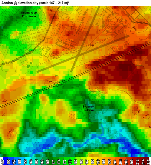
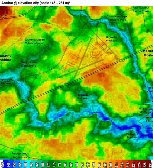
Below is the Elevation map of Annino, which displays elevation range with different colors. Scale of the first map is from 147 to 217 m (482 to 712 ft) with average elevation of 187.1 meters (=614 ft) [note 1]
These maps also provides idea of topography and contour of this city, they are displayed at different zoom levels. More info about maps, scale and edge coordinates you can find below images.
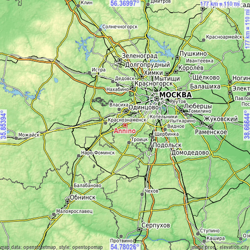
| \ | Map #1 | Map #2 | Topo.Map |
| Scale [m] | 147..217 m | 145..231 m | × |
| Scale [ft] | 482..712 ft | 476..758 ft | × |
| Average | 187.1 m = 614 ft | 186 m = 610 ft | × |
| Width | 5.52 km = 3.4 mi | 11.05 km = 6.9 mi | 176.8 km = 109.9 mi |
| Height | 5.52 km = 3.4 mi | 11.05 km = 6.9 mi | 176.7 km = 109.8 mi |
| ↑Max Latitude | 55.60799° | 55.632805° | 56.36997° |
| Latitude at center | 55.58316° | 55.58316° | 55.58316° |
| ↓Min Latitude | 55.558314° | 55.533452° | 54.78026° |
| ← Min Longitude | 37.216245° | 37.172299° | 35.85394° |
| Longitude center | 37.26019° | 37.26019° | 37.26019° |
| →Max Longitude | 37.304135° | 37.348081° | 38.66644° |
Nearby cities:
Cities around Annino sort by population:
• Odintsovo elevation 199 m
10.6 km,  5°
5°
• Solntsevo 178 m
9.7 km,  51°
51°
• Novo-Peredelkino 166 m
8.4 km,  34°
34°
• Vnukovo 190 m
3.9 km,  35°
35°
• Moskovskiy 185 m
6.2 km,  73°
73°
• Kokoshkino 193 m
5.9 km,  285°
285°
• Vatutinki 161 m
10.6 km,  155°
155°
• Vniissok 188 m
8.7 km,  339°
339°
• Lesnoy Gorodok 201 m
7 km,  332°
332°
• Posëlok Mar’ino 170 m
5.3 km,  134°
134°
• Filimonki 160 m
6.1 km,  117°
117°
• Tolstopal’tsevo 195 m
4 km,  318°
318°
Multilingual:
 En español:
Annino elevación 182 m.
 En France:
Annino élévation 182 m.


Sources and notes:
- [note 1] Map square and city borders are not equal. Map elevation data is calculated only from area inside that square.
- [src 1] Elevation data from geonames database provided with same terms of usage.
- [src 2] The elevation map of Annino is generated using elevation data from NASA's 3 arcsec (90m) resolution SRTM data.
- [src 3] Base (background) map © OpenStreetMap contributors tiles are generated by Geofabrik and OpenTopoMap.
Copyright & License:
This Annino Elevation Map is licensed under CC BY-SA. You may reuse any part from this page, if you give a proper credit by linking to this URL:
 More info on terms of use page.