Andreyevo elevation
Andreyevo (Vladimir), Russia elevation is 168 meters and Andreyevo elevation in feet is 551 ft above sea level [src 1]. Andreyevo is a populated place (feature code) with elevation that is 31 meters (102 ft) smaller than average city elevation in Russia.
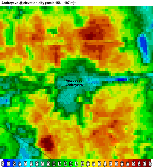
Below is the Elevation map of Andreyevo, which displays elevation range with different colors. Scale of the first map is from 156 to 197 m (512 to 646 ft) with average elevation of 178.2 meters (=585 ft) [note 1]
These maps also provides idea of topography and contour of this city, they are displayed at different zoom levels. More info about maps, scale and edge coordinates you can find below images.
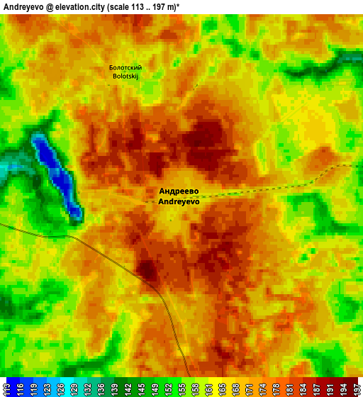
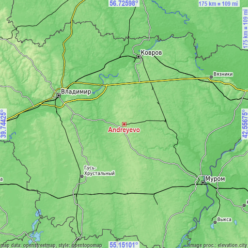
| \ | Map #1 | Map #2 | Topo.Map |
| Scale [m] | 156..197 m | 113..197 m | × |
| Scale [ft] | 512..646 ft | 371..646 ft | × |
| Average | 178.2 m = 585 ft | 167.3 m = 549 ft | × |
| Width | 5.47 km = 3.4 mi | 10.94 km = 6.8 mi | 175.1 km = 108.8 mi |
| Height | 5.47 km = 3.4 mi | 10.94 km = 6.8 mi | 175.1 km = 108.8 mi |
| ↑Max Latitude | 55.9711° | 55.995685° | 56.72598° |
| Latitude at center | 55.9465° | 55.9465° | 55.9465° |
| ↓Min Latitude | 55.921884° | 55.897253° | 55.15101° |
| ← Min Longitude | 41.106555° | 41.062609° | 39.74425° |
| Longitude center | 41.1505° | 41.1505° | 41.1505° |
| →Max Longitude | 41.194445° | 41.238391° | 42.55675° |
Nearby cities:
Cities around Andreyevo sort by population:
• Kameshkovo elevation 99 m
46 km,  349°
349°
• Sudogda 98 m
17.9 km,  272°
272°
• Krasnaya Gorbatka 111 m
39.2 km,  102°
102°
• Melekhovo 97 m
37.8 km,  13°
13°
• Orgtrud 114 m
42.4 km,  308°
308°
• Muromtsevo 117 m
15.2 km,  263°
263°
• Golovino 154 m
45.2 km, 272°
• Stepantsevo 123 m
40 km,  59°
59°
• Imeni Vorovskogo 139 m
24.9 km,  184°
184°
• Anopino 138 m
40.9 km,  227°
227°
• Krasnyy Oktyabr’ 129 m
22.7 km,  39°
39°
• Krasnyy Bogatyr’ 164 m
7.7 km, 350°
Multilingual:
 En español:
Andreyevo elevación 168 m.
 En France:
Andreyevo élévation 168 m.
 Auf Deutsch:
Andreyevo höhe über dem Meeresspiegel ist 168 m.

Sources and notes:
- [note 1] Map square and city borders are not equal. Map elevation data is calculated only from area inside that square.
- [src 1] Elevation data from geonames database provided with same terms of usage.
- [src 2] The elevation map of Andreyevo is generated using elevation data from NASA's 3 arcsec (90m) resolution SRTM data.
- [src 3] Base (background) map © OpenStreetMap contributors tiles are generated by Geofabrik and OpenTopoMap.
Copyright & License:
This Andreyevo Elevation Map is licensed under CC BY-SA. You may reuse any part from this page, if you give a proper credit by linking to this URL:
 More info on terms of use page.