Bylym elevation
Bylym (Kabardino-Balkariya Republic), Russia elevation is 1048 meters and Bylym elevation in feet is 3438 ft above sea level [src 1]. Bylym is a populated place (feature code) with elevation that is 849 meters (2785 ft) bigger than average city elevation in Russia.
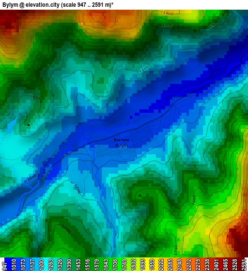
Below is the Elevation map of Bylym, which displays elevation range with different colors. Scale of the first map is from 947 to 2591 m (3107 to 8501 ft) with average elevation of 1406.7 meters (=4615 ft) [note 1]
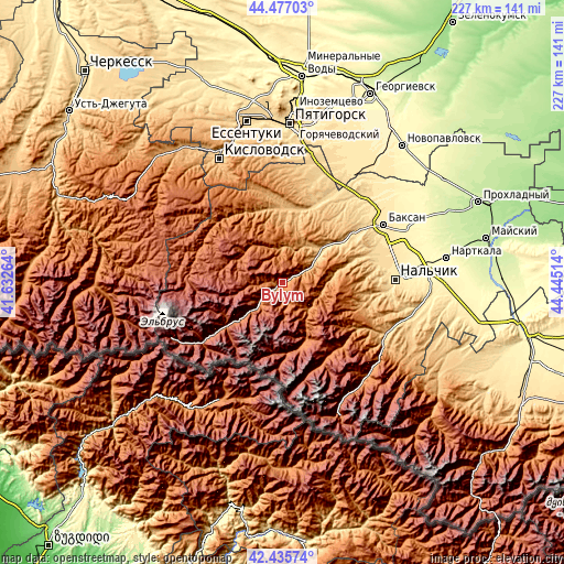
These maps also provides idea of topography and contour of this city, they are displayed at different zoom levels. More info about maps, scale and edge coordinates you can find below images.
| \ | Map #1 | Topo.Map |
| Scale [m] | 947..2591 m | × |
| Scale [ft] | 3107..8501 ft | × |
| Average | 1406.7 m = 4615 ft | × |
| Width | 7.09 km = 4.4 mi | 227 km = 141.1 mi |
| Height | 7.09 km = 4.4 mi | 227 km = 141.1 mi |
| ↑Max Latitude | 43.496887° | 44.47703° |
| Latitude at center | 43.465° | 43.465° |
| ↓Min Latitude | 43.433096° | 42.43574° |
| ← Min Longitude | 42.994945° | 41.63264° |
| Longitude center | 43.03889° | 43.03889° |
| →Max Longitude | 43.082835° | 44.44514° |
Nearby cities:
Cities around Bylym sort by population:
• Tyrnyauz elevation 1291 m
13.4 km,  226°
226°
• Chegem 2433 m
21.6 km,  159°
159°
• Zayukovo 709 m
29.1 km,  54°
54°
• Sarmakovo 686 m
33.8 km,  22°
22°
• Gundelen 809 m
18.2 km,  36°
36°
• Kamennomostskoye 821 m
30.3 km,  1°
1°
• Kyzburun Pervyy 573 m
35.4 km, 54°
• Lechinkay 726 m
33.6 km,  70°
70°
• Kamenka 555 m
39.3 km,  78°
78°
• El’brus 1792 m
39.4 km, 234°
• Verkhniy Kurkuzhin 804 m
31.9 km, 36°
• Zhankhoteko 800 m
17.7 km, 51°
Multilingual:
 En español:
Bylym elevación 1048 m.
 En France:
Bylym élévation 1048 m.


Sources and notes:
- [note 1] Map square and city borders are not equal. Map elevation data is calculated only from area inside that square.
- [src 1] Elevation data from geonames database provided with same terms of usage.
- [src 2] The elevation map of Bylym is generated using elevation data from NASA's 3 arcsec (90m) resolution SRTM data.
- [src 3] Base (background) map © OpenStreetMap contributors tiles are generated by Geofabrik and OpenTopoMap.
Copyright & License:
This Bylym Elevation Map is licensed under CC BY-SA. You may reuse any part from this page, if you give a proper credit by linking to this URL:
 More info on terms of use page.