Chaltyr elevation
Chaltyr (Rostov), Russia elevation is 56 meters and Chaltyr elevation in feet is 184 ft above sea level [src 1]. Chaltyr is a seat of a second-order administrative division (feature code) with elevation that is 143 meters (469 ft) smaller than average city elevation in Russia.
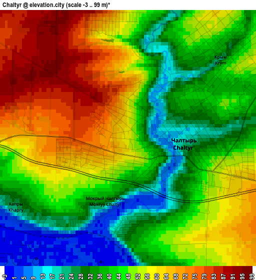
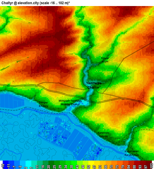
Below is the Elevation map of Chaltyr, which displays elevation range with different colors. Scale of the first map is from -3 to 99 m (-10 to 325 ft) with average elevation of 48.3 meters (=158 ft) [note 1]
These maps also provides idea of topography and contour of this city, they are displayed at different zoom levels. More info about maps, scale and edge coordinates you can find below images.
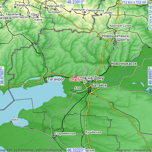
| \ | Map #1 | Map #2 | Topo.Map |
| Scale [m] | -3..99 m | -16..102 m | × |
| Scale [ft] | -10..325 ft | -52..335 ft | × |
| Average | 48.3 m = 158 ft | 46 m = 151 ft | × |
| Width | 6.63 km = 4.1 mi | 13.26 km = 8.2 mi | 212.1 km = 131.8 mi |
| Height | 6.63 km = 4.1 mi | 13.26 km = 8.2 mi | 212.1 km = 131.8 mi |
| ↑Max Latitude | 47.314572° | 47.344357° | 48.23011° |
| Latitude at center | 47.28477° | 47.28477° | 47.28477° |
| ↓Min Latitude | 47.254951° | 47.225115° | 46.32223° |
| ← Min Longitude | 39.438375° | 39.394429° | 38.07607° |
| Longitude center | 39.48232° | 39.48232° | 39.48232° |
| →Max Longitude | 39.526265° | 39.570211° | 40.88857° |
Nearby cities:
Cities around Chaltyr sort by population:
• Rostov-na-Donu elevation 74 m
19.1 km,  108°
108°
• Bataysk 7 m
26 km,  128°
128°
• Azov 39 m
20.3 km,  194°
194°
• Aksay 72 m
29.2 km,  95°
95°
• Persianovka 26 m
27.7 km,  349°
349°
• Kuleshovka 6 m
23.7 km,  166°
166°
• Krym 48 m
3.1 km,  56°
56°
• Sinyavskoye 30 m
15.4 km,  266°
266°
• Peshkovo 11 m
30.4 km, 193°
• Kalinin 37 m
4.7 km,  152°
152°
• Tanais 23 m
11.3 km,  260°
260°
• Nedvigovka 27 m
10.2 km, 259°
Multilingual:
 En español:
Chaltyr elevación 56 m.
 En France:
Chaltyr élévation 56 m.


Sources and notes:
- [note 1] Map square and city borders are not equal. Map elevation data is calculated only from area inside that square.
- [src 1] Elevation data from geonames database provided with same terms of usage.
- [src 2] The elevation map of Chaltyr is generated using elevation data from NASA's 3 arcsec (90m) resolution SRTM data.
- [src 3] Base (background) map © OpenStreetMap contributors tiles are generated by Geofabrik and OpenTopoMap.
Copyright & License:
This Chaltyr Elevation Map is licensed under CC BY-SA. You may reuse any part from this page, if you give a proper credit by linking to this URL:
 More info on terms of use page.