Chemodanovka elevation
Chemodanovka (Penza), Russia elevation is 178 meters and Chemodanovka elevation in feet is 584 ft above sea level [src 1]. Chemodanovka is a populated place (feature code) with elevation that is 21 meters (69 ft) smaller than average city elevation in Russia.
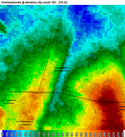
Below is the Elevation map of Chemodanovka, which displays elevation range with different colors. Scale of the first map is from 163 to 216 m (535 to 709 ft) with average elevation of 184.3 meters (=605 ft) [note 1]
These maps also provides idea of topography and contour of this city, they are displayed at different zoom levels. More info about maps, scale and edge coordinates you can find below images.
| \ | Map #1 | Map #2 | Topo.Map |
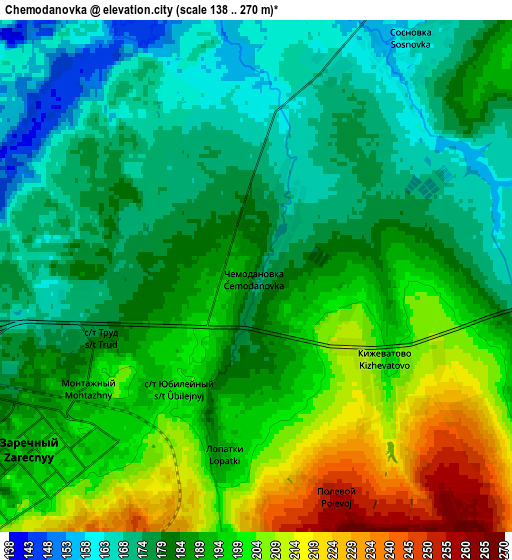
| Scale [m] | 163..216 m | 138..270 m | × |
| Scale [ft] | 535..709 ft | 453..886 ft | × |
| Average | 184.3 m = 605 ft | 187.4 m = 615 ft | × |
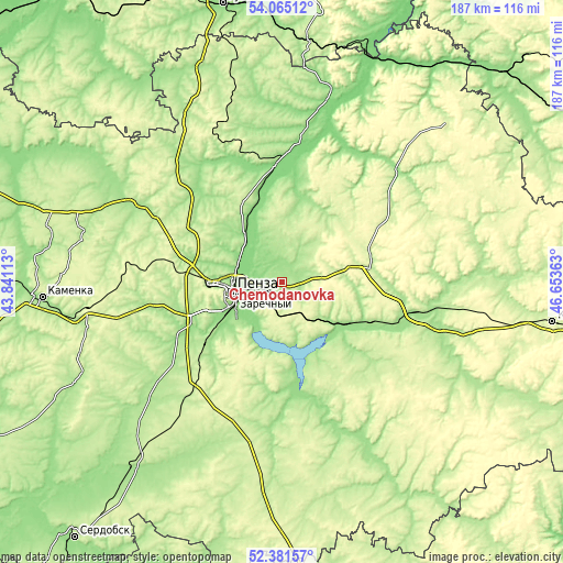
| Width | 5.85 km = 3.6 mi | 11.7 km = 7.3 mi | 187.2 km = 116.3 mi |
| Height | 5.85 km = 3.6 mi | 11.7 km = 7.3 mi | 187.2 km = 116.3 mi |
| ↑Max Latitude | 53.257917° | 53.284197° | 54.06512° |
| Latitude at center | 53.23162° | 53.23162° | 53.23162° |
| ↓Min Latitude | 53.205307° | 53.178978° | 52.38157° |
| ← Min Longitude | 45.203435° | 45.159489° | 43.84113° |
| Longitude center | 45.24738° | 45.24738° | 45.24738° |
| →Max Longitude | 45.291325° | 45.335271° | 46.65363° |
Nearby cities:
Cities around Chemodanovka sort by population:
• Penza elevation 150 m
16.5 km,  257°
257°
• Zarechnyy 194 m
4.8 km,  229°
229°
• Bessonovka 136 m
16.3 km,  302°
302°
• Gorodishche 202 m
30.6 km,  80°
80°
• Lunino 147 m
40.1 km,  358°
358°
• Sursk 217 m
33.9 km,  120°
120°
• Grabovo 171 m
21.2 km,  324°
324°
• Chaadayevka 165 m
45.4 km,  102°
102°
• Shemysheyka 169 m
39 km,  165°
165°
• Zasechnoye 150 m
17.6 km,  219°
219°
• Bogoslovka 207 m
29.8 km,  265°
265°
• Kanayevka 173 m
25.1 km, 123°
Multilingual:
 En español:
Chemodanovka elevación 178 m.
 En France:
Chemodanovka élévation 178 m.
 Auf Deutsch:
Chemodanovka höhe über dem Meeresspiegel ist 178 m.

Sources and notes:
- [note 1] Map square and city borders are not equal. Map elevation data is calculated only from area inside that square.
- [src 1] Elevation data from geonames database provided with same terms of usage.
- [src 2] The elevation map of Chemodanovka is generated using elevation data from NASA's 3 arcsec (90m) resolution SRTM data.
- [src 3] Base (background) map © OpenStreetMap contributors tiles are generated by Geofabrik and OpenTopoMap.
Copyright & License:
This Chemodanovka Elevation Map is licensed under CC BY-SA. You may reuse any part from this page, if you give a proper credit by linking to this URL:
 More info on terms of use page.