Gizel’ elevation
Gizel’ (North Ossetia), Russia elevation is 642 meters and Gizel’ elevation in feet is 2106 ft above sea level [src 1]. Gizel’ is a populated place (feature code) with elevation that is 443 meters (1453 ft) bigger than average city elevation in Russia.
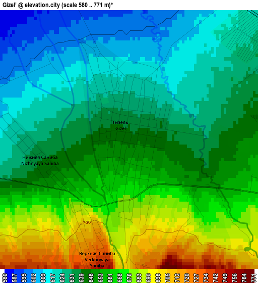
Below is the Elevation map of Gizel’, which displays elevation range with different colors. Scale of the first map is from 580 to 771 m (1903 to 2530 ft) with average elevation of 646.5 meters (=2121 ft) [note 1]
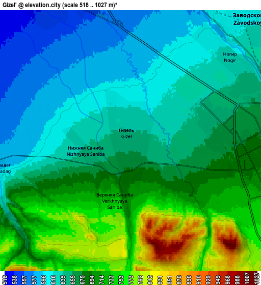
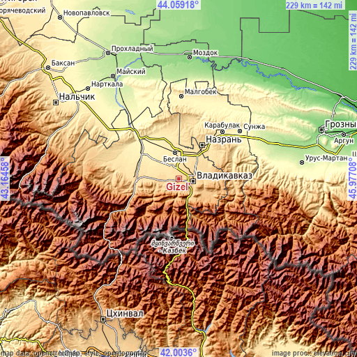
These maps also provides idea of topography and contour of this city, they are displayed at different zoom levels. More info about maps, scale and edge coordinates you can find below images.
| \ | Map #1 | Map #2 | Topo.Map |
| Scale [m] | 580..771 m | 518..1027 m | × |
| Scale [ft] | 1903..2530 ft | 1699..3369 ft | × |
| Average | 646.5 m = 2121 ft | 667.3 m = 2189 ft | × |
| Width | 7.14 km = 4.4 mi | 14.29 km = 8.9 mi | 228.6 km = 142 mi |
| Height | 7.14 km = 4.4 mi | 14.29 km = 8.9 mi | 228.5 km = 142 mi |
| ↑Max Latitude | 43.07211° | 43.104204° | 44.05918° |
| Latitude at center | 43.04° | 43.04° | 43.04° |
| ↓Min Latitude | 43.007873° | 42.975729° | 42.0036° |
| ← Min Longitude | 44.526885° | 44.482939° | 43.16458° |
| Longitude center | 44.57083° | 44.57083° | 44.57083° |
| →Max Longitude | 44.614775° | 44.658721° | 45.97708° |
Nearby cities:
Cities around Gizel’ sort by population:
• Vladikavkaz elevation 671 m
7.9 km,  92°
92°
• Beslan 494 m
17.1 km,  352°
352°
• Kantyshevo 542 m
21.5 km,  13°
13°
• Sunzha 685 m
20.6 km,  84°
84°
• Nogir 623 m
7.1 km,  49°
49°
• Mikhaylovskoye 605 m
8.3 km,  36°
36°
• Dalakovo 537 m
22 km,  3°
3°
• Chermen 572 m
16.9 km, 42°
• Arkhonskaya 534 m
9.1 km,  328°
328°
• Kambileyevskoye 632 m
15.3 km,  73°
73°
• Dachnoye 626 m
14.3 km, 69°
• Tarskoye 786 m
18.6 km,  116°
116°
Multilingual:
 En español:
Gizel’ elevación 642 m.
 En France:
Gizel’ élévation 642 m.


Sources and notes:
- [note 1] Map square and city borders are not equal. Map elevation data is calculated only from area inside that square.
- [src 1] Elevation data from geonames database provided with same terms of usage.
- [src 2] The elevation map of Gizel’ is generated using elevation data from NASA's 3 arcsec (90m) resolution SRTM data.
- [src 3] Base (background) map © OpenStreetMap contributors tiles are generated by Geofabrik and OpenTopoMap.
Copyright & License:
This Gizel’ Elevation Map is licensed under CC BY-SA. You may reuse any part from this page, if you give a proper credit by linking to this URL:
 More info on terms of use page.