Gorelki elevation
Gorelki (Tula), Russia elevation is 195 meters and Gorelki elevation in feet is 640 ft above sea level [src 1]. Gorelki is a section of populated place (feature code) with elevation that is 4 meters (13 ft) smaller than average city elevation in Russia.
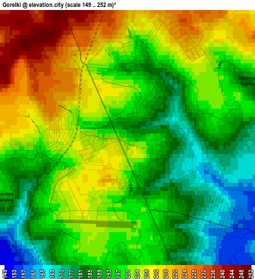
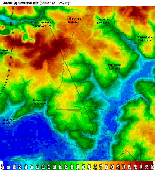
Below is the Elevation map of Gorelki, which displays elevation range with different colors. Scale of the first map is from 149 to 252 m (489 to 827 ft) with average elevation of 198.6 meters (=652 ft) [note 1]
These maps also provides idea of topography and contour of this city, they are displayed at different zoom levels. More info about maps, scale and edge coordinates you can find below images.
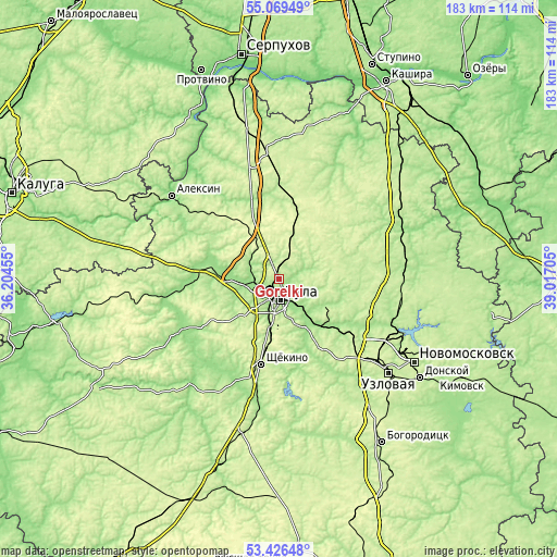
| \ | Map #1 | Map #2 | Topo.Map |
| Scale [m] | 149..252 m | 147..252 m | × |
| Scale [ft] | 489..827 ft | 482..827 ft | × |
| Average | 198.6 m = 652 ft | 193.5 m = 635 ft | × |
| Width | 5.71 km = 3.5 mi | 11.42 km = 7.1 mi | 182.7 km = 113.5 mi |
| Height | 5.71 km = 3.5 mi | 11.42 km = 7.1 mi | 182.7 km = 113.5 mi |
| ↑Max Latitude | 54.281833° | 54.30748° | 55.06949° |
| Latitude at center | 54.25617° | 54.25617° | 54.25617° |
| ↓Min Latitude | 54.230491° | 54.204796° | 53.42648° |
| ← Min Longitude | 37.566855° | 37.522909° | 36.20455° |
| Longitude center | 37.6108° | 37.6108° | 37.6108° |
| →Max Longitude | 37.654745° | 37.698691° | 39.01705° |
Nearby cities:
Cities around Gorelki sort by population:
• Tula elevation 161 m
6.7 km,  175°
175°
• Shchëkino 241 m
28.5 km,  191°
191°
• Yasnogorsk 252 m
25.6 km,  12°
12°
• Kosaya Gora 233 m
15.9 km,  195°
195°
• Skuratovskiy 250 m
17.2 km, 181°
• Pervomayskiy 239 m
24.4 km, 195°
• Bolokhovo 237 m
23.9 km,  143°
143°
• Leninskiy 180 m
10.4 km,  289°
289°
• Mendeleyevskiy 244 m
13.3 km, 186°
• Rozhdestvenskiy 211 m
5.1 km,  329°
329°
• Barsuki 183 m
8.1 km,  277°
277°
• Revyakino 252 m
12.6 km,  15°
15°
Multilingual:
 En español:
Gorelki elevación 195 m.
 En France:
Gorelki élévation 195 m.


Sources and notes:
- [note 1] Map square and city borders are not equal. Map elevation data is calculated only from area inside that square.
- [src 1] Elevation data from geonames database provided with same terms of usage.
- [src 2] The elevation map of Gorelki is generated using elevation data from NASA's 3 arcsec (90m) resolution SRTM data.
- [src 3] Base (background) map © OpenStreetMap contributors tiles are generated by Geofabrik and OpenTopoMap.
Copyright & License:
This Gorelki Elevation Map is licensed under CC BY-SA. You may reuse any part from this page, if you give a proper credit by linking to this URL:
 More info on terms of use page.