Kotlas elevation
Kotlas (Arkhangelskaya), Russia elevation is 84 meters and Kotlas elevation in feet is 276 ft above sea level [src 1]. Kotlas is a populated place (feature code) with elevation that is 115 meters (377 ft) smaller than average city elevation in Russia.
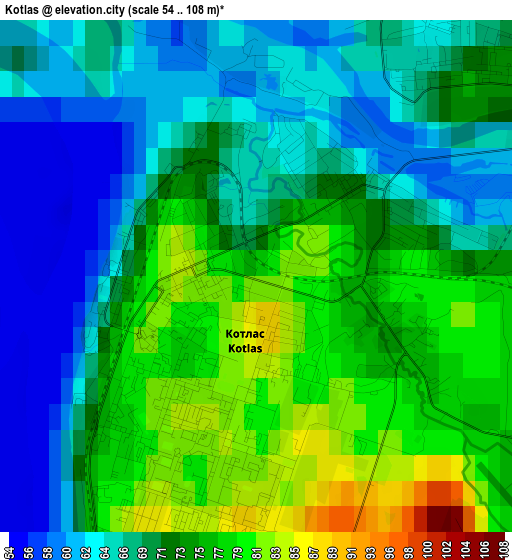
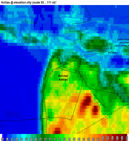
Below is the Elevation map of Kotlas, which displays elevation range with different colors. Scale of the first map is from 54 to 108 m (177 to 354 ft) with average elevation of 71.3 meters (=234 ft) [note 1]
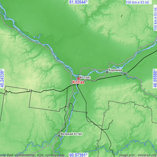
These maps also provides idea of topography and contour of this city, they are displayed at different zoom levels. More info about maps, scale and edge coordinates you can find below images.
| \ | Map #1 | Map #2 | Topo.Map |
| Scale [m] | 54..108 m | 52..111 m | × |
| Scale [ft] | 177..354 ft | 171..364 ft | × |
| Average | 71.3 m = 234 ft | 67.1 m = 220 ft | × |
| Width | 4.7 km = 2.9 mi | 9.4 km = 5.8 mi | 150.4 km = 93.5 mi |
| Height | 4.7 km = 2.9 mi | 9.4 km = 5.8 mi | 150.4 km = 93.5 mi |
| ↑Max Latitude | 61.278575° | 61.299686° | 61.92644° |
| Latitude at center | 61.25745° | 61.25745° | 61.25745° |
| ↓Min Latitude | 61.236311° | 61.215157° | 60.57391° |
| ← Min Longitude | 46.605685° | 46.561739° | 45.24338° |
| Longitude center | 46.64963° | 46.64963° | 46.64963° |
| →Max Longitude | 46.693575° | 46.737521° | 48.05588° |
Nearby cities:
Cities around Kotlas sort by population:
• Koryazhma elevation 90 m
28.5 km,  77°
77°
• Velikiy Ustyug 72 m
58 km,  198°
198°
• Vychegodskiy 76 m
13.4 km,  94°
94°
• Krasavino 70 m
34 km, 195°
• Krasnoborsk 51 m
50.8 km,  311°
311°
• Shipitsyno 66 m
7.3 km,  290°
290°
• Privodino 66 m
21.7 km, 201°
• Il’insko-Podomskoye 102 m
73 km,  102°
102°
• Udimskiy 201 m
41.4 km,  251°
251°
• Sol’vychegodsk 70 m
16.4 km,  60°
60°
• Kharitonovo 110 m
48 km,  70°
70°
• Cheremushskiy 94 m
32.9 km, 86°
Multilingual:
 En español:
Kotlas elevación 84 m.
 En France:
Kotlas élévation 84 m.


Sources and notes:
- [note 1] Map square and city borders are not equal. Map elevation data is calculated only from area inside that square.
- [src 1] Elevation data from geonames database provided with same terms of usage.
- [src 2] The elevation map of Kotlas is generated using GMTED2010 database with 7.5 arcsec (225m) resolution.
- [src 3] Base (background) map © OpenStreetMap contributors tiles are generated by Geofabrik and OpenTopoMap.
Copyright & License:
This Kotlas Elevation Map is licensed under CC BY-SA. You may reuse any part from this page, if you give a proper credit by linking to this URL:
 More info on terms of use page.