Kungur elevation
Kungur (Perm), Russia elevation is 120 meters and Kungur elevation in feet is 394 ft above sea level [src 1]. Kungur is a seat of a second-order administrative division (feature code) with elevation that is 79 meters (259 ft) smaller than average city elevation in Russia.
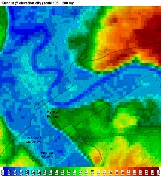
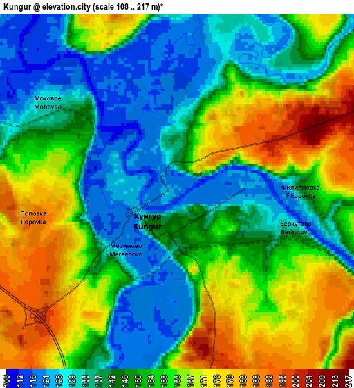
Below is the Elevation map of Kungur, which displays elevation range with different colors. Scale of the first map is from 108 to 200 m (354 to 656 ft) with average elevation of 137.1 meters (=450 ft) [note 1]
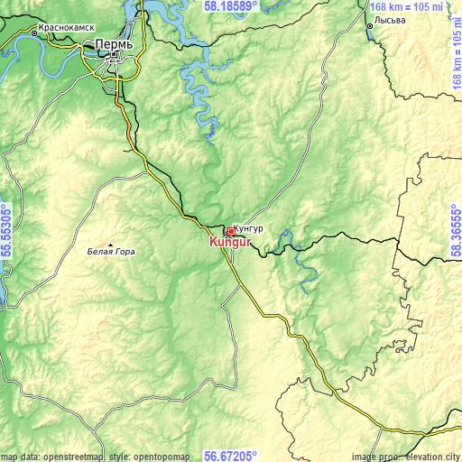
These maps also provides idea of topography and contour of this city, they are displayed at different zoom levels. More info about maps, scale and edge coordinates you can find below images.
| \ | Map #1 | Map #2 | Topo.Map |
| Scale [m] | 108..200 m | 108..217 m | × |
| Scale [ft] | 354..656 ft | 354..712 ft | × |
| Average | 137.1 m = 450 ft | 150.9 m = 495 ft | × |
| Width | 5.26 km = 3.3 mi | 10.52 km = 6.5 mi | 168.3 km = 104.6 mi |
| Height | 5.26 km = 3.3 mi | 10.52 km = 6.5 mi | 168.3 km = 104.6 mi |
| ↑Max Latitude | 57.460445° | 57.484075° | 58.18589° |
| Latitude at center | 57.4368° | 57.4368° | 57.4368° |
| ↓Min Latitude | 57.41314° | 57.389464° | 56.67205° |
| ← Min Longitude | 56.915355° | 56.871409° | 55.55305° |
| Longitude center | 56.9593° | 56.9593° | 56.9593° |
| →Max Longitude | 57.003245° | 57.047191° | 58.36555° |
Nearby cities:
Cities around Kungur sort by population:
• Zvëzdnyy elevation 220 m
50.6 km,  310°
310°
• Suksun 188 m
41.9 km,  141°
141°
• Sylva 170 m
67.2 km,  350°
350°
• Orda 152 m
27 km,  186°
186°
• Kukushtan 152 m
36.2 km, 310°
• Ust’-Kishert’ 134 m
19.1 km,  114°
114°
• Uinskoye 165 m
65.8 km,  200°
200°
• Lobanovo 132 m
61.1 km,  320°
320°
• Bershet’ 189 m
47.6 km, 313°
• Ferma 109 m
64.6 km, 323°
• Yug 225 m
57.1 km,  304°
304°
• Filippovka 141 m
3.6 km,  89°
89°
Multilingual:
 En español:
Kungur elevación 120 m.
 En France:
Koungour élévation 120 m.


Sources and notes:
- [note 1] Map square and city borders are not equal. Map elevation data is calculated only from area inside that square.
- [src 1] Elevation data from geonames database provided with same terms of usage.
- [src 2] The elevation map of Kungur is generated using elevation data from NASA's 3 arcsec (90m) resolution SRTM data.
- [src 3] Base (background) map © OpenStreetMap contributors tiles are generated by Geofabrik and OpenTopoMap.
Copyright & License:
This Kungur Elevation Map is licensed under CC BY-SA. You may reuse any part from this page, if you give a proper credit by linking to this URL:
 More info on terms of use page.