Log elevation
Log (Volgograd Oblast), Russia elevation is 87 meters and Log elevation in feet is 285 ft above sea level [src 1]. Log is a populated place (feature code) with elevation that is 112 meters (367 ft) smaller than average city elevation in Russia.
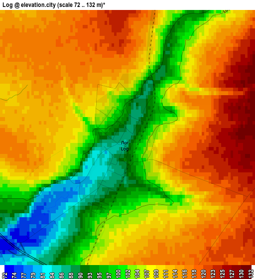
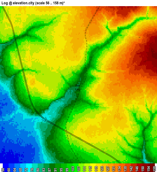
Below is the Elevation map of Log, which displays elevation range with different colors. Scale of the first map is from 72 to 132 m (236 to 433 ft) with average elevation of 108.2 meters (=355 ft) [note 1]
These maps also provides idea of topography and contour of this city, they are displayed at different zoom levels. More info about maps, scale and edge coordinates you can find below images.
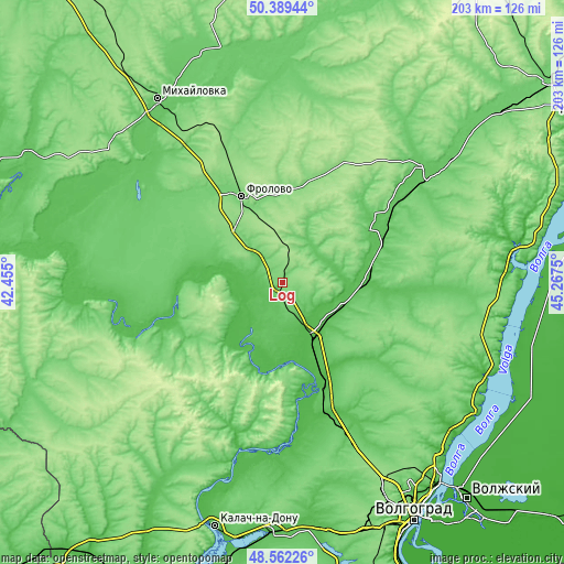
| \ | Map #1 | Map #2 | Topo.Map |
| Scale [m] | 72..132 m | 56..158 m | × |
| Scale [ft] | 236..433 ft | 184..518 ft | × |
| Average | 108.2 m = 355 ft | 108.1 m = 355 ft | × |
| Width | 6.35 km = 3.9 mi | 12.7 km = 7.9 mi | 203.2 km = 126.3 mi |
| Height | 6.35 km = 3.9 mi | 12.7 km = 7.9 mi | 203.1 km = 126.2 mi |
| ↑Max Latitude | 49.512911° | 49.541435° | 50.38944° |
| Latitude at center | 49.48437° | 49.48437° | 49.48437° |
| ↓Min Latitude | 49.455812° | 49.427238° | 48.56226° |
| ← Min Longitude | 43.817305° | 43.773359° | 42.455° |
| Longitude center | 43.86125° | 43.86125° | 43.86125° |
| →Max Longitude | 43.905195° | 43.949141° | 45.2675° |
Nearby cities:
Cities around Log sort by population:
• Mikhaylovka elevation 80 m
78.1 km,  325°
325°
• Frolovo 116 m
35 km,  335°
335°
• Gorodishche 65 m
87.8 km,  149°
149°
• Dubovka 56 m
84.7 km,  124°
124°
• Ilovlya 42 m
21.9 km,  156°
156°
• Serafimovich 99 m
81.9 km,  277°
277°
• Kletskaya 54 m
61.1 km,  251°
251°
• Gumrak 146 m
86.8 km, 154°
• Sebrovo 77 m
79.3 km, 329°
• Vodstroy 110 m
87.6 km,  144°
144°
• Primorsk 20 m
88 km,  106°
106°
• Gornyy Balykley 53 m
87.4 km,  85°
85°
Multilingual:
 En español:
Log elevación 87 m.
 En France:
Log élévation 87 m.


Sources and notes:
- [note 1] Map square and city borders are not equal. Map elevation data is calculated only from area inside that square.
- [src 1] Elevation data from geonames database provided with same terms of usage.
- [src 2] The elevation map of Log is generated using elevation data from NASA's 3 arcsec (90m) resolution SRTM data.
- [src 3] Base (background) map © OpenStreetMap contributors tiles are generated by Geofabrik and OpenTopoMap.
Copyright & License:
This Log Elevation Map is licensed under CC BY-SA. You may reuse any part from this page, if you give a proper credit by linking to this URL:
 More info on terms of use page.