Maloyaroslavets elevation
Maloyaroslavets (Kaluga), Russia elevation is 190 meters and Maloyaroslavets elevation in feet is 623 ft above sea level [src 1]. Maloyaroslavets is a populated place (feature code) with elevation that is 9 meters (30 ft) smaller than average city elevation in Russia.
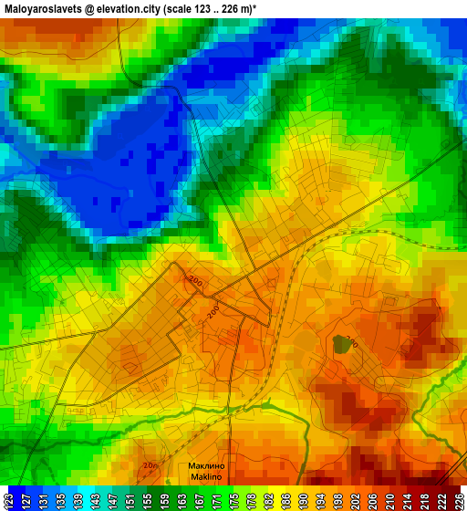
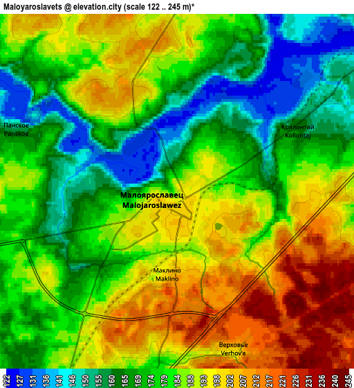
Below is the Elevation map of Maloyaroslavets, which displays elevation range with different colors. Scale of the first map is from 123 to 226 m (404 to 741 ft) with average elevation of 175.4 meters (=575 ft) [note 1]
These maps also provides idea of topography and contour of this city, they are displayed at different zoom levels. More info about maps, scale and edge coordinates you can find below images.
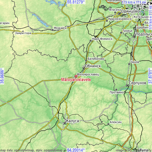
| \ | Map #1 | Map #2 | Topo.Map |
| Scale [m] | 123..226 m | 122..245 m | × |
| Scale [ft] | 404..741 ft | 400..804 ft | × |
| Average | 175.4 m = 575 ft | 181.9 m = 597 ft | × |
| Width | 5.6 km = 3.5 mi | 11.21 km = 7 mi | 179.3 km = 111.4 mi |
| Height | 5.6 km = 3.5 mi | 11.21 km = 7 mi | 179.3 km = 111.4 mi |
| ↑Max Latitude | 55.039759° | 55.064932° | 55.81279° |
| Latitude at center | 55.01457° | 55.01457° | 55.01457° |
| ↓Min Latitude | 54.989365° | 54.964145° | 54.20014° |
| ← Min Longitude | 36.427905° | 36.383959° | 35.0656° |
| Longitude center | 36.47185° | 36.47185° | 36.47185° |
| →Max Longitude | 36.515795° | 36.559741° | 37.8781° |
Nearby cities:
Cities around Maloyaroslavets sort by population:
• Obninsk elevation 174 m
12.7 km,  43°
43°
• Balabanovo 160 m
22.1 km,  32°
32°
• Zhukovo 130 m
17.5 km,  83°
83°
• Borovsk 166 m
21.3 km,  2°
2°
• Yermolino 141 m
21.5 km,  21°
21°
• Belousovo 174 m
15.6 km,  55°
55°
• Medyn’ 201 m
39.4 km,  262°
262°
• Vereya 204 m
41.4 km,  332°
332°
• Detchino 161 m
25.1 km,  204°
204°
• Ateptsevo 159 m
38.6 km, 27°
• Kudinovo 191 m
14 km, 263°
• Vysokinichi 125 m
31.6 km,  111°
111°
Multilingual:
 En español:
Maloyaroslavets elevación 190 m.
 En France:
Maloïaroslavets élévation 190 m.
 Auf Deutsch:
Maloyaroslavets höhe über dem Meeresspiegel ist 190 m.

Sources and notes:
- [note 1] Map square and city borders are not equal. Map elevation data is calculated only from area inside that square.
- [src 1] Elevation data from geonames database provided with same terms of usage.
- [src 2] The elevation map of Maloyaroslavets is generated using elevation data from NASA's 3 arcsec (90m) resolution SRTM data.
- [src 3] Base (background) map © OpenStreetMap contributors tiles are generated by Geofabrik and OpenTopoMap.
Copyright & License:
This Maloyaroslavets Elevation Map is licensed under CC BY-SA. You may reuse any part from this page, if you give a proper credit by linking to this URL:
 More info on terms of use page.