Sunzha elevation
Sunzha (Ingushetiya Republic), Russia elevation is 325 meters and Sunzha elevation in feet is 1066 ft above sea level [src 1]. Sunzha is a populated place (feature code) with elevation that is 126 meters (413 ft) bigger than average city elevation in Russia.
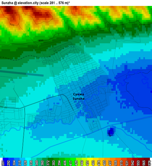
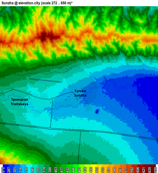
Below is the Elevation map of Sunzha, which displays elevation range with different colors. Scale of the first map is from 281 to 576 m (922 to 1890 ft) with average elevation of 353.2 meters (=1159 ft) [note 1]
These maps also provides idea of topography and contour of this city, they are displayed at different zoom levels. More info about maps, scale and edge coordinates you can find below images.
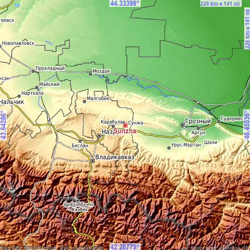
| \ | Map #1 | Map #2 | Topo.Map |
| Scale [m] | 281..576 m | 272..650 m | × |
| Scale [ft] | 922..1890 ft | 892..2133 ft | × |
| Average | 353.2 m = 1159 ft | 386.3 m = 1267 ft | × |
| Width | 7.11 km = 4.4 mi | 14.22 km = 8.8 mi | 227.5 km = 141.4 mi |
| Height | 7.11 km = 4.4 mi | 14.22 km = 8.8 mi | 227.5 km = 141.4 mi |
| ↑Max Latitude | 43.351464° | 43.38341° | 44.33398° |
| Latitude at center | 43.3195° | 43.3195° | 43.3195° |
| ↓Min Latitude | 43.28752° | 43.255522° | 42.28779° |
| ← Min Longitude | 45.005165° | 44.961219° | 43.64286° |
| Longitude center | 45.04911° | 45.04911° | 45.04911° |
| →Max Longitude | 45.093055° | 45.137001° | 46.45536° |
Nearby cities:
Cities around Sunzha sort by population:
• Karabulak elevation 418 m
12.2 km,  262°
262°
• Ekazhevo 541 m
21.8 km,  236°
236°
• Troitskaya 348 m
5.5 km,  254°
254°
• Nesterovskaya 405 m
9 km,  179°
179°
• Surkhakhi 651 m
18.9 km,  219°
219°
• Samashki 216 m
20.4 km,  99°
99°
• Assinovskaya 273 m
13.8 km,  128°
128°
• Sernovodsk 262 m
9 km,  94°
94°
• Alkhan-Churt 546 m
21.5 km,  279°
279°
• Galashki 551 m
23 km,  191°
191°
• Bamut 350 m
21.4 km,  145°
145°
• Goragorskiy 430 m
20.3 km,  8°
8°
Multilingual:
 En español:
Sunzha elevación 325 m.
 En France:
Sunzha élévation 325 m.


Sources and notes:
- [note 1] Map square and city borders are not equal. Map elevation data is calculated only from area inside that square.
- [src 1] Elevation data from geonames database provided with same terms of usage.
- [src 2] The elevation map of Sunzha is generated using elevation data from NASA's 3 arcsec (90m) resolution SRTM data.
- [src 3] Base (background) map © OpenStreetMap contributors tiles are generated by Geofabrik and OpenTopoMap.
Copyright & License:
This Sunzha Elevation Map is licensed under CC BY-SA. You may reuse any part from this page, if you give a proper credit by linking to this URL:
 More info on terms of use page.