Annino elevation
Annino (Moscow), Russia elevation is 184 meters and Annino elevation in feet is 604 ft above sea level [src 1]. Annino is a section of populated place (feature code) with elevation that is 15 meters (49 ft) smaller than average city elevation in Russia.
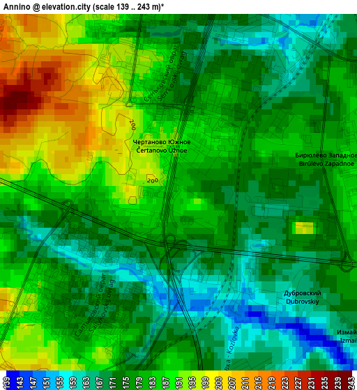
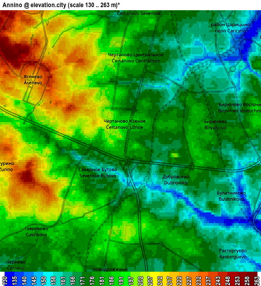
Below is the Elevation map of Annino, which displays elevation range with different colors. Scale of the first map is from 139 to 243 m (456 to 797 ft) with average elevation of 179.3 meters (=588 ft) [note 1]
These maps also provides idea of topography and contour of this city, they are displayed at different zoom levels. More info about maps, scale and edge coordinates you can find below images.
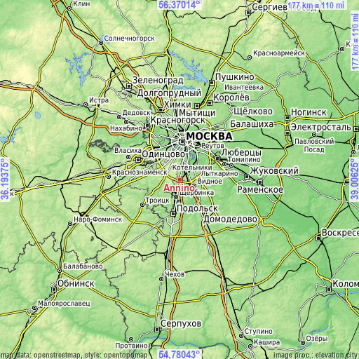
| \ | Map #1 | Map #2 | Topo.Map |
| Scale [m] | 139..243 m | 130..263 m | × |
| Scale [ft] | 456..797 ft | 427..863 ft | × |
| Average | 179.3 m = 588 ft | 183.7 m = 603 ft | × |
| Width | 5.52 km = 3.4 mi | 11.05 km = 6.9 mi | 176.8 km = 109.9 mi |
| Height | 5.52 km = 3.4 mi | 11.05 km = 6.9 mi | 176.7 km = 109.8 mi |
| ↑Max Latitude | 55.60816° | 55.632975° | 56.37014° |
| Latitude at center | 55.58333° | 55.58333° | 55.58333° |
| ↓Min Latitude | 55.558484° | 55.533622° | 54.78043° |
| ← Min Longitude | 37.556055° | 37.512109° | 36.19375° |
| Longitude center | 37.6° | 37.6° | 37.6° |
| →Max Longitude | 37.643945° | 37.687891° | 39.00625° |
Nearby cities:
Cities around Annino sort by population:
• Yasenevo elevation 228 m
5.7 km,  297°
297°
• Biryulëvo 175 m
4.9 km,  86°
86°
• Chertanovo Yuzhnoye 191 m
0.9 km,  339°
339°
• Orekhovo-Borisovo Severnoye 151 m
6.4 km,  54°
54°
• Tyoply Stan 240 m
7.9 km, 301°
• Tsaritsyno 164 m
5.6 km,  34°
34°
• Biryulëvo Zapadnoye 182 m
2.7 km,  79°
79°
• Nagornyy 185 m
7.5 km,  8°
8°
• Vidnoye 170 m
7.7 km,  116°
116°
• Zagor’ye 163 m
4.3 km,  100°
100°
• Kommunarka 193 m
7.1 km,  257°
257°
• Izmaylovo 171 m
3.4 km,  128°
128°
Multilingual:
 En español:
Annino elevación 184 m.
 En France:
Annino élévation 184 m.


Sources and notes:
- [note 1] Map square and city borders are not equal. Map elevation data is calculated only from area inside that square.
- [src 1] Elevation data from geonames database provided with same terms of usage.
- [src 2] The elevation map of Annino is generated using elevation data from NASA's 3 arcsec (90m) resolution SRTM data.
- [src 3] Base (background) map © OpenStreetMap contributors tiles are generated by Geofabrik and OpenTopoMap.
Copyright & License:
This Annino Elevation Map is licensed under CC BY-SA. You may reuse any part from this page, if you give a proper credit by linking to this URL:
 More info on terms of use page.