Reutov elevation
Reutov (Moscow Oblast), Russia elevation is 168 meters and Reutov elevation in feet is 551 ft above sea level [src 1]. Reutov is a populated place (feature code) with elevation that is 31 meters (102 ft) smaller than average city elevation in Russia.
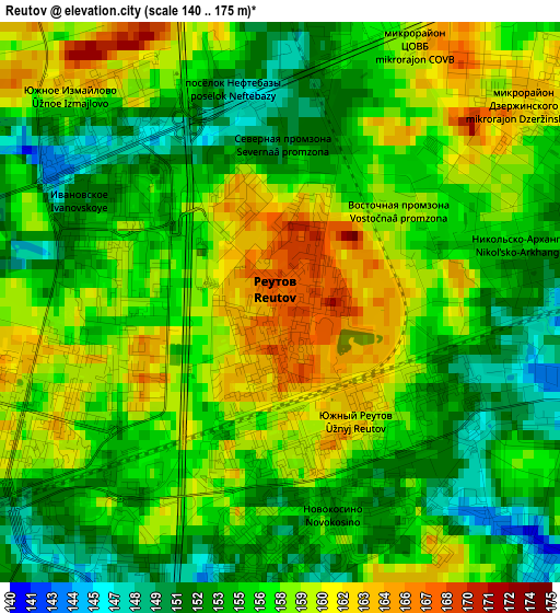
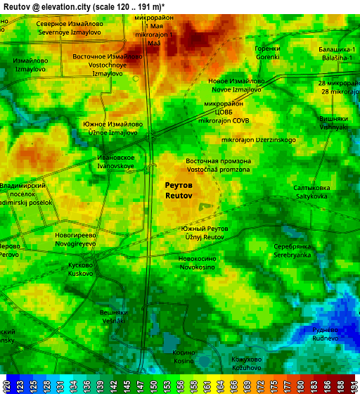
Below is the Elevation map of Reutov, which displays elevation range with different colors. Scale of the first map is from 140 to 175 m (459 to 574 ft) with average elevation of 156.5 meters (=513 ft) [note 1]
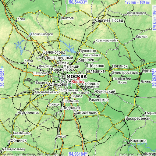
These maps also provides idea of topography and contour of this city, they are displayed at different zoom levels. More info about maps, scale and edge coordinates you can find below images.
| \ | Map #1 | Map #2 | Topo.Map |
| Scale [m] | 140..175 m | 120..191 m | × |
| Scale [ft] | 459..574 ft | 394..627 ft | × |
| Average | 156.5 m = 513 ft | 154.3 m = 506 ft | × |
| Width | 5.5 km = 3.4 mi | 11 km = 6.8 mi | 176 km = 109.4 mi |
| Height | 5.5 km = 3.4 mi | 11 km = 6.8 mi | 175.9 km = 109.3 mi |
| ↑Max Latitude | 55.785828° | 55.81053° | 56.54433° |
| Latitude at center | 55.76111° | 55.76111° | 55.76111° |
| ↓Min Latitude | 55.736377° | 55.711627° | 54.96184° |
| ← Min Longitude | 37.813555° | 37.769609° | 36.45125° |
| Longitude center | 37.8575° | 37.8575° | 37.8575° |
| →Max Longitude | 37.901445° | 37.945391° | 39.26375° |
Nearby cities:
Cities around Reutov sort by population:
• Vykhino-Zhulebino elevation 133 m
7.2 km,  203°
203°
• Zhulebino 140 m
6.8 km,  183°
183°
• Ivanovskoye 156 m
1.6 km,  292°
292°
• Veshnyaki 155 m
4.8 km,  209°
209°
• Izmaylovo 164 m
4.5 km,  309°
309°
• Ryazanskiy 153 m
6.5 km,  241°
241°
• Novogireyevo 158 m
2.6 km,  251°
251°
• Metrogorodok 161 m
6.9 km,  320°
320°
• Novokuz’minki 146 m
6.8 km,  223°
223°
• Kuskovo 145 m
3.6 km, 213°
• Vostochnyy 168 m
6.2 km,  5°
5°
• Saltykovka 150 m
4.9 km,  82°
82°
Multilingual:
 En español:
Reutov elevación 168 m.
 En France:
Reoutov élévation 168 m.


Sources and notes:
- [note 1] Map square and city borders are not equal. Map elevation data is calculated only from area inside that square.
- [src 1] Elevation data from geonames database provided with same terms of usage.
- [src 2] The elevation map of Reutov is generated using elevation data from NASA's 3 arcsec (90m) resolution SRTM data.
- [src 3] Base (background) map © OpenStreetMap contributors tiles are generated by Geofabrik and OpenTopoMap.
Copyright & License:
This Reutov Elevation Map is licensed under CC BY-SA. You may reuse any part from this page, if you give a proper credit by linking to this URL:
 More info on terms of use page.