Rublëvo elevation
Rublëvo (Moscow), Russia elevation is 151 meters and Rublëvo elevation in feet is 495 ft above sea level [src 1]. Rublëvo is a section of populated place (feature code) with elevation that is 48 meters (157 ft) smaller than average city elevation in Russia.
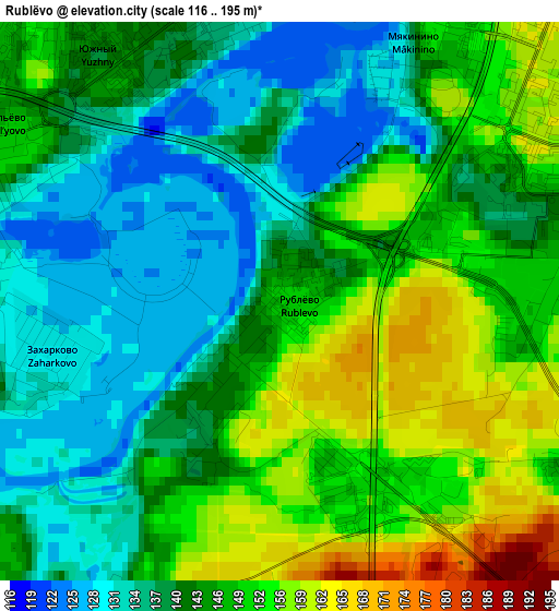
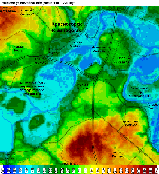
Below is the Elevation map of Rublëvo, which displays elevation range with different colors. Scale of the first map is from 116 to 195 m (381 to 640 ft) with average elevation of 144.9 meters (=475 ft) [note 1]
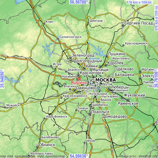
These maps also provides idea of topography and contour of this city, they are displayed at different zoom levels. More info about maps, scale and edge coordinates you can find below images.
| \ | Map #1 | Map #2 | Topo.Map |
| Scale [m] | 116..195 m | 110..220 m | × |
| Scale [ft] | 381..640 ft | 361..722 ft | × |
| Average | 144.9 m = 475 ft | 153 m = 502 ft | × |
| Width | 5.5 km = 3.4 mi | 10.99 km = 6.8 mi | 175.8 km = 109.2 mi |
| Height | 5.5 km = 3.4 mi | 10.99 km = 6.8 mi | 175.8 km = 109.2 mi |
| ↑Max Latitude | 55.809843° | 55.834529° | 56.56788° |
| Latitude at center | 55.78514° | 55.78514° | 55.78514° |
| ↓Min Latitude | 55.760422° | 55.735688° | 54.98636° |
| ← Min Longitude | 37.310865° | 37.266919° | 35.94856° |
| Longitude center | 37.35481° | 37.35481° | 37.35481° |
| →Max Longitude | 37.398755° | 37.442701° | 38.76106° |
Nearby cities:
Cities around Rublëvo sort by population:
• Khoroshëvo-Mnevniki elevation 148 m
7.3 km,  91°
91°
• Strogino 125 m
5.2 km,  44°
44°
• Shchukino 153 m
6.2 km,  74°
74°
• Krasnogorsk 155 m
4.2 km,  338°
338°
• Pokrovskoye-Streshnëvo 157 m
6.9 km, 68°
• Bol’shaya Setun’ 144 m
8.5 km,  153°
153°
• Setun’ 144 m
8.5 km, 153°
• Opalikha 188 m
7.8 km,  305°
305°
• Nemchinovka 178 m
6.9 km,  176°
176°
• Barvikha 146 m
6.7 km,  224°
224°
• Arkhangel’skoye 159 m
3.5 km,  275°
275°
• Pavshino 137 m
3.5 km,  355°
355°
Multilingual:
 En español:
Rublëvo elevación 151 m.
 En France:
Rublëvo élévation 151 m.


Sources and notes:
- [note 1] Map square and city borders are not equal. Map elevation data is calculated only from area inside that square.
- [src 1] Elevation data from geonames database provided with same terms of usage.
- [src 2] The elevation map of Rublëvo is generated using elevation data from NASA's 3 arcsec (90m) resolution SRTM data.
- [src 3] Base (background) map © OpenStreetMap contributors tiles are generated by Geofabrik and OpenTopoMap.
Copyright & License:
This Rublëvo Elevation Map is licensed under CC BY-SA. You may reuse any part from this page, if you give a proper credit by linking to this URL:
 More info on terms of use page.