Sergiyev Posad elevation
Sergiyev Posad (Moscow Oblast), Russia elevation is 207 meters and Sergiyev Posad elevation in feet is 679 ft above sea level [src 1]. Sergiyev Posad is a populated place (feature code) with elevation that is 8 meters (26 ft) bigger than average city elevation in Russia.
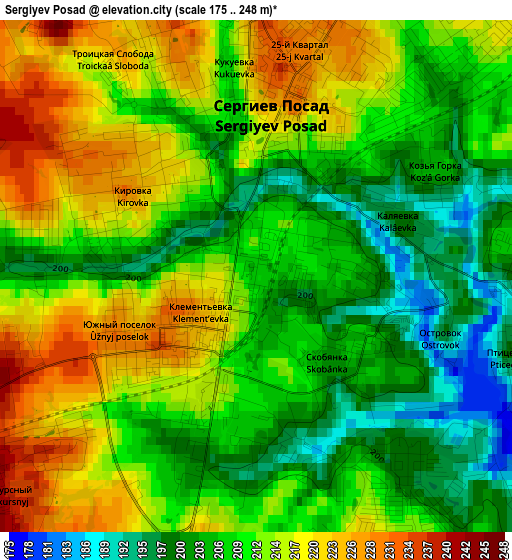
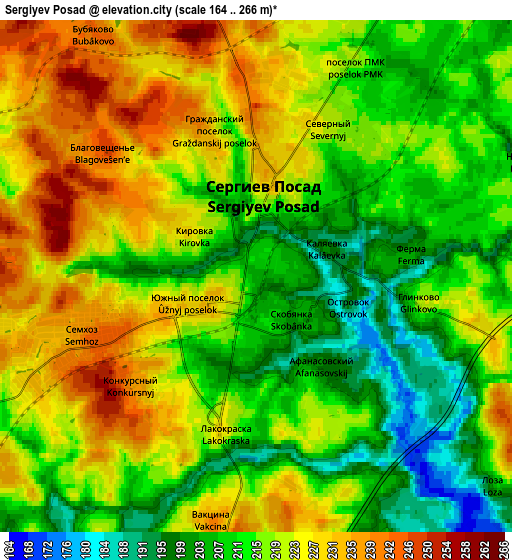
Below is the Elevation map of Sergiyev Posad, which displays elevation range with different colors. Scale of the first map is from 175 to 248 m (574 to 814 ft) with average elevation of 210.7 meters (=691 ft) [note 1]
These maps also provides idea of topography and contour of this city, they are displayed at different zoom levels. More info about maps, scale and edge coordinates you can find below images.
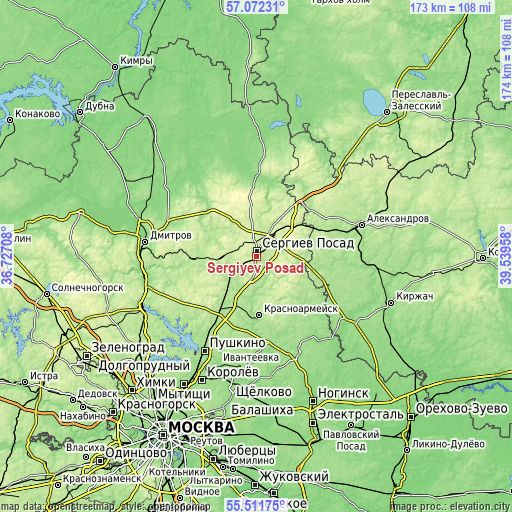
| \ | Map #1 | Map #2 | Topo.Map |
| Scale [m] | 175..248 m | 164..266 m | × |
| Scale [ft] | 574..814 ft | 538..873 ft | × |
| Average | 210.7 m = 691 ft | 217.3 m = 713 ft | × |
| Width | 5.42 km = 3.4 mi | 10.84 km = 6.7 mi | 173.5 km = 107.8 mi |
| Height | 5.42 km = 3.4 mi | 10.84 km = 6.7 mi | 173.5 km = 107.8 mi |
| ↑Max Latitude | 56.324375° | 56.348735° | 57.07231° |
| Latitude at center | 56.3° | 56.3° | 56.3° |
| ↓Min Latitude | 56.275609° | 56.251203° | 55.51175° |
| ← Min Longitude | 38.089385° | 38.045439° | 36.72708° |
| Longitude center | 38.13333° | 38.13333° | 38.13333° |
| →Max Longitude | 38.177275° | 38.221221° | 39.53958° |
Nearby cities:
Cities around Sergiyev Posad sort by population:
• Krasnoarmeysk elevation 156 m
22.2 km,  180°
180°
• Khot'kovo 200 m
9.8 km,  240°
240°
• Sofrino 184 m
20.8 km,  216°
216°
• Peresvet 220 m
13.9 km,  10°
10°
• Krasnozavodsk 170 m
17.4 km,  17°
17°
• Bogorodskoye 207 m
22.4 km, 7°
• Muranovo 225 m
19.4 km,  228°
228°
• Ashukino 191 m
18.7 km, 217°
• Skoropuskovskiy 199 m
7.7 km, 15°
• Arsaki 191 m
23.5 km,  66°
66°
• Semkhoz 240 m
4.5 km,  245°
245°
• Svatkovo 209 m
10.6 km,  28°
28°
Multilingual:
 En español:
Sergiyev Posad elevación 207 m.
 En France:
Sergiyev Posad élévation 207 m.
 Auf Deutsch:
Sergijew Possad höhe über dem Meeresspiegel ist 207 m.

Sources and notes:
- [note 1] Map square and city borders are not equal. Map elevation data is calculated only from area inside that square.
- [src 1] Elevation data from geonames database provided with same terms of usage.
- [src 2] The elevation map of Sergiyev Posad is generated using elevation data from NASA's 3 arcsec (90m) resolution SRTM data.
- [src 3] Base (background) map © OpenStreetMap contributors tiles are generated by Geofabrik and OpenTopoMap.
Copyright & License:
This Sergiyev Posad Elevation Map is licensed under CC BY-SA. You may reuse any part from this page, if you give a proper credit by linking to this URL:
 More info on terms of use page.