Suzëmka elevation
Suzëmka (Bryansk Oblast), Russia elevation is 168 meters and Suzëmka elevation in feet is 551 ft above sea level [src 1]. Suzëmka is a populated place (feature code) with elevation that is 31 meters (102 ft) smaller than average city elevation in Russia.
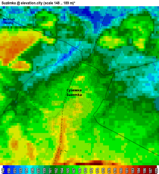
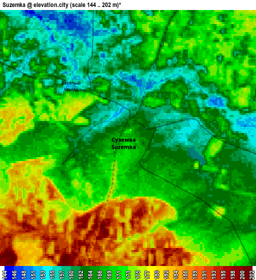
Below is the Elevation map of Suzëmka, which displays elevation range with different colors. Scale of the first map is from 148 to 189 m (486 to 620 ft) with average elevation of 164.5 meters (=540 ft) [note 1]
These maps also provides idea of topography and contour of this city, they are displayed at different zoom levels. More info about maps, scale and edge coordinates you can find below images.
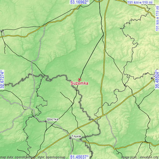
| \ | Map #1 | Map #2 | Topo.Map |
| Scale [m] | 148..189 m | 144..202 m | × |
| Scale [ft] | 486..620 ft | 472..663 ft | × |
| Average | 164.5 m = 540 ft | 169.3 m = 555 ft | × |
| Width | 5.97 km = 3.7 mi | 11.95 km = 7.4 mi | 191.2 km = 118.8 mi |
| Height | 5.97 km = 3.7 mi | 11.95 km = 7.4 mi | 191.1 km = 118.7 mi |
| ↑Max Latitude | 52.345194° | 52.372033° | 53.16962° |
| Latitude at center | 52.31834° | 52.31834° | 52.31834° |
| ↓Min Latitude | 52.291469° | 52.264582° | 51.45037° |
| ← Min Longitude | 34.035045° | 33.991099° | 32.67274° |
| Longitude center | 34.07899° | 34.07899° | 34.07899° |
| →Max Longitude | 34.122935° | 34.166881° | 35.48524° |
Nearby cities:
Cities around Suzëmka sort by population:
• Trubchevsk elevation 177 m
36.1 km,  323°
323°
• Navlya 174 m
63.1 km,  26°
26°
• Lokot’ 212 m
43.5 km,  50°
50°
• Pogar 155 m
61.4 km,  295°
295°
• Sevsk 177 m
33.9 km,  123°
123°
• Komarichi 218 m
49.5 km,  77°
77°
• Khomutovka 193 m
55.2 km,  143°
143°
• Kokino 182 m
51.6 km,  67°
67°
• Kokorevka 177 m
32.6 km,  23°
23°
• Lopandino 192 m
52.7 km, 71°
• Altukhovo 172 m
44.2 km, 26°
• Pervoavgustovskiy 210 m
67.2 km,  98°
98°
Multilingual:
 En español:
Suzëmka elevación 168 m.
 En France:
Suzëmka élévation 168 m.


Sources and notes:
- [note 1] Map square and city borders are not equal. Map elevation data is calculated only from area inside that square.
- [src 1] Elevation data from geonames database provided with same terms of usage.
- [src 2] The elevation map of Suzëmka is generated using elevation data from NASA's 3 arcsec (90m) resolution SRTM data.
- [src 3] Base (background) map © OpenStreetMap contributors tiles are generated by Geofabrik and OpenTopoMap.
Copyright & License:
This Suzëmka Elevation Map is licensed under CC BY-SA. You may reuse any part from this page, if you give a proper credit by linking to this URL:
 More info on terms of use page.