Sviblovo elevation
Sviblovo (Moscow), Russia elevation is 145 meters and Sviblovo elevation in feet is 476 ft above sea level [src 1]. Sviblovo is a section of populated place (feature code) with elevation that is 54 meters (177 ft) smaller than average city elevation in Russia.
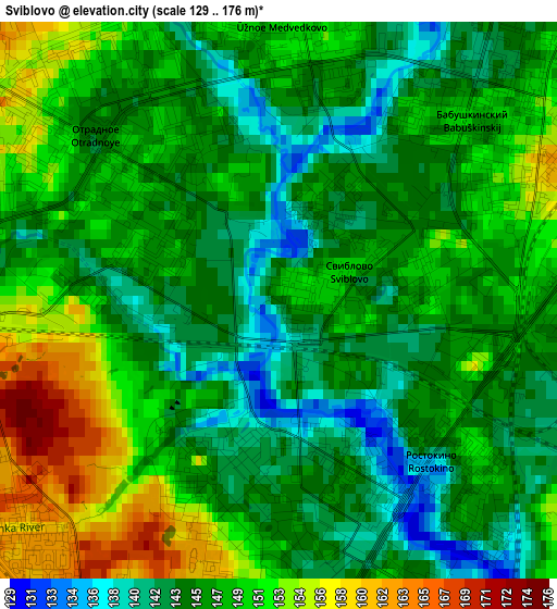
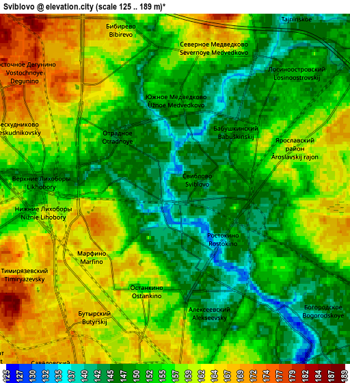
Below is the Elevation map of Sviblovo, which displays elevation range with different colors. Scale of the first map is from 129 to 176 m (423 to 577 ft) with average elevation of 147.2 meters (=483 ft) [note 1]
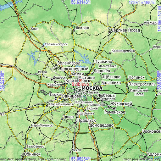
These maps also provides idea of topography and contour of this city, they are displayed at different zoom levels. More info about maps, scale and edge coordinates you can find below images.
| \ | Map #1 | Map #2 | Topo.Map |
| Scale [m] | 129..176 m | 125..189 m | × |
| Scale [ft] | 423..577 ft | 410..620 ft | × |
| Average | 147.2 m = 483 ft | 154.9 m = 508 ft | × |
| Width | 5.49 km = 3.4 mi | 10.97 km = 6.8 mi | 175.6 km = 109.1 mi |
| Height | 5.49 km = 3.4 mi | 10.97 km = 6.8 mi | 175.5 km = 109.1 mi |
| ↑Max Latitude | 55.874661° | 55.899307° | 56.63143° |
| Latitude at center | 55.85° | 55.85° | 55.85° |
| ↓Min Latitude | 55.825323° | 55.80063° | 55.05254° |
| ← Min Longitude | 37.589385° | 37.545439° | 36.22708° |
| Longitude center | 37.63333° | 37.63333° | 37.63333° |
| →Max Longitude | 37.677275° | 37.721221° | 39.03958° |
Nearby cities:
Cities around Sviblovo sort by population:
• Bibirevo elevation 155 m
4.2 km,  330°
330°
• Ostankinskiy 161 m
2.5 km,  205°
205°
• Sokol’niki 157 m
5.8 km,  155°
155°
• Altuf’yevskiy 169 m
4.8 km,  319°
319°
• Vatutino 149 m
5.2 km,  43°
43°
• Likhobory 147 m
4.2 km,  270°
270°
• Novovladykino 149 m
3.1 km, 270°
• Kozeyevo 148 m
2.1 km, 330°
• Rostokino 146 m
2.8 km,  131°
131°
• Leonovo 140 m
1 km,  90°
90°
• Slobodka 156 m
3.6 km,  300°
300°
• Otradnoye 147 m
2.8 km,  311°
311°
Multilingual:
 En español:
Sviblovo elevación 145 m.
 En France:
Sviblovo élévation 145 m.
 Auf Deutsch:
Sviblovo höhe über dem Meeresspiegel ist 145 m.

Sources and notes:
- [note 1] Map square and city borders are not equal. Map elevation data is calculated only from area inside that square.
- [src 1] Elevation data from geonames database provided with same terms of usage.
- [src 2] The elevation map of Sviblovo is generated using elevation data from NASA's 3 arcsec (90m) resolution SRTM data.
- [src 3] Base (background) map © OpenStreetMap contributors tiles are generated by Geofabrik and OpenTopoMap.
Copyright & License:
This Sviblovo Elevation Map is licensed under CC BY-SA. You may reuse any part from this page, if you give a proper credit by linking to this URL:
 More info on terms of use page.