Talovyy elevation
Talovyy (Rostov), Russia elevation is 163 meters and Talovyy elevation in feet is 535 ft above sea level [src 1]. Talovyy is a populated place (feature code) with elevation that is 36 meters (118 ft) smaller than average city elevation in Russia.
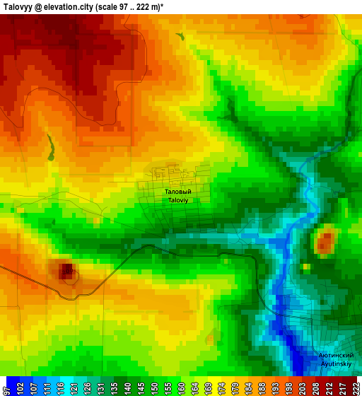
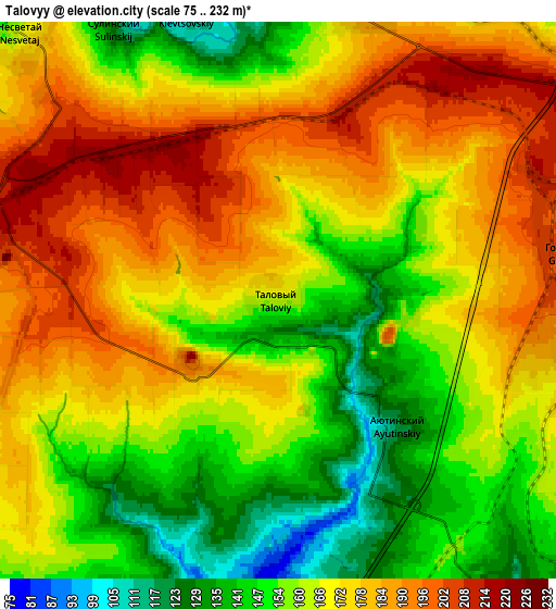
Below is the Elevation map of Talovyy, which displays elevation range with different colors. Scale of the first map is from 97 to 222 m (318 to 728 ft) with average elevation of 165.4 meters (=543 ft) [note 1]
These maps also provides idea of topography and contour of this city, they are displayed at different zoom levels. More info about maps, scale and edge coordinates you can find below images.
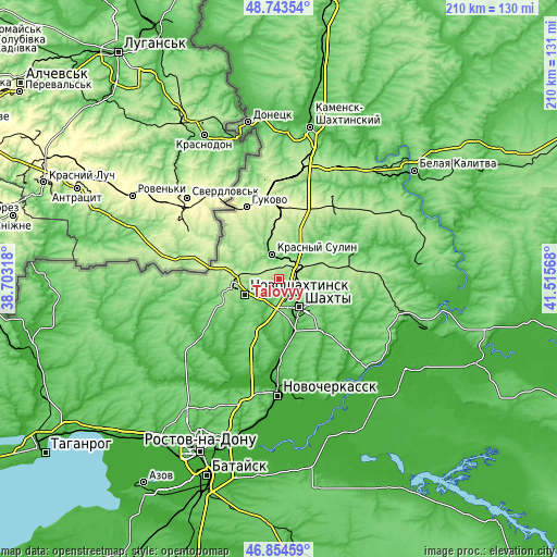
| \ | Map #1 | Map #2 | Topo.Map |
| Scale [m] | 97..222 m | 75..232 m | × |
| Scale [ft] | 318..728 ft | 246..761 ft | × |
| Average | 165.4 m = 543 ft | 167.9 m = 551 ft | × |
| Width | 6.56 km = 4.1 mi | 13.13 km = 8.2 mi | 210 km = 130.5 mi |
| Height | 6.56 km = 4.1 mi | 13.13 km = 8.2 mi | 210 km = 130.5 mi |
| ↑Max Latitude | 47.837156° | 47.866646° | 48.74354° |
| Latitude at center | 47.80765° | 47.80765° | 47.80765° |
| ↓Min Latitude | 47.778127° | 47.748587° | 46.85459° |
| ← Min Longitude | 40.065485° | 40.021539° | 38.70318° |
| Longitude center | 40.10943° | 40.10943° | 40.10943° |
| →Max Longitude | 40.153375° | 40.197321° | 41.51568° |
Nearby cities:
Cities around Talovyy sort by population:
• Shakhty elevation 114 m
13.5 km,  144°
144°
• Novoshakhtinsk 152 m
14.2 km,  248°
248°
• Krasnyy Sulin 146 m
9.8 km,  342°
342°
• Zverevo 238 m
23.8 km,  2°
2°
• Kamenolomni 62 m
17 km,  155°
155°
• Mayskiy 129 m
12.4 km,  182°
182°
• Ayutinskiy 124 m
4 km,  134°
134°
• Sokolovo-Kundryuchenskiy 126 m
12.5 km,  284°
284°
• Sambek 144 m
22 km, 250°
• Krasyukovskaya 16 m
28.4 km, 180°
• Almaznyy 218 m
26.8 km,  349°
349°
• Gornyy 187 m
7.1 km,  82°
82°
Multilingual:
 En español:
Talovyy elevación 163 m.
 En France:
Talovyy élévation 163 m.


Sources and notes:
- [note 1] Map square and city borders are not equal. Map elevation data is calculated only from area inside that square.
- [src 1] Elevation data from geonames database provided with same terms of usage.
- [src 2] The elevation map of Talovyy is generated using elevation data from NASA's 3 arcsec (90m) resolution SRTM data.
- [src 3] Base (background) map © OpenStreetMap contributors tiles are generated by Geofabrik and OpenTopoMap.
Copyright & License:
This Talovyy Elevation Map is licensed under CC BY-SA. You may reuse any part from this page, if you give a proper credit by linking to this URL:
 More info on terms of use page.