Ugleural’skiy elevation
Ugleural’skiy (Perm), Russia elevation is 405 meters and Ugleural’skiy elevation in feet is 1329 ft above sea level [src 1]. Ugleural’skiy is a populated place (feature code) with elevation that is 206 meters (676 ft) bigger than average city elevation in Russia.
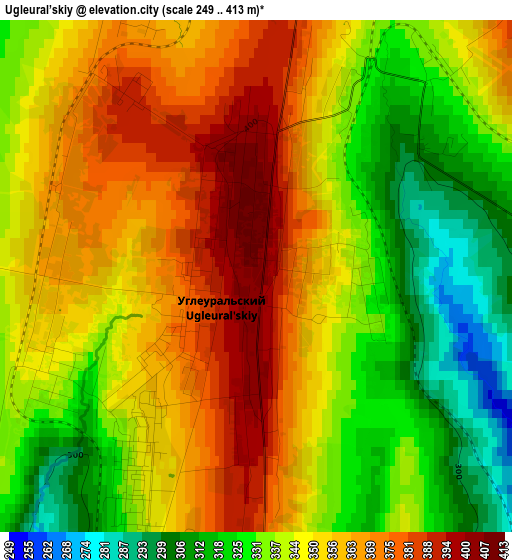
Below is the Elevation map of Ugleural’skiy, which displays elevation range with different colors. Scale of the first map is from 249 to 413 m (817 to 1355 ft) with average elevation of 346.7 meters (=1137 ft) [note 1]
These maps also provides idea of topography and contour of this city, they are displayed at different zoom levels. More info about maps, scale and edge coordinates you can find below images.
| \ | Map #1 | Map #2 | Topo.Map |
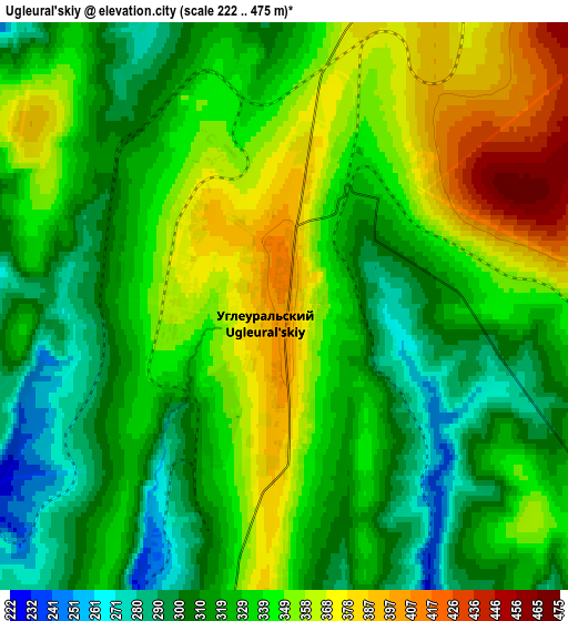
| Scale [m] | 249..413 m | 222..475 m | × |
| Scale [ft] | 817..1355 ft | 728..1558 ft | × |
| Average | 346.7 m = 1137 ft | 334 m = 1096 ft | × |
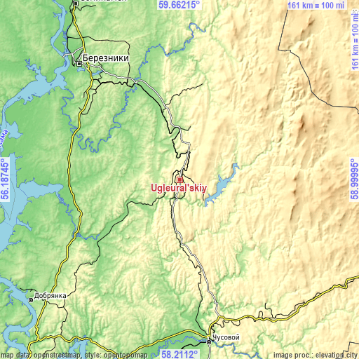
| Width | 5.04 km = 3.1 mi | 10.08 km = 6.3 mi | 161.3 km = 100.2 mi |
| Height | 5.04 km = 3.1 mi | 10.08 km = 6.3 mi | 161.3 km = 100.2 mi |
| ↑Max Latitude | 58.966963° | 58.98961° | 59.66215° |
| Latitude at center | 58.9443° | 58.9443° | 58.9443° |
| ↓Min Latitude | 58.921622° | 58.89893° | 58.2112° |
| ← Min Longitude | 57.549755° | 57.505809° | 56.18745° |
| Longitude center | 57.5937° | 57.5937° | 57.5937° |
| →Max Longitude | 57.637645° | 57.681591° | 58.99995° |
Nearby cities:
Cities around Ugleural’skiy sort by population:
• Berezniki elevation 189 m
67.9 km,  319°
319°
• Gubakha 308 m
12 km,  191°
191°
• Kizel 293 m
11.8 km,  15°
15°
• Aleksandrovsk 174 m
23.8 km,  356°
356°
• Gremyachinsk 352 m
45.2 km,  160°
160°
• Yayva 137 m
47.4 km,  336°
336°
• Shakhta 348 m
16.7 km,  12°
12°
• Yuzhnyy-Kospashskiy 432 m
10 km,  71°
71°
• Severnyy-Kospashskiy 369 m
20.2 km,  36°
36°
• Shumikhinskiy 339 m
22.9 km,  165°
165°
• Shirokovskiy 246 m
15.9 km,  136°
136°
• Yubileynyy 417 m
21.3 km,  149°
149°
Multilingual:
 En español:
Ugleural’skiy elevación 405 m.
 En France:
Ugleural’skiy élévation 405 m.
 Auf Deutsch:
Ugleural’skiy höhe über dem Meeresspiegel ist 405 m.

Sources and notes:
- [note 1] Map square and city borders are not equal. Map elevation data is calculated only from area inside that square.
- [src 1] Elevation data from geonames database provided with same terms of usage.
- [src 2] The elevation map of Ugleural’skiy is generated using elevation data from NASA's 3 arcsec (90m) resolution SRTM data.
- [src 3] Base (background) map © OpenStreetMap contributors tiles are generated by Geofabrik and OpenTopoMap.
Copyright & License:
This Ugleural’skiy Elevation Map is licensed under CC BY-SA. You may reuse any part from this page, if you give a proper credit by linking to this URL:
 More info on terms of use page.