Voznesenskaya elevation
Voznesenskaya (Ingushetiya Republic), Russia elevation is 566 meters and Voznesenskaya elevation in feet is 1857 ft above sea level [src 1]. Voznesenskaya is a populated place (feature code) with elevation that is 367 meters (1204 ft) bigger than average city elevation in Russia.
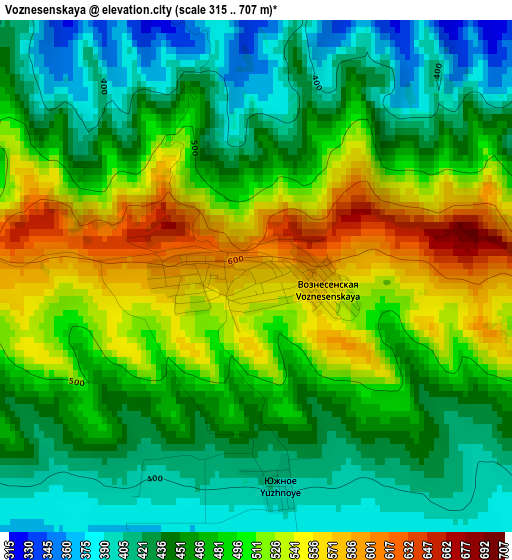
Below is the Elevation map of Voznesenskaya, which displays elevation range with different colors. Scale of the first map is from 315 to 707 m (1033 to 2320 ft) with average elevation of 477.4 meters (=1566 ft) [note 1]
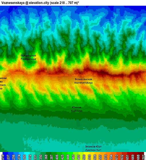
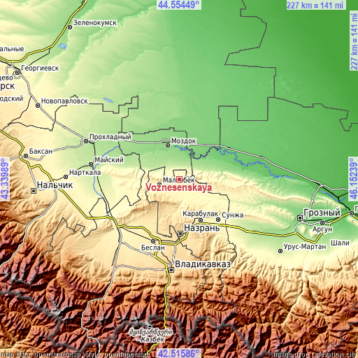
These maps also provides idea of topography and contour of this city, they are displayed at different zoom levels. More info about maps, scale and edge coordinates you can find below images.
| \ | Map #1 | Map #2 | Topo.Map |
| Scale [m] | 315..707 m | 218..707 m | × |
| Scale [ft] | 1033..2320 ft | 715..2320 ft | × |
| Average | 477.4 m = 1566 ft | 393.3 m = 1290 ft | × |
| Width | 7.08 km = 4.4 mi | 14.17 km = 8.8 mi | 226.7 km = 140.9 mi |
| Height | 7.08 km = 4.4 mi | 14.17 km = 8.8 mi | 226.7 km = 140.9 mi |
| ↑Max Latitude | 43.575635° | 43.607464° | 44.55449° |
| Latitude at center | 43.54379° | 43.54379° | 43.54379° |
| ↓Min Latitude | 43.511928° | 43.480049° | 42.51586° |
| ← Min Longitude | 44.702195° | 44.658249° | 43.33989° |
| Longitude center | 44.74614° | 44.74614° | 44.74614° |
| →Max Longitude | 44.790085° | 44.834031° | 46.15239° |
Nearby cities:
Cities around Voznesenskaya sort by population:
• Staryy Malgobek elevation 644 m
12.1 km,  270°
270°
• Malgobek 368 m
13.2 km,  254°
254°
• Sagopshi 397 m
14.1 km,  242°
242°
• Verkhniye Achaluki 473 m
22.2 km,  190°
190°
• Kizlyar 157 m
21.6 km,  325°
325°
• Alkhan-Churt 546 m
21.6 km,  171°
171°
• Elin-Yurt 108 m
22.4 km,  49°
49°
• Psedakh 464 m
16.6 km, 239°
• Nizhniye Achaluki 381 m
15.7 km,  176°
176°
• Nogamerzin-Yurt 151 m
16.8 km,  43°
43°
• Galyugayevskaya 116 m
22.8 km, 41°
• Terskaya 135 m
20.1 km,  355°
355°
Multilingual:
 En español:
Voznesenskaya elevación 566 m.
 En France:
Voznesenskaya élévation 566 m.
 Auf Deutsch:
Voznesenskaya höhe über dem Meeresspiegel ist 566 m.

Sources and notes:
- [note 1] Map square and city borders are not equal. Map elevation data is calculated only from area inside that square.
- [src 1] Elevation data from geonames database provided with same terms of usage.
- [src 2] The elevation map of Voznesenskaya is generated using elevation data from NASA's 3 arcsec (90m) resolution SRTM data.
- [src 3] Base (background) map © OpenStreetMap contributors tiles are generated by Geofabrik and OpenTopoMap.
Copyright & License:
This Voznesenskaya Elevation Map is licensed under CC BY-SA. You may reuse any part from this page, if you give a proper credit by linking to this URL:
 More info on terms of use page.