Yukamenskoye elevation
Yukamenskoye (Udmurtiya Republic), Russia elevation is 179 meters and Yukamenskoye elevation in feet is 587 ft above sea level [src 1]. Yukamenskoye is a populated place (feature code) with elevation that is 20 meters (66 ft) smaller than average city elevation in Russia.
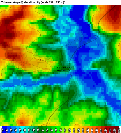
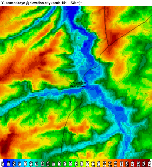
Below is the Elevation map of Yukamenskoye, which displays elevation range with different colors. Scale of the first map is from 154 to 233 m (505 to 764 ft) with average elevation of 185.1 meters (=607 ft) [note 1]
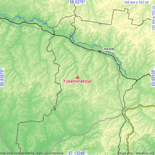
These maps also provides idea of topography and contour of this city, they are displayed at different zoom levels. More info about maps, scale and edge coordinates you can find below images.
| \ | Map #1 | Map #2 | Topo.Map |
| Scale [m] | 154..233 m | 151..239 m | × |
| Scale [ft] | 505..764 ft | 495..784 ft | × |
| Average | 185.1 m = 607 ft | 191.9 m = 630 ft | × |
| Width | 5.19 km = 3.2 mi | 10.39 km = 6.5 mi | 166.2 km = 103.3 mi |
| Height | 5.19 km = 3.2 mi | 10.39 km = 6.5 mi | 166.2 km = 103.3 mi |
| ↑Max Latitude | 57.911153° | 57.93449° | 58.6276° |
| Latitude at center | 57.8878° | 57.8878° | 57.8878° |
| ↓Min Latitude | 57.864432° | 57.841049° | 57.13246° |
| ← Min Longitude | 52.201055° | 52.157109° | 50.83875° |
| Longitude center | 52.245° | 52.245° | 52.245° |
| →Max Longitude | 52.288945° | 52.332891° | 53.65125° |
Nearby cities:
Cities around Yukamenskoye sort by population:
• Glazov elevation 151 m
37.1 km,  41°
41°
• Igra 176 m
60.7 km,  127°
127°
• Balezino 154 m
46.5 km,  77°
77°
• Kez 207 m
86.8 km,  89°
89°
• Yar 147 m
40.6 km,  348°
348°
• Selty 138 m
64.2 km,  185°
185°
• Falënki 157 m
65 km,  324°
324°
• Uni 175 m
47.2 km,  251°
251°
• Krasnogorskoye 248 m
25.4 km,  143°
143°
• Kosino 126 m
81.4 km, 315°
• Pudem 146 m
46.6 km, 354°
• Fakel 201 m
54.4 km,  121°
121°
Multilingual:
 En español:
Yukamenskoye elevación 179 m.
 En France:
Yukamenskoye élévation 179 m.
 Auf Deutsch:
Yukamenskoye höhe über dem Meeresspiegel ist 179 m.

Sources and notes:
- [note 1] Map square and city borders are not equal. Map elevation data is calculated only from area inside that square.
- [src 1] Elevation data from geonames database provided with same terms of usage.
- [src 2] The elevation map of Yukamenskoye is generated using elevation data from NASA's 3 arcsec (90m) resolution SRTM data.
- [src 3] Base (background) map © OpenStreetMap contributors tiles are generated by Geofabrik and OpenTopoMap.
Copyright & License:
This Yukamenskoye Elevation Map is licensed under CC BY-SA. You may reuse any part from this page, if you give a proper credit by linking to this URL:
 More info on terms of use page.