Zaymishche elevation
Zaymishche (Bryansk Oblast), Russia elevation is 173 meters and Zaymishche elevation in feet is 568 ft above sea level [src 1]. Zaymishche is a populated place (feature code) with elevation that is 26 meters (85 ft) smaller than average city elevation in Russia.
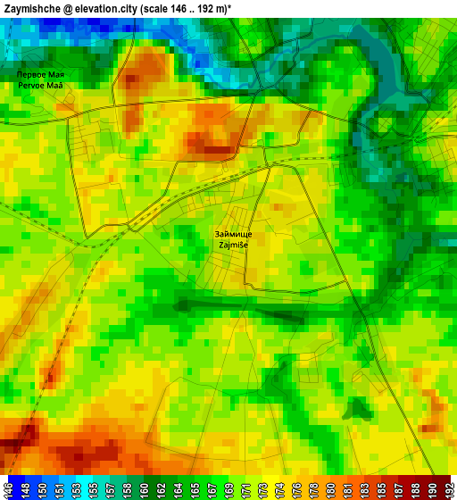
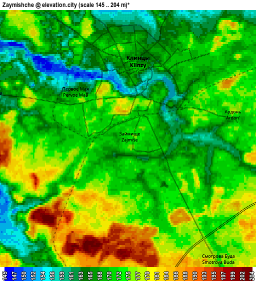
Below is the Elevation map of Zaymishche, which displays elevation range with different colors. Scale of the first map is from 146 to 192 m (479 to 630 ft) with average elevation of 169.7 meters (=557 ft) [note 1]
These maps also provides idea of topography and contour of this city, they are displayed at different zoom levels. More info about maps, scale and edge coordinates you can find below images.
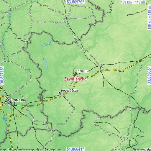
| \ | Map #1 | Map #2 | Topo.Map |
| Scale [m] | 146..192 m | 145..204 m | × |
| Scale [ft] | 479..630 ft | 476..669 ft | × |
| Average | 169.7 m = 557 ft | 171.8 m = 564 ft | × |
| Width | 5.92 km = 3.7 mi | 11.84 km = 7.4 mi | 189.4 km = 117.7 mi |
| Height | 5.92 km = 3.7 mi | 11.84 km = 7.4 mi | 189.4 km = 117.7 mi |
| ↑Max Latitude | 52.753006° | 52.779596° | 53.56976° |
| Latitude at center | 52.7264° | 52.7264° | 52.7264° |
| ↓Min Latitude | 52.699778° | 52.673139° | 51.86641° |
| ← Min Longitude | 32.189455° | 32.145509° | 30.82715° |
| Longitude center | 32.2334° | 32.2334° | 32.2334° |
| →Max Longitude | 32.277345° | 32.321291° | 33.63965° |
Nearby cities:
Cities around Zaymishche sort by population:
• Klintsy elevation 168 m
3.8 km,  6°
6°
• Novozybkov 160 m
29.3 km,  224°
224°
• Unecha 189 m
32.5 km,  65°
65°
• Starodub 179 m
39.1 km,  113°
113°
• Klimovo 164 m
38.6 km,  184°
184°
• Surazh 162 m
34.1 km,  18°
18°
• Gordeyevka 143 m
31.1 km,  325°
325°
• Vyshkov 143 m
46.2 km,  232°
232°
• Ardon’ 168 m
5.2 km,  79°
79°
• Korzhovka-Golubovka 171 m
9.3 km,  60°
60°
• Zamishevo 178 m
25.6 km, 215°
• Sachkovichi 164 m
42.3 km, 180°
Multilingual:
 En español:
Zaymishche elevación 173 m.
 En France:
Zaymishche élévation 173 m.
 Auf Deutsch:
Zaymishche höhe über dem Meeresspiegel ist 173 m.

Sources and notes:
- [note 1] Map square and city borders are not equal. Map elevation data is calculated only from area inside that square.
- [src 1] Elevation data from geonames database provided with same terms of usage.
- [src 2] The elevation map of Zaymishche is generated using elevation data from NASA's 3 arcsec (90m) resolution SRTM data.
- [src 3] Base (background) map © OpenStreetMap contributors tiles are generated by Geofabrik and OpenTopoMap.
Copyright & License:
This Zaymishche Elevation Map is licensed under CC BY-SA. You may reuse any part from this page, if you give a proper credit by linking to this URL:
 More info on terms of use page.