Zelenograd elevation
Zelenograd (Moscow), Russia elevation is 220 meters and Zelenograd elevation in feet is 722 ft above sea level [src 1]. Zelenograd is a populated place (feature code) with elevation that is 21 meters (69 ft) bigger than average city elevation in Russia.
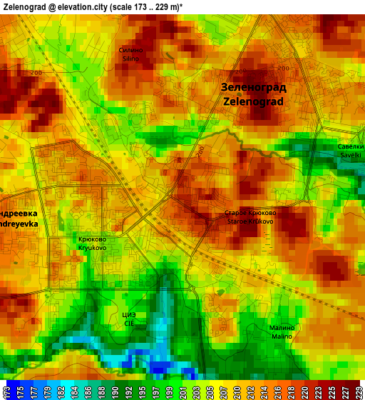
Below is the Elevation map of Zelenograd, which displays elevation range with different colors. Scale of the first map is from 173 to 229 m (568 to 751 ft) with average elevation of 208.5 meters (=684 ft) [note 1]
These maps also provides idea of topography and contour of this city, they are displayed at different zoom levels. More info about maps, scale and edge coordinates you can find below images.
| \ | Map #1 | Map #2 | Topo.Map |
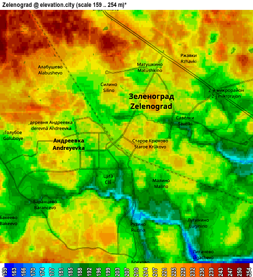
| Scale [m] | 173..229 m | 159..254 m | × |
| Scale [ft] | 568..751 ft | 522..833 ft | × |
| Average | 208.5 m = 684 ft | 212 m = 696 ft | × |
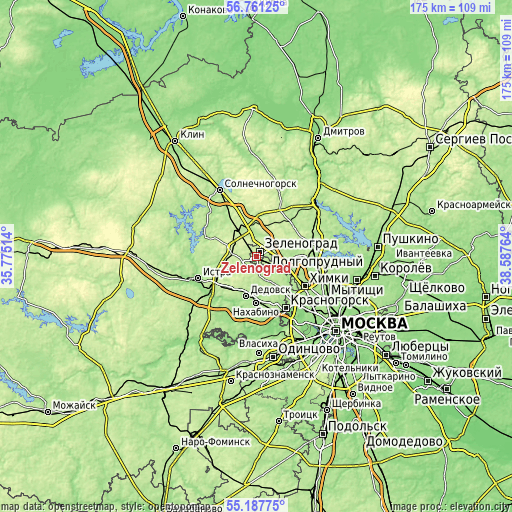
| Width | 5.47 km = 3.4 mi | 10.93 km = 6.8 mi | 175 km = 108.7 mi |
| Height | 5.47 km = 3.4 mi | 10.93 km = 6.8 mi | 174.9 km = 108.7 mi |
| ↑Max Latitude | 56.007077° | 56.031639° | 56.76125° |
| Latitude at center | 55.9825° | 55.9825° | 55.9825° |
| ↓Min Latitude | 55.957907° | 55.933299° | 55.18775° |
| ← Min Longitude | 37.137445° | 37.093499° | 35.77514° |
| Longitude center | 37.18139° | 37.18139° | 37.18139° |
| →Max Longitude | 37.225335° | 37.269281° | 38.58764° |
Nearby cities:
Cities around Zelenograd sort by population:
• Dedovsk elevation 192 m
13.2 km,  196°
196°
• Skhodnya 196 m
8.2 km,  117°
117°
• Novopodrezkovo 190 m
11.2 km, 115°
• Andreyevka 218 m
2.9 km,  265°
265°
• Mendeleyevo 214 m
6.1 km,  21°
21°
• Povarovo 217 m
12.4 km,  318°
318°
• Rzhavki 197 m
4.7 km,  65°
65°
• Chashnikovo 213 m
5.7 km,  350°
350°
• Firsanovka 200 m
4.9 km,  130°
130°
• Alabushevo 224 m
4.3 km,  332°
332°
• Radumlya 185 m
9.8 km, 348°
• Lozhki 230 m
13.2 km,  339°
339°
Multilingual:
 En español:
Zelenograd elevación 220 m.
 En France:
Zelenograd élévation 220 m.
 Auf Deutsch:
Zelenograd höhe über dem Meeresspiegel ist 220 m.

Sources and notes:
- [note 1] Map square and city borders are not equal. Map elevation data is calculated only from area inside that square.
- [src 1] Elevation data from geonames database provided with same terms of usage.
- [src 2] The elevation map of Zelenograd is generated using elevation data from NASA's 3 arcsec (90m) resolution SRTM data.
- [src 3] Base (background) map © OpenStreetMap contributors tiles are generated by Geofabrik and OpenTopoMap.
Copyright & License:
This Zelenograd Elevation Map is licensed under CC BY-SA. You may reuse any part from this page, if you give a proper credit by linking to this URL:
 More info on terms of use page.