Rybnoye elevation
Rybnoye (Moscow Oblast), Russia elevation is 154 meters and Rybnoye elevation in feet is 505 ft above sea level [src 1]. Rybnoye is a populated place (feature code) with elevation that is 45 meters (148 ft) smaller than average city elevation in Russia.
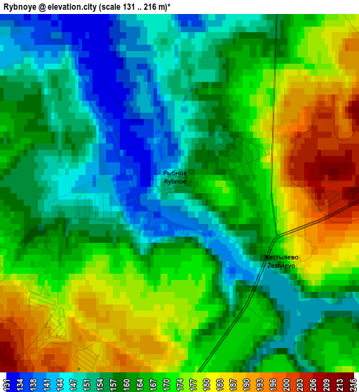
Below is the Elevation map of Rybnoye, which displays elevation range with different colors. Scale of the first map is from 131 to 216 m (430 to 709 ft) with average elevation of 164.6 meters (=540 ft) [note 1]
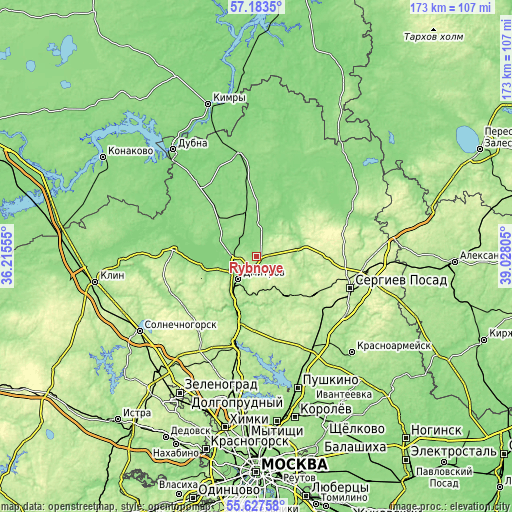
These maps also provides idea of topography and contour of this city, they are displayed at different zoom levels. More info about maps, scale and edge coordinates you can find below images.
| \ | Map #1 | Topo.Map |
| Scale [m] | 131..216 m | × |
| Scale [ft] | 430..709 ft | × |
| Average | 164.6 m = 540 ft | × |
| Width | 5.41 km = 3.4 mi | 173 km = 107.5 mi |
| Height | 5.41 km = 3.4 mi | 173 km = 107.5 mi |
| ↑Max Latitude | 56.437793° | 57.1835° |
| Latitude at center | 56.41349° | 56.41349° |
| ↓Min Latitude | 56.389172° | 55.62758° |
| ← Min Longitude | 37.577855° | 36.21555° |
| Longitude center | 37.6218° | 37.6218° |
| →Max Longitude | 37.665745° | 39.02805° |
Nearby cities:
Cities around Rybnoye sort by population:
• Dmitrov elevation 138 m
9.9 km,  219°
219°
• Yakhroma 130 m
15.2 km,  214°
214°
• Novosin’kovo 163 m
18.5 km,  257°
257°
• Verbilki 129 m
13.4 km,  354°
354°
• Dedenëvo 168 m
20 km,  198°
198°
• Zhukovka 159 m
10.1 km,  320°
320°
• Gorshkovo 163 m
13.6 km,  251°
251°
• Orud’yevo 153 m
5.9 km,  292°
292°
• Budenovetc 179 m
3.8 km,  174°
174°
• Avtopoligon 199 m
19.7 km, 248°
• Novo-Nikol’skoye 136 m
17.9 km,  342°
342°
• Ol'yavidovo 191 m
12.8 km,  38°
38°
Multilingual:
 En español:
Rybnoye elevación 154 m.
 En France:
Rybnoye élévation 154 m.


Sources and notes:
- [note 1] Map square and city borders are not equal. Map elevation data is calculated only from area inside that square.
- [src 1] Elevation data from geonames database provided with same terms of usage.
- [src 2] The elevation map of Rybnoye is generated using elevation data from NASA's 3 arcsec (90m) resolution SRTM data.
- [src 3] Base (background) map © OpenStreetMap contributors tiles are generated by Geofabrik and OpenTopoMap.
Copyright & License:
This Rybnoye Elevation Map is licensed under CC BY-SA. You may reuse any part from this page, if you give a proper credit by linking to this URL:
 More info on terms of use page.