Pervomayskoye elevation
Pervomayskoye (Altai Krai), Russia elevation is 243 meters and Pervomayskoye elevation in feet is 797 ft above sea level [src 1]. Pervomayskoye is a populated place (feature code) with elevation that is 44 meters (144 ft) bigger than average city elevation in Russia.
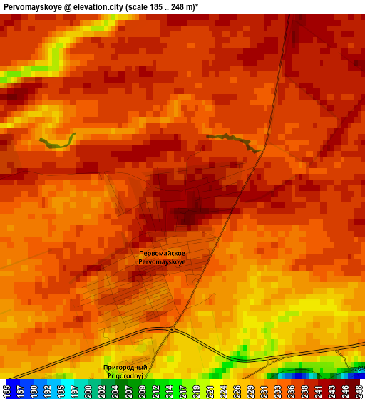
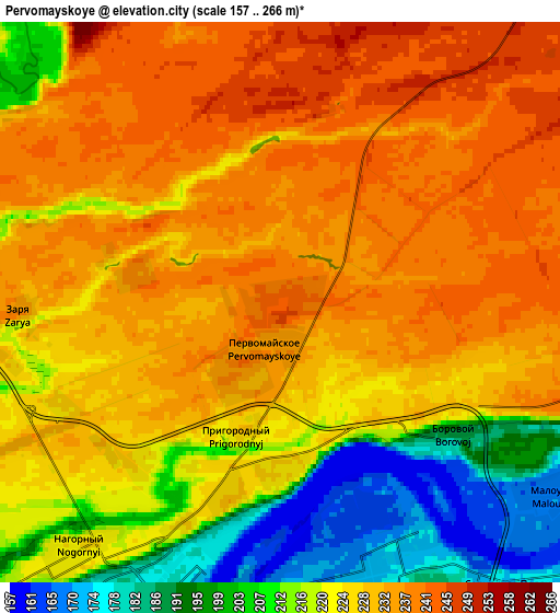
Below is the Elevation map of Pervomayskoye, which displays elevation range with different colors. Scale of the first map is from 185 to 248 m (607 to 814 ft) with average elevation of 234.3 meters (=769 ft) [note 1]
These maps also provides idea of topography and contour of this city, they are displayed at different zoom levels. More info about maps, scale and edge coordinates you can find below images.
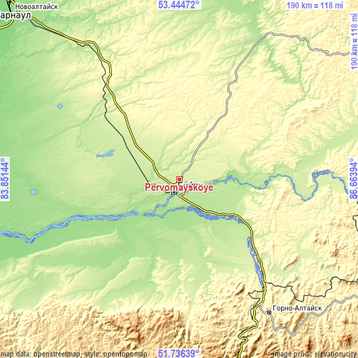
| \ | Map #1 | Map #2 | Topo.Map |
| Scale [m] | 185..248 m | 157..266 m | × |
| Scale [ft] | 607..814 ft | 515..873 ft | × |
| Average | 234.3 m = 769 ft | 224.5 m = 737 ft | × |
| Width | 5.94 km = 3.7 mi | 11.87 km = 7.4 mi | 189.9 km = 118 mi |
| Height | 5.94 km = 3.7 mi | 11.87 km = 7.4 mi | 189.9 km = 118 mi |
| ↑Max Latitude | 52.625564° | 52.652231° | 53.44472° |
| Latitude at center | 52.59888° | 52.59888° | 52.59888° |
| ↓Min Latitude | 52.57218° | 52.545463° | 51.73639° |
| ← Min Longitude | 85.213745° | 85.169799° | 83.85144° |
| Longitude center | 85.25769° | 85.25769° | 85.25769° |
| →Max Longitude | 85.301635° | 85.345581° | 86.66394° |
Nearby cities:
Cities around Pervomayskoye sort by population:
• Biysk elevation 172 m
7.7 km,  206°
206°
• Smolenskoye 181 m
34.9 km,  200°
200°
• Zonal’noye 221 m
23.2 km,  288°
288°
• Sokolovo 199 m
32.5 km,  256°
256°
• Verkh-Katunskoye 192 m
20.3 km,  144°
144°
• Lesnoye 190 m
14.4 km,  180°
180°
• Zarya 238 m
5.5 km,  267°
267°
• Malougrenevo 170 m
7.2 km,  130°
130°
• Usyatskoye 183 m
34.2 km,  95°
95°
• Krasnyy Yar 181 m
27.4 km,  168°
168°
• Shubenka 204 m
12.4 km,  300°
300°
• Stan-Bekhtemir 198 m
24.9 km,  88°
88°
Multilingual:
 En español:
Pervomayskoye elevación 243 m.
 En France:
Pervomayskoye élévation 243 m.
 Auf Deutsch:
Pervomayskoye höhe über dem Meeresspiegel ist 243 m.

Sources and notes:
- [note 1] Map square and city borders are not equal. Map elevation data is calculated only from area inside that square.
- [src 1] Elevation data from geonames database provided with same terms of usage.
- [src 2] The elevation map of Pervomayskoye is generated using elevation data from NASA's 3 arcsec (90m) resolution SRTM data.
- [src 3] Base (background) map © OpenStreetMap contributors tiles are generated by Geofabrik and OpenTopoMap.
Copyright & License:
This Pervomayskoye Elevation Map is licensed under CC BY-SA. You may reuse any part from this page, if you give a proper credit by linking to this URL:
 More info on terms of use page.