Poronaysk elevation
Poronaysk (Sakhalin Oblast), Russia elevation is 7 meters and Poronaysk elevation in feet is 23 ft above sea level [src 1]. Poronaysk is a populated place (feature code) with elevation that is 192 meters (630 ft) smaller than average city elevation in Russia.
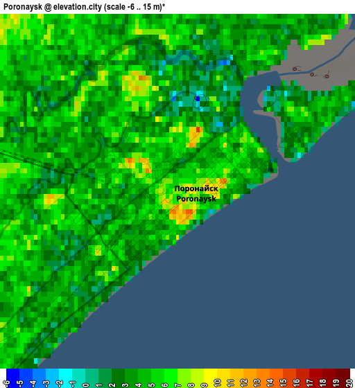
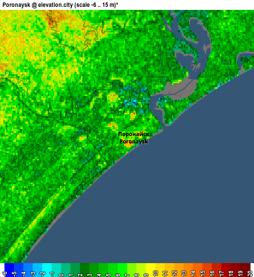
Below is the Elevation map of Poronaysk, which displays elevation range with different colors. Scale of the first map is from -6 to 15 m (-20 to 49 ft) with average elevation of 3.9 meters (=13 ft) [note 1]
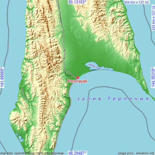
These maps also provides idea of topography and contour of this city, they are displayed at different zoom levels. More info about maps, scale and edge coordinates you can find below images.
| \ | Map #1 | Map #2 | Topo.Map |
| Scale [m] | -6..15 m | -6..15 m | × |
| Scale [ft] | -20..49 ft | -20..49 ft | × |
| Average | 3.9 m = 13 ft | 4.7 m = 15 ft | × |
| Width | 6.38 km = 4 mi | 12.77 km = 7.9 mi | 204.3 km = 126.9 mi |
| Height | 6.38 km = 4 mi | 12.77 km = 7.9 mi | 204.2 km = 126.9 mi |
| ↑Max Latitude | 49.250574° | 49.279251° | 50.13183° |
| Latitude at center | 49.22188° | 49.22188° | 49.22188° |
| ↓Min Latitude | 49.19317° | 49.164443° | 48.29487° |
| ← Min Longitude | 143.052995° | 143.009049° | 141.69069° |
| Longitude center | 143.09694° | 143.09694° | 143.09694° |
| →Max Longitude | 143.140885° | 143.184831° | 144.50319° |
Nearby cities:
Cities around Poronaysk sort by population:
• Uglegorsk elevation 8 m
76.7 km,  258°
258°
• Shakhtersk 21 m
70 km,  265°
265°
• Tymovskoye 117 m
183.6 km,  350°
350°
• Smirnykh 81 m
61.2 km,  342°
342°
• Makarov 16 m
70.1 km,  199°
199°
• Tomari 10 m
178.8 km,  205°
205°
• Krasnogorsk 5 m
116.1 km,  219°
219°
• Vakhrushev 14 m
27.8 km, 202°
• Vostok 27 m
30.2 km, 205°
• Boshnyakovo 11 m
81.9 km,  305°
305°
• Leonidovo 64 m
18 km,  293°
293°
• Gastello 12 m
16.8 km, 216°
Multilingual:
 En español:
Poronaysk elevación 7 m.
 En France:
Poronaysk élévation 7 m.


Sources and notes:
- [note 1] Map square and city borders are not equal. Map elevation data is calculated only from area inside that square.
- [src 1] Elevation data from geonames database provided with same terms of usage.
- [src 2] The elevation map of Poronaysk is generated using elevation data from NASA's 3 arcsec (90m) resolution SRTM data.
- [src 3] Base (background) map © OpenStreetMap contributors tiles are generated by Geofabrik and OpenTopoMap.
Copyright & License:
This Poronaysk Elevation Map is licensed under CC BY-SA. You may reuse any part from this page, if you give a proper credit by linking to this URL:
 More info on terms of use page.