Makkaveyevo elevation
Makkaveyevo (Transbaikal Territory), Russia elevation is 615 meters and Makkaveyevo elevation in feet is 2018 ft above sea level [src 1]. Makkaveyevo is a populated place (feature code) with elevation that is 416 meters (1365 ft) bigger than average city elevation in Russia.
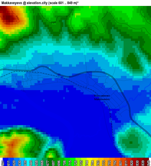
Below is the Elevation map of Makkaveyevo, which displays elevation range with different colors. Scale of the first map is from 601 to 849 m (1972 to 2785 ft) with average elevation of 651 meters (=2136 ft) [note 1]
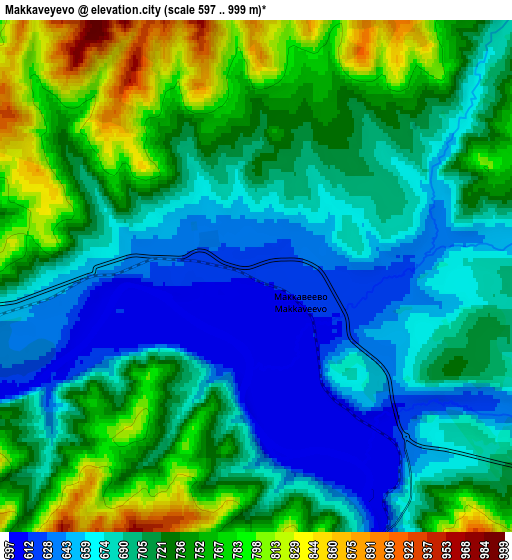
These maps also provides idea of topography and contour of this city, they are displayed at different zoom levels. More info about maps, scale and edge coordinates you can find below images.
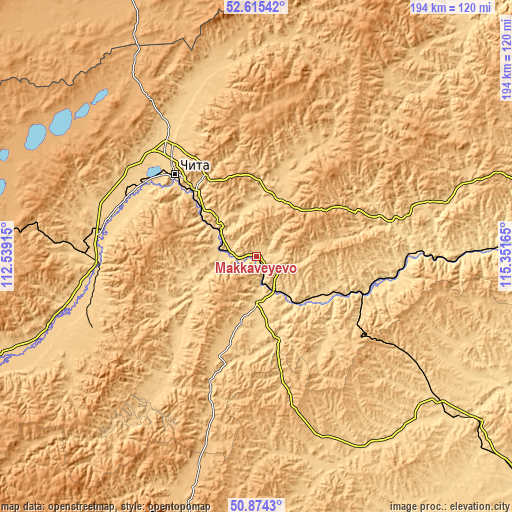
| \ | Map #1 | Map #2 | Topo.Map |
| Scale [m] | 601..849 m | 597..999 m | × |
| Scale [ft] | 1972..2785 ft | 1959..3278 ft | × |
| Average | 651 m = 2136 ft | 713 m = 2339 ft | × |
| Width | 6.05 km = 3.8 mi | 12.1 km = 7.5 mi | 193.6 km = 120.3 mi |
| Height | 6.05 km = 3.8 mi | 12.1 km = 7.5 mi | 193.6 km = 120.3 mi |
| ↑Max Latitude | 51.780446° | 51.807626° | 52.61542° |
| Latitude at center | 51.75325° | 51.75325° | 51.75325° |
| ↓Min Latitude | 51.726037° | 51.698809° | 50.8743° |
| ← Min Longitude | 113.901455° | 113.857509° | 112.53915° |
| Longitude center | 113.9454° | 113.9454° | 113.9454° |
| →Max Longitude | 113.989345° | 114.033291° | 115.35165° |
Nearby cities:
Cities around Makkaveyevo sort by population:
• Chita elevation 668 m
43.5 km,  315°
315°
• Aginskoye 675 m
83.2 km,  150°
150°
• Karymskoye 594 m
31.8 km,  118°
118°
• Novokruchininskiy 663 m
12.1 km,  286°
286°
• Atamanovka 652 m
29.3 km,  313°
313°
• Mogoytuy 650 m
85.1 km,  127°
127°
• Darasun 603 m
10.6 km,  168°
168°
• Domna 667 m
56.5 km, 286°
• Kurort-Darasun 791 m
63.6 km,  194°
194°
• Drovyanaya 705 m
65.4 km,  252°
252°
• Smolenka 672 m
52.4 km, 324°
• Bol’shaya Tura 597 m
19.1 km,  142°
142°
Multilingual:
 En español:
Makkaveyevo elevación 615 m.
 En France:
Makkaveyevo élévation 615 m.
 Auf Deutsch:
Makkaveyevo höhe über dem Meeresspiegel ist 615 m.

Sources and notes:
- [note 1] Map square and city borders are not equal. Map elevation data is calculated only from area inside that square.
- [src 1] Elevation data from geonames database provided with same terms of usage.
- [src 2] The elevation map of Makkaveyevo is generated using elevation data from NASA's 3 arcsec (90m) resolution SRTM data.
- [src 3] Base (background) map © OpenStreetMap contributors tiles are generated by Geofabrik and OpenTopoMap.
Copyright & License:
This Makkaveyevo Elevation Map is licensed under CC BY-SA. You may reuse any part from this page, if you give a proper credit by linking to this URL:
 More info on terms of use page.