Tavrichanka elevation
Tavrichanka (Primorskiy (Maritime) Kray), Russia elevation is 31 meters and Tavrichanka elevation in feet is 102 ft above sea level [src 1]. Tavrichanka is a populated place (feature code) with elevation that is 168 meters (551 ft) smaller than average city elevation in Russia.
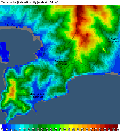
Below is the Elevation map of Tavrichanka, which displays elevation range with different colors. Scale of the first map is from -4 to 94 m (-13 to 308 ft) with average elevation of 28.8 meters (=94 ft) [note 1]
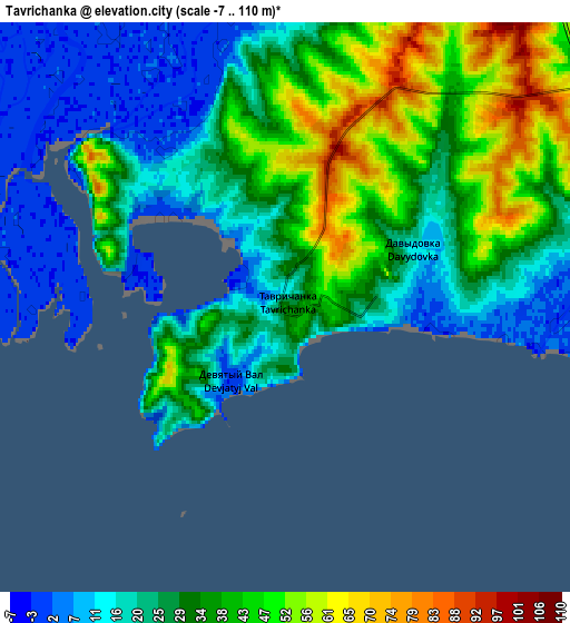
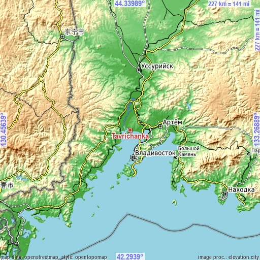
These maps also provides idea of topography and contour of this city, they are displayed at different zoom levels. More info about maps, scale and edge coordinates you can find below images.
| \ | Map #1 | Map #2 | Topo.Map |
| Scale [m] | -4..94 m | -7..110 m | × |
| Scale [ft] | -13..308 ft | -23..361 ft | × |
| Average | 28.8 m = 94 ft | 30.2 m = 99 ft | × |
| Width | 7.11 km = 4.4 mi | 14.22 km = 8.8 mi | 227.5 km = 141.4 mi |
| Height | 7.11 km = 4.4 mi | 14.22 km = 8.8 mi | 227.5 km = 141.4 mi |
| ↑Max Latitude | 43.35747° | 43.389414° | 44.33989° |
| Latitude at center | 43.32551° | 43.32551° | 43.32551° |
| ↓Min Latitude | 43.293533° | 43.261539° | 42.2939° |
| ← Min Longitude | 131.818695° | 131.774749° | 130.45639° |
| Longitude center | 131.86264° | 131.86264° | 131.86264° |
| →Max Longitude | 131.906585° | 131.950531° | 133.26889° |
Nearby cities:
Cities around Tavrichanka sort by population:
• Vladivostok elevation 40 m
24.5 km,  177°
177°
• Artëm 49 m
26.6 km,  81°
81°
• Trudovoye 27 m
17 km,  100°
100°
• Uglovoye 6 m
18.3 km,  89°
89°
• Razdol’noye 39 m
23.9 km,  6°
6°
• Vol’no-Nadezhdinskoye 47 m
12.2 km,  63°
63°
• Novyy 42 m
13.5 km,  71°
71°
• Russkiy 49 m
33.7 km, 180°
• Knevichi 15 m
27.6 km, 72°
• Barabash 34 m
33.1 km,  244°
244°
• Emar 20 m
27.3 km,  119°
119°
• Primorskiy 40 m
33.5 km,  221°
221°
Multilingual:
 En español:
Tavrichanka elevación 31 m.
 En France:
Tavrichanka élévation 31 m.
 Auf Deutsch:
Tavrichanka höhe über dem Meeresspiegel ist 31 m.

Sources and notes:
- [note 1] Map square and city borders are not equal. Map elevation data is calculated only from area inside that square.
- [src 1] Elevation data from geonames database provided with same terms of usage.
- [src 2] The elevation map of Tavrichanka is generated using elevation data from NASA's 3 arcsec (90m) resolution SRTM data.
- [src 3] Base (background) map © OpenStreetMap contributors tiles are generated by Geofabrik and OpenTopoMap.
Copyright & License:
This Tavrichanka Elevation Map is licensed under CC BY-SA. You may reuse any part from this page, if you give a proper credit by linking to this URL:
 More info on terms of use page.