Tel’ma elevation
Tel’ma (Irkutsk Oblast), Russia elevation is 406 meters and Tel’ma elevation in feet is 1332 ft above sea level [src 1]. Tel’ma is a populated place (feature code) with elevation that is 207 meters (679 ft) bigger than average city elevation in Russia.
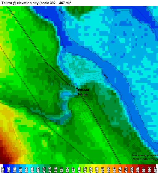
Below is the Elevation map of Tel’ma, which displays elevation range with different colors. Scale of the first map is from 392 to 467 m (1286 to 1532 ft) with average elevation of 415.2 meters (=1362 ft) [note 1]
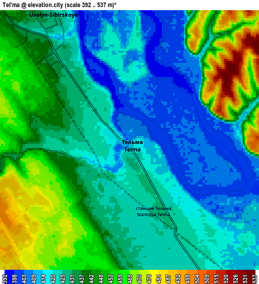
These maps also provides idea of topography and contour of this city, they are displayed at different zoom levels. More info about maps, scale and edge coordinates you can find below images.
| \ | Map #1 | Map #2 | Topo.Map |
| Scale [m] | 392..467 m | 392..537 m | × |
| Scale [ft] | 1286..1532 ft | 1286..1762 ft | × |
| Average | 415.2 m = 1362 ft | 433.7 m = 1423 ft | × |
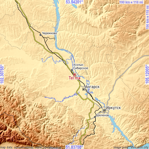
| Width | 5.92 km = 3.7 mi | 11.84 km = 7.4 mi | 189.5 km = 117.7 mi |
| Height | 5.92 km = 3.7 mi | 11.84 km = 7.4 mi | 189.5 km = 117.7 mi |
| ↑Max Latitude | 52.724723° | 52.751331° | 53.54201° |
| Latitude at center | 52.6981° | 52.6981° | 52.6981° |
| ↓Min Latitude | 52.67146° | 52.644804° | 51.83755° |
| ← Min Longitude | 103.669855° | 103.625909° | 102.30755° |
| Longitude center | 103.7138° | 103.7138° | 103.7138° |
| →Max Longitude | 103.757745° | 103.801691° | 105.12005° |
Nearby cities:
Cities around Tel’ma sort by population:
• Angarsk elevation 437 m
21.4 km,  147°
147°
• Usol’ye-Sibirskoye 435 m
7.6 km,  322°
322°
• Svirsk 422 m
50.1 km,  329°
329°
• Meget 433 m
38.8 km,  144°
144°
• Mishelevka 416 m
40.5 km,  295°
295°
• Sredniy 459 m
25.9 km, 324°
• Bokhan 443 m
50.7 km,  4°
4°
• Tayturka 410 m
25.5 km, 318°
• Khomutovo 445 m
53.2 km,  119°
119°
• Kitoy 422 m
16.6 km,  130°
130°
• Oyëk 463 m
51.6 km,  103°
103°
• Urik 444 m
44.3 km, 126°
Multilingual:
 En español:
Tel’ma elevación 406 m.
 En France:
Tel’ma élévation 406 m.


Sources and notes:
- [note 1] Map square and city borders are not equal. Map elevation data is calculated only from area inside that square.
- [src 1] Elevation data from geonames database provided with same terms of usage.
- [src 2] The elevation map of Tel’ma is generated using elevation data from NASA's 3 arcsec (90m) resolution SRTM data.
- [src 3] Base (background) map © OpenStreetMap contributors tiles are generated by Geofabrik and OpenTopoMap.
Copyright & License:
This Tel’ma Elevation Map is licensed under CC BY-SA. You may reuse any part from this page, if you give a proper credit by linking to this URL:
 More info on terms of use page.