Tulun elevation
Tulun (Irkutsk Oblast), Russia elevation is 468 meters and Tulun elevation in feet is 1535 ft above sea level [src 1]. Tulun is a populated place (feature code) with elevation that is 269 meters (883 ft) bigger than average city elevation in Russia.
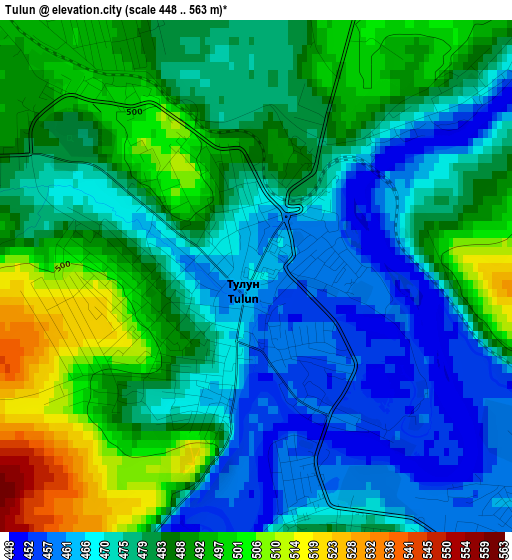
Below is the Elevation map of Tulun, which displays elevation range with different colors. Scale of the first map is from 448 to 563 m (1470 to 1847 ft) with average elevation of 480.6 meters (=1577 ft) [note 1]
These maps also provides idea of topography and contour of this city, they are displayed at different zoom levels. More info about maps, scale and edge coordinates you can find below images.
| \ | Map #1 | Map #2 | Topo.Map |
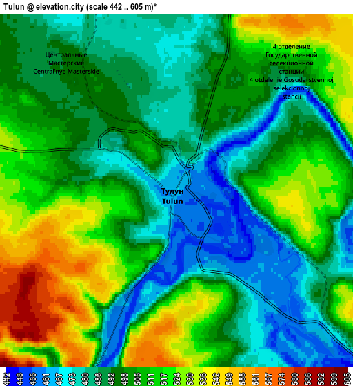
| Scale [m] | 448..563 m | 442..605 m | × |
| Scale [ft] | 1470..1847 ft | 1450..1985 ft | × |
| Average | 480.6 m = 1577 ft | 501 m = 1644 ft | × |
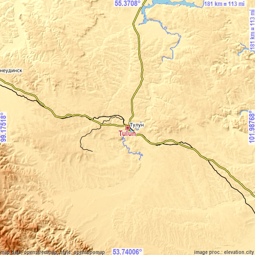
| Width | 5.67 km = 3.5 mi | 11.33 km = 7 mi | 181.3 km = 112.7 mi |
| Height | 5.67 km = 3.5 mi | 11.33 km = 7 mi | 181.3 km = 112.7 mi |
| ↑Max Latitude | 54.589051° | 54.614507° | 55.3708° |
| Latitude at center | 54.56358° | 54.56358° | 54.56358° |
| ↓Min Latitude | 54.538093° | 54.512589° | 53.74006° |
| ← Min Longitude | 100.537485° | 100.493539° | 99.17518° |
| Longitude center | 100.58143° | 100.58143° | 100.58143° |
| →Max Longitude | 100.625375° | 100.669321° | 101.98768° |
Nearby cities:
Cities around Tulun sort by population:
• Sheragul elevation 498 m
24 km,  117°
117°
• Tulyushka 522 m
39.8 km,  107°
107°
• Budagovo 549 m
29.8 km,  283°
283°
• Badar 488 m
18.3 km,  177°
177°
• Guran 528 m
22.3 km,  10°
10°
• Gadaley 469 m
20.6 km,  149°
149°
• Kotik 516 m
12.7 km,  319°
319°
• Algatuy 510 m
27.8 km,  229°
229°
• Mugun 527 m
23.8 km,  244°
244°
• Perfilovo 488 m
18.1 km,  200°
200°
• Yedogon 572 m
40.9 km,  212°
212°
• Afanas’yeva 476 m
8.8 km,  15°
15°
Multilingual:
 En español:
Tulún elevación 468 m.
 En France:
Touloun élévation 468 m.


Sources and notes:
- [note 1] Map square and city borders are not equal. Map elevation data is calculated only from area inside that square.
- [src 1] Elevation data from geonames database provided with same terms of usage.
- [src 2] The elevation map of Tulun is generated using elevation data from NASA's 3 arcsec (90m) resolution SRTM data.
- [src 3] Base (background) map © OpenStreetMap contributors tiles are generated by Geofabrik and OpenTopoMap.
Copyright & License:
This Tulun Elevation Map is licensed under CC BY-SA. You may reuse any part from this page, if you give a proper credit by linking to this URL:
 More info on terms of use page.