Aradac elevation
Aradac (Vojvodina, Central Banat), Serbia elevation is 76 meters and Aradac elevation in feet is 249 ft above sea level [src 1]. Aradac is a populated place (feature code) with elevation that is 91 meters (299 ft) smaller than average city elevation in Serbia.
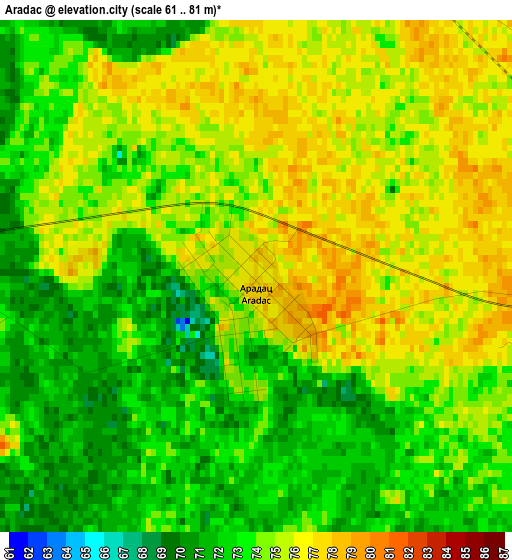
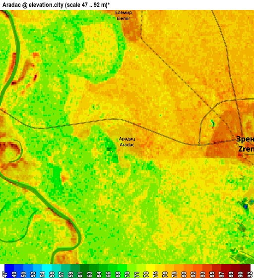
Below is the Elevation map of Aradac, which displays elevation range with different colors. Scale of the first map is from 61 to 81 m (200 to 266 ft) with average elevation of 73.8 meters (=242 ft) [note 1]
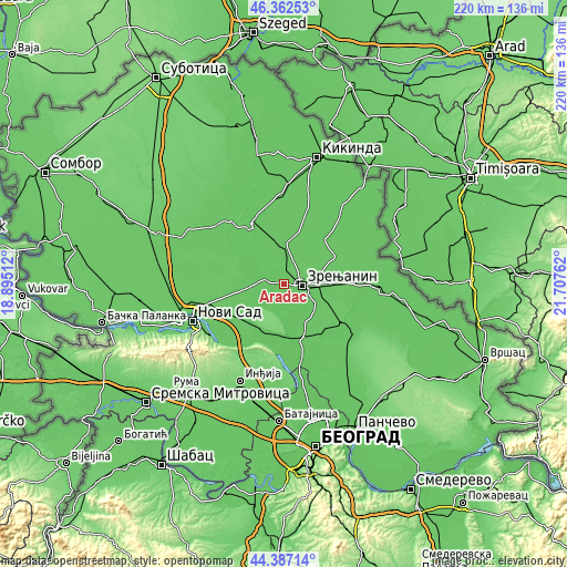
These maps also provides idea of topography and contour of this city, they are displayed at different zoom levels. More info about maps, scale and edge coordinates you can find below images.
| \ | Map #1 | Map #2 | Topo.Map |
| Scale [m] | 61..81 m | 47..92 m | × |
| Scale [ft] | 200..266 ft | 154..302 ft | × |
| Average | 73.8 m = 242 ft | 73.7 m = 242 ft | × |
| Width | 6.86 km = 4.3 mi | 13.73 km = 8.5 mi | 219.6 km = 136.5 mi |
| Height | 6.86 km = 4.3 mi | 13.73 km = 8.5 mi | 219.6 km = 136.5 mi |
| ↑Max Latitude | 45.414317° | 45.445157° | 46.36253° |
| Latitude at center | 45.38346° | 45.38346° | 45.38346° |
| ↓Min Latitude | 45.352586° | 45.321696° | 44.38714° |
| ← Min Longitude | 20.257425° | 20.213479° | 18.89512° |
| Longitude center | 20.30137° | 20.30137° | 20.30137° |
| →Max Longitude | 20.345315° | 20.389261° | 21.70762° |
Nearby cities:
Cities around Aradac sort by population:
• Zrenjanin elevation 81 m
6.3 km,  89°
89°
• Melenci 78 m
14.9 km,  5°
5°
• Ečka 77 m
12.9 km,  121°
121°
• Elemir 81 m
6.6 km,  359°
359°
• Kumane 77 m
18.2 km,  341°
341°
• Mošorin 75 m
13.7 km,  228°
228°
• Klek 77 m
14.6 km,  72°
72°
• Lukićevo 80 m
16.2 km,  108°
108°
• Stajićevo 78 m
15.7 km,  128°
128°
• Belo Blato 71 m
13.6 km,  154°
154°
• Taraš 77 m
12.3 km,  319°
319°
• Mihajlovo 77 m
13.2 km,  42°
42°
Multilingual:
 En español:
Aradac elevación 76 m.
 En France:
Aradac élévation 76 m.


Sources and notes:
- [note 1] Map square and city borders are not equal. Map elevation data is calculated only from area inside that square.
- [src 1] Elevation data from geonames database provided with same terms of usage.
- [src 2] The elevation map of Aradac is generated using elevation data from NASA's 3 arcsec (90m) resolution SRTM data.
- [src 3] Base (background) map © OpenStreetMap contributors tiles are generated by Geofabrik and OpenTopoMap.
Copyright & License:
This Aradac Elevation Map is licensed under CC BY-SA. You may reuse any part from this page, if you give a proper credit by linking to this URL:
 More info on terms of use page.