Torak elevation
Torak (Vojvodina, Central Banat), Serbia elevation is 78 meters and Torak elevation in feet is 256 ft above sea level [src 1]. Torak is a populated place (feature code) with elevation that is 89 meters (292 ft) smaller than average city elevation in Serbia.
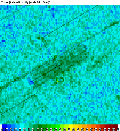
Below is the Elevation map of Torak, which displays elevation range with different colors. Scale of the first map is from 70 to 84 m (230 to 276 ft) with average elevation of 74.5 meters (=244 ft) [note 1]
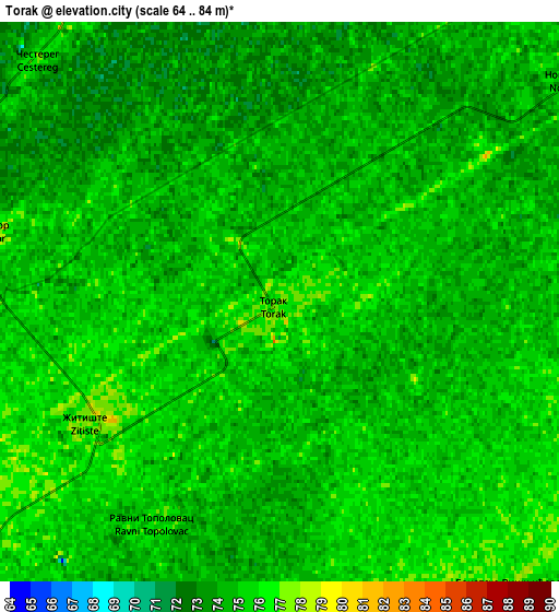
These maps also provides idea of topography and contour of this city, they are displayed at different zoom levels. More info about maps, scale and edge coordinates you can find below images.
| \ | Map #1 | Map #2 | Topo.Map |
| Scale [m] | 70..84 m | 64..84 m | × |
| Scale [ft] | 230..276 ft | 210..276 ft | × |
| Average | 74.5 m = 244 ft | 74.3 m = 244 ft | × |
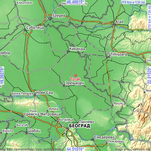
| Width | 6.85 km = 4.3 mi | 13.7 km = 8.5 mi | 219.2 km = 136.2 mi |
| Height | 6.85 km = 4.3 mi | 13.7 km = 8.5 mi | 219.1 km = 136.1 mi |
| ↑Max Latitude | 45.540068° | 45.570839° | 46.48615° |
| Latitude at center | 45.50928° | 45.50928° | 45.50928° |
| ↓Min Latitude | 45.478475° | 45.447653° | 44.51516° |
| ← Min Longitude | 20.565055° | 20.521109° | 19.20275° |
| Longitude center | 20.609° | 20.609° | 20.609° |
| →Max Longitude | 20.652945° | 20.696891° | 22.01525° |
Nearby cities:
Cities around Torak sort by population:
• Lazarevo elevation 76 m
14.4 km,  201°
201°
• Srpski Itebej 78 m
10.4 km,  51°
51°
• Aleksandrovo 76 m
14.3 km,  354°
354°
• Žitište 78 m
5.4 km,  239°
239°
• Banatsko Karađorđevo 74 m
9.3 km,  338°
338°
• Torda 78 m
14.3 km,  305°
305°
• Krajišnik 79 m
11.3 km,  123°
123°
• Klek 77 m
13.9 km,  226°
226°
• Ravni Topolovac 75 m
6.2 km,  209°
209°
• Čestereg 77 m
8.5 km,  315°
315°
• Novi Itebej 75 m
9 km, 52°
• Banatski Dvor 76 m
7.7 km,  277°
277°
Multilingual:
 En español:
Torak elevación 78 m.
 En France:
Torak élévation 78 m.


Sources and notes:
- [note 1] Map square and city borders are not equal. Map elevation data is calculated only from area inside that square.
- [src 1] Elevation data from geonames database provided with same terms of usage.
- [src 2] The elevation map of Torak is generated using elevation data from NASA's 3 arcsec (90m) resolution SRTM data.
- [src 3] Base (background) map © OpenStreetMap contributors tiles are generated by Geofabrik and OpenTopoMap.
Copyright & License:
This Torak Elevation Map is licensed under CC BY-SA. You may reuse any part from this page, if you give a proper credit by linking to this URL:
 More info on terms of use page.