Dobanovci elevation
Dobanovci (Central Serbia, Belgrade), Serbia elevation is 78 meters and Dobanovci elevation in feet is 256 ft above sea level [src 1]. Dobanovci is a populated place (feature code) with elevation that is 89 meters (292 ft) smaller than average city elevation in Serbia.
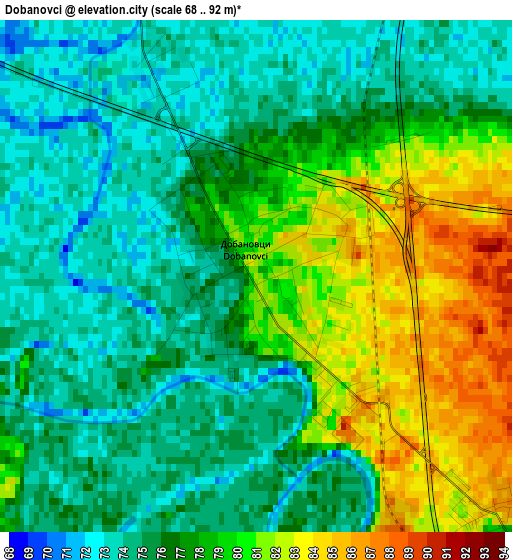
Below is the Elevation map of Dobanovci, which displays elevation range with different colors. Scale of the first map is from 68 to 92 m (223 to 302 ft) with average elevation of 77 meters (=253 ft) [note 1]
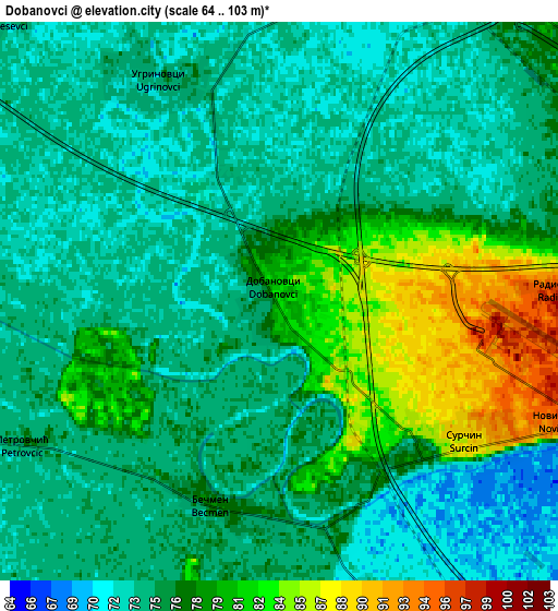
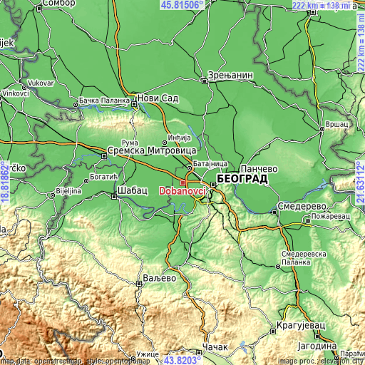
These maps also provides idea of topography and contour of this city, they are displayed at different zoom levels. More info about maps, scale and edge coordinates you can find below images.
| \ | Map #1 | Map #2 | Topo.Map |
| Scale [m] | 68..92 m | 64..103 m | × |
| Scale [ft] | 223..302 ft | 210..338 ft | × |
| Average | 77 m = 253 ft | 75.7 m = 248 ft | × |
| Width | 6.93 km = 4.3 mi | 13.86 km = 8.6 mi | 221.8 km = 137.8 mi |
| Height | 6.93 km = 4.3 mi | 13.86 km = 8.6 mi | 221.8 km = 137.8 mi |
| ↑Max Latitude | 44.85747° | 44.888612° | 45.81506° |
| Latitude at center | 44.82631° | 44.82631° | 44.82631° |
| ↓Min Latitude | 44.795133° | 44.76394° | 43.8203° |
| ← Min Longitude | 20.180925° | 20.136979° | 18.81862° |
| Longitude center | 20.22487° | 20.22487° | 20.22487° |
| →Max Longitude | 20.268815° | 20.312761° | 21.63112° |
Nearby cities:
Cities around Dobanovci sort by population:
• Zemun elevation 88 m
14.1 km,  81°
81°
• Nova Pazova 76 m
13.1 km,  358°
358°
• Surčin 87 m
5.7 km,  130°
130°
• Vojka 76 m
13.6 km,  335°
335°
• Ostružnica 77 m
13.2 km,  146°
146°
• Novi Banovci 59 m
15.2 km,  16°
16°
• Boljevci 75 m
11.4 km,  180°
180°
• Ugrinovci 75 m
6.3 km,  332°
332°
• Bečmen 76 m
5.4 km,  196°
196°
• Šimanovci 76 m
11.8 km,  296°
296°
• Čukarica 116 m
16.2 km,  107°
107°
• Novi Beograd 71 m
15.9 km,  98°
98°
Multilingual:
 En español:
Dobanovci elevación 78 m.
 En France:
Dobanovci élévation 78 m.
 Auf Deutsch:
Dobanovci höhe über dem Meeresspiegel ist 78 m.

Sources and notes:
- [note 1] Map square and city borders are not equal. Map elevation data is calculated only from area inside that square.
- [src 1] Elevation data from geonames database provided with same terms of usage.
- [src 2] The elevation map of Dobanovci is generated using elevation data from NASA's 3 arcsec (90m) resolution SRTM data.
- [src 3] Base (background) map © OpenStreetMap contributors tiles are generated by Geofabrik and OpenTopoMap.
Copyright & License:
This Dobanovci Elevation Map is licensed under CC BY-SA. You may reuse any part from this page, if you give a proper credit by linking to this URL:
 More info on terms of use page.