Umka elevation
Umka (Central Serbia, Belgrade), Serbia elevation is 82 meters and Umka elevation in feet is 269 ft above sea level [src 1]. Umka is a populated place (feature code) with elevation that is 85 meters (279 ft) smaller than average city elevation in Serbia.
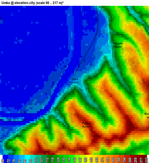
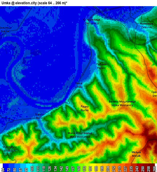
Below is the Elevation map of Umka, which displays elevation range with different colors. Scale of the first map is from 66 to 217 m (217 to 712 ft) with average elevation of 113.5 meters (=372 ft) [note 1]
These maps also provides idea of topography and contour of this city, they are displayed at different zoom levels. More info about maps, scale and edge coordinates you can find below images.
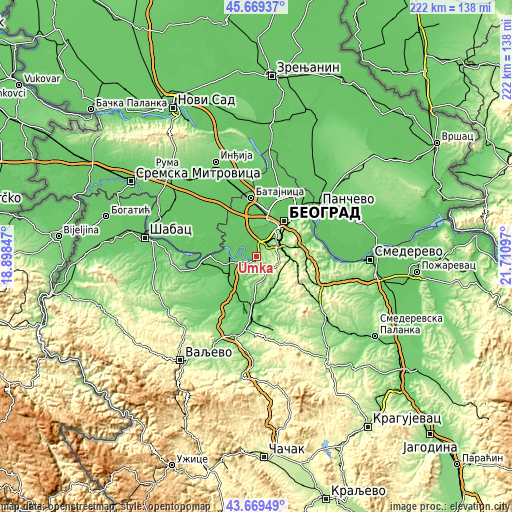
| \ | Map #1 | Map #2 | Topo.Map |
| Scale [m] | 66..217 m | 64..266 m | × |
| Scale [ft] | 217..712 ft | 210..873 ft | × |
| Average | 113.5 m = 372 ft | 122.5 m = 402 ft | × |
| Width | 6.95 km = 4.3 mi | 13.9 km = 8.6 mi | 222.4 km = 138.2 mi |
| Height | 6.95 km = 4.3 mi | 13.9 km = 8.6 mi | 222.4 km = 138.2 mi |
| ↑Max Latitude | 44.7093° | 44.740523° | 45.66937° |
| Latitude at center | 44.67806° | 44.67806° | 44.67806° |
| ↓Min Latitude | 44.646803° | 44.61553° | 43.66949° |
| ← Min Longitude | 20.260775° | 20.216829° | 18.89847° |
| Longitude center | 20.30472° | 20.30472° | 20.30472° |
| →Max Longitude | 20.348665° | 20.392611° | 21.71097° |
Nearby cities:
Cities around Umka sort by population:
• Sremčica elevation 225 m
6.9 km,  91°
91°
• Obrenovac 78 m
8.7 km,  252°
252°
• Surčin 87 m
12.9 km,  351°
351°
• Zvečka 76 m
11.9 km, 249°
• Barič 82 m
4.7 km,  229°
229°
• Rušanj 201 m
11.5 km, 86°
• Ostružnica 77 m
5.6 km,  11°
11°
• Boljevci 75 m
8.2 km,  308°
308°
• Vranić 209 m
8.6 km,  167°
167°
• Velika Moštanica 200 m
4.2 km,  110°
110°
• Mala Moštanica 113 m
4.4 km,  178°
178°
• Rakovica 98 m
12.9 km,  56°
56°
Multilingual:
 En español:
Umka elevación 82 m.
 En France:
Umka élévation 82 m.


Sources and notes:
- [note 1] Map square and city borders are not equal. Map elevation data is calculated only from area inside that square.
- [src 1] Elevation data from geonames database provided with same terms of usage.
- [src 2] The elevation map of Umka is generated using elevation data from NASA's 3 arcsec (90m) resolution SRTM data.
- [src 3] Base (background) map © OpenStreetMap contributors tiles are generated by Geofabrik and OpenTopoMap.
Copyright & License:
This Umka Elevation Map is licensed under CC BY-SA. You may reuse any part from this page, if you give a proper credit by linking to this URL:
 More info on terms of use page.