Vršac elevation
Vršac (Vojvodina, South Banat), Serbia elevation is 96 meters and Vršac elevation in feet is 315 ft above sea level [src 1]. Vršac is a seat of a third-order administrative division (feature code) with elevation that is 71 meters (233 ft) smaller than average city elevation in Serbia.
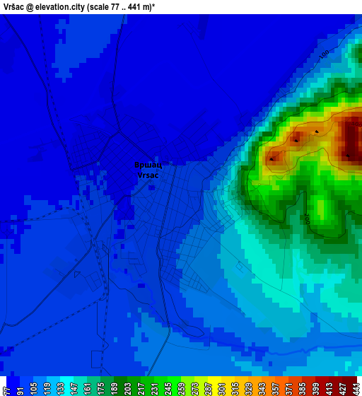
Below is the Elevation map of Vršac, which displays elevation range with different colors. Scale of the first map is from 77 to 441 m (253 to 1447 ft) with average elevation of 118.8 meters (=390 ft) [note 1]
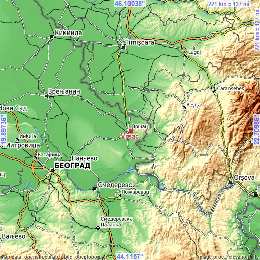
These maps also provides idea of topography and contour of this city, they are displayed at different zoom levels. More info about maps, scale and edge coordinates you can find below images.
| \ | Map #1 | Map #2 | Topo.Map |
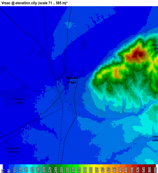
| Scale [m] | 77..441 m | 71..585 m | × |
| Scale [ft] | 253..1447 ft | 233..1919 ft | × |
| Average | 118.8 m = 390 ft | 118.8 m = 390 ft | × |
| Width | 6.9 km = 4.3 mi | 13.79 km = 8.6 mi | 220.7 km = 137.1 mi |
| Height | 6.9 km = 4.3 mi | 13.79 km = 8.6 mi | 220.7 km = 137.1 mi |
| ↑Max Latitude | 45.147672° | 45.178658° | 46.10038° |
| Latitude at center | 45.11667° | 45.11667° | 45.11667° |
| ↓Min Latitude | 45.085651° | 45.054615° | 44.1157° |
| ← Min Longitude | 21.259665° | 21.215719° | 19.89736° |
| Longitude center | 21.30361° | 21.30361° | 21.30361° |
| →Max Longitude | 21.347555° | 21.391501° | 22.70986° |
Nearby cities:
Cities around Vršac sort by population:
• Plandište elevation 78 m
18.8 km,  310°
310°
• Uljma 87 m
14.4 km,  234°
234°
• Pavliš 89 m
5.2 km,  256°
256°
• Izbište 95 m
14.1 km,  221°
221°
• Nikolinci 87 m
19.9 km,  248°
248°
• Veliko Središte 103 m
10.5 km,  48°
48°
• Margita 79 m
14.9 km,  317°
317°
• Jermenovci 78 m
21.7 km,  290°
290°
• Gudurica 115 m
12.3 km,  62°
62°
• Vlajkovac 80 m
9.6 km,  238°
238°
• Kuštilj 88 m
10.9 km,  146°
146°
• Barice 77 m
18.8 km, 292°
Multilingual:
 En español:
Vršac elevación 96 m.
 En France:
Vršac élévation 96 m.


Sources and notes:
- [note 1] Map square and city borders are not equal. Map elevation data is calculated only from area inside that square.
- [src 1] Elevation data from geonames database provided with same terms of usage.
- [src 2] The elevation map of Vršac is generated using elevation data from NASA's 3 arcsec (90m) resolution SRTM data.
- [src 3] Base (background) map © OpenStreetMap contributors tiles are generated by Geofabrik and OpenTopoMap.
Copyright & License:
This Vršac Elevation Map is licensed under CC BY-SA. You may reuse any part from this page, if you give a proper credit by linking to this URL:
 More info on terms of use page.