Bačka Topola elevation
Bačka Topola (Vojvodina, North Bačka), Serbia elevation is 94 meters and Bačka Topola elevation in feet is 308 ft above sea level [src 1]. Bačka Topola is a seat of a third-order administrative division (feature code) with elevation that is 73 meters (240 ft) smaller than average city elevation in Serbia.
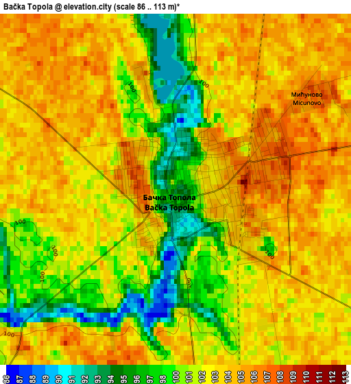
Below is the Elevation map of Bačka Topola, which displays elevation range with different colors. Scale of the first map is from 86 to 113 m (282 to 371 ft) with average elevation of 101.9 meters (=334 ft) [note 1]
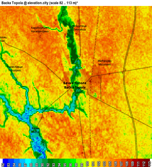
These maps also provides idea of topography and contour of this city, they are displayed at different zoom levels. More info about maps, scale and edge coordinates you can find below images.
| \ | Map #1 | Map #2 | Topo.Map |
| Scale [m] | 86..113 m | 82..113 m | × |
| Scale [ft] | 282..371 ft | 269..371 ft | × |
| Average | 101.9 m = 334 ft | 101.8 m = 334 ft | × |
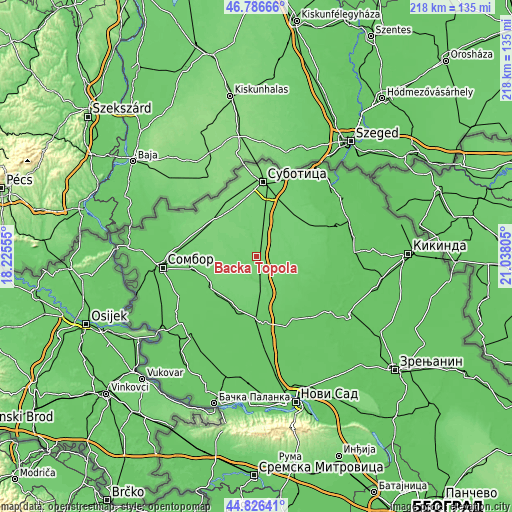
| Width | 6.81 km = 4.2 mi | 13.62 km = 8.5 mi | 218 km = 135.5 mi |
| Height | 6.81 km = 4.2 mi | 13.62 km = 8.5 mi | 217.9 km = 135.4 mi |
| ↑Max Latitude | 45.84578° | 45.876384° | 46.78666° |
| Latitude at center | 45.81516° | 45.81516° | 45.81516° |
| ↓Min Latitude | 45.784523° | 45.753869° | 44.82641° |
| ← Min Longitude | 19.587855° | 19.543909° | 18.22555° |
| Longitude center | 19.6318° | 19.6318° | 19.6318° |
| →Max Longitude | 19.675745° | 19.719691° | 21.03805° |
Nearby cities:
Cities around Bačka Topola sort by population:
• Subotica elevation 115 m
31.8 km,  4°
4°
• Vrbas 85 m
27.1 km,  178°
178°
• Bečej 77 m
38.2 km,  125°
125°
• Senta 81 m
36.7 km,  70°
70°
• Bačko Petrovo Selo 79 m
36.7 km,  109°
109°
• Stanišić 95 m
38.5 km,  290°
290°
• Gornji Breg 94 m
32.1 km, 68°
• Adorjan 80 m
37.9 km,  56°
56°
• Ada 79 m
38.3 km,  92°
92°
• Srbobran 77 m
31.9 km,  155°
155°
• Kula 80 m
24.4 km,  199°
199°
• Mali Iđoš 87 m
12.2 km,  167°
167°
Multilingual:
 En español:
Bačka Topola elevación 94 m.
 En France:
Bačka Topola élévation 94 m.
 Auf Deutsch:
Bačka Topola höhe über dem Meeresspiegel ist 94 m.

Sources and notes:
- [note 1] Map square and city borders are not equal. Map elevation data is calculated only from area inside that square.
- [src 1] Elevation data from geonames database provided with same terms of usage.
- [src 2] The elevation map of Bačka Topola is generated using elevation data from NASA's 3 arcsec (90m) resolution SRTM data.
- [src 3] Base (background) map © OpenStreetMap contributors tiles are generated by Geofabrik and OpenTopoMap.
Copyright & License:
This Bačka Topola Elevation Map is licensed under CC BY-SA. You may reuse any part from this page, if you give a proper credit by linking to this URL:
 More info on terms of use page.