Čelarevo elevation
Čelarevo (Vojvodina, South Bačka), Serbia elevation is 79 meters and Čelarevo elevation in feet is 259 ft above sea level [src 1]. Čelarevo is a populated place (feature code) with elevation that is 88 meters (289 ft) smaller than average city elevation in Serbia.
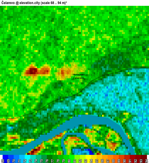
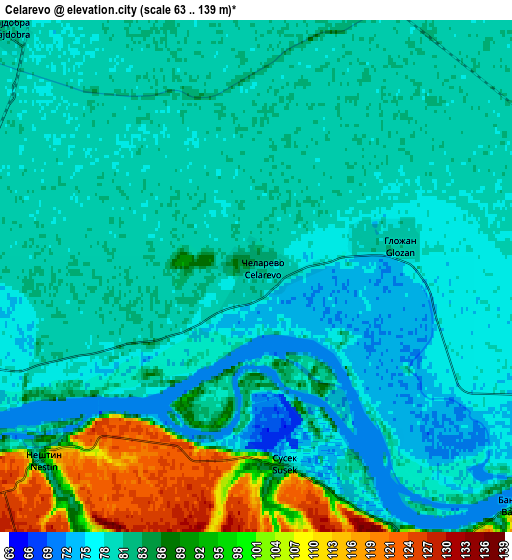
Below is the Elevation map of Čelarevo, which displays elevation range with different colors. Scale of the first map is from 68 to 94 m (223 to 308 ft) with average elevation of 77.7 meters (=255 ft) [note 1]
These maps also provides idea of topography and contour of this city, they are displayed at different zoom levels. More info about maps, scale and edge coordinates you can find below images.
| \ | Map #1 | Map #2 | Topo.Map |
| Scale [m] | 68..94 m | 63..139 m | × |
| Scale [ft] | 223..308 ft | 207..456 ft | × |
| Average | 77.7 m = 255 ft | 82.4 m = 270 ft | × |
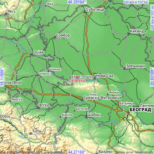
| Width | 6.88 km = 4.3 mi | 13.76 km = 8.6 mi | 220.1 km = 136.8 mi |
| Height | 6.88 km = 4.3 mi | 13.76 km = 8.6 mi | 220.1 km = 136.8 mi |
| ↑Max Latitude | 45.300909° | 45.331811° | 46.25104° |
| Latitude at center | 45.26999° | 45.26999° | 45.26999° |
| ↓Min Latitude | 45.239054° | 45.208102° | 44.27169° |
| ← Min Longitude | 19.480895° | 19.436949° | 18.11859° |
| Longitude center | 19.52484° | 19.52484° | 19.52484° |
| →Max Longitude | 19.568785° | 19.612731° | 20.93109° |
Nearby cities:
Cities around Čelarevo sort by population:
• Bačka Palanka elevation 88 m
10.3 km,  257°
257°
• Veternik 79 m
18.4 km,  95°
95°
• Bački Petrovac 83 m
11.3 km,  27°
27°
• Rumenka 82 m
17.3 km,  81°
81°
• Kulpin 81 m
15.5 km,  18°
18°
• Obrovac 82 m
14.8 km,  292°
292°
• Maglić 83 m
10.3 km,  3°
3°
• Gložan 79 m
3.6 km,  72°
72°
• Despotovo 82 m
21.1 km, 0°
• Stepanovićevo 80 m
21 km,  40°
40°
• Kisač 81 m
18.6 km,  59°
59°
• Beočin 87 m
16.8 km,  114°
114°
Multilingual:
 En español:
Čelarevo elevación 79 m.
 En France:
Čelarevo élévation 79 m.


Sources and notes:
- [note 1] Map square and city borders are not equal. Map elevation data is calculated only from area inside that square.
- [src 1] Elevation data from geonames database provided with same terms of usage.
- [src 2] The elevation map of Čelarevo is generated using elevation data from NASA's 3 arcsec (90m) resolution SRTM data.
- [src 3] Base (background) map © OpenStreetMap contributors tiles are generated by Geofabrik and OpenTopoMap.
Copyright & License:
This Čelarevo Elevation Map is licensed under CC BY-SA. You may reuse any part from this page, if you give a proper credit by linking to this URL:
 More info on terms of use page.