Majur elevation
Majur (Central Serbia, Mačva), Serbia elevation is 78 meters and Majur elevation in feet is 256 ft above sea level [src 1]. Majur is a populated place (feature code) with elevation that is 89 meters (292 ft) smaller than average city elevation in Serbia.
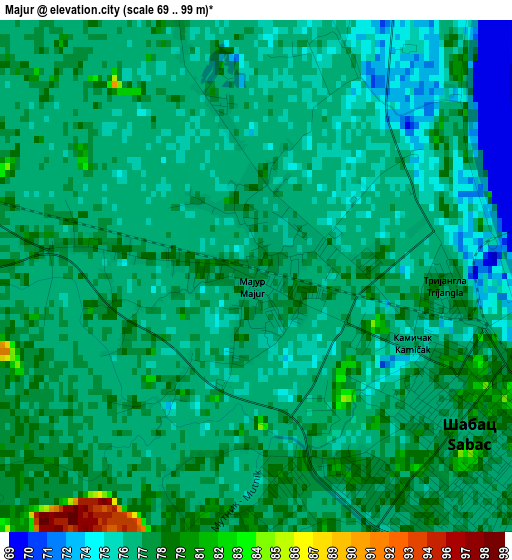
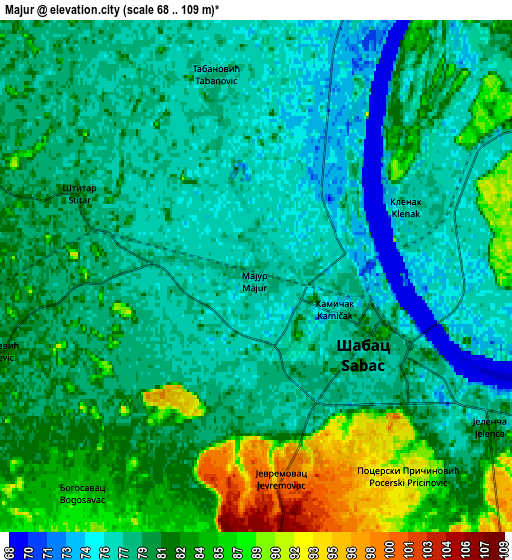
Below is the Elevation map of Majur, which displays elevation range with different colors. Scale of the first map is from 69 to 99 m (226 to 325 ft) with average elevation of 76.9 meters (=252 ft) [note 1]
These maps also provides idea of topography and contour of this city, they are displayed at different zoom levels. More info about maps, scale and edge coordinates you can find below images.
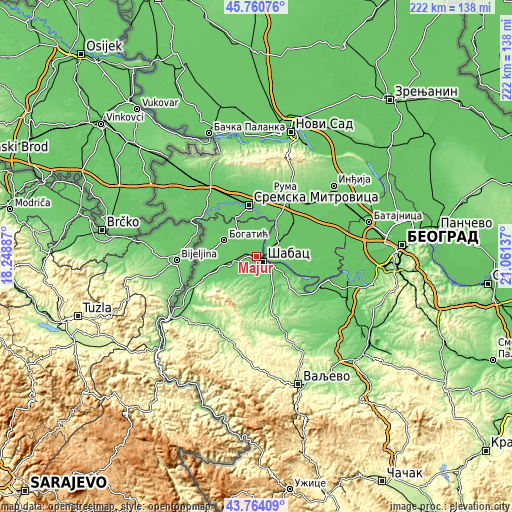
| \ | Map #1 | Map #2 | Topo.Map |
| Scale [m] | 69..99 m | 68..109 m | × |
| Scale [ft] | 226..325 ft | 223..358 ft | × |
| Average | 76.9 m = 252 ft | 80.1 m = 263 ft | × |
| Width | 6.94 km = 4.3 mi | 13.88 km = 8.6 mi | 222 km = 137.9 mi |
| Height | 6.94 km = 4.3 mi | 13.88 km = 8.6 mi | 222 km = 137.9 mi |
| ↑Max Latitude | 44.80224° | 44.833412° | 45.76076° |
| Latitude at center | 44.77105° | 44.77105° | 44.77105° |
| ↓Min Latitude | 44.739844° | 44.70862° | 43.76409° |
| ← Min Longitude | 19.611175° | 19.567229° | 18.24887° |
| Longitude center | 19.65512° | 19.65512° | 19.65512° |
| →Max Longitude | 19.699065° | 19.743011° | 21.06137° |
Nearby cities:
Cities around Majur sort by population:
• Šabac elevation 79 m
3.9 km,  134°
134°
• Pocerski Pričinović 91 m
6.8 km,  142°
142°
• Klenak 77 m
4.7 km,  65°
65°
• Štitar 79 m
5.4 km,  298°
298°
• Jelenča 83 m
8 km, 127°
• Jevremovac 100 m
5.5 km,  173°
173°
• Belotić 83 m
9.9 km, 301°
• Varna 113 m
10.2 km,  181°
181°
• Ševarice 78 m
10.7 km,  2°
2°
• Dobrić 91 m
9.7 km,  218°
218°
• Tabanović 78 m
5.6 km,  348°
348°
• Bogosavac 86 m
7.6 km, 218°
Multilingual:
 En español:
Majur elevación 78 m.
 En France:
Majur élévation 78 m.


Sources and notes:
- [note 1] Map square and city borders are not equal. Map elevation data is calculated only from area inside that square.
- [src 1] Elevation data from geonames database provided with same terms of usage.
- [src 2] The elevation map of Majur is generated using elevation data from NASA's 3 arcsec (90m) resolution SRTM data.
- [src 3] Base (background) map © OpenStreetMap contributors tiles are generated by Geofabrik and OpenTopoMap.
Copyright & License:
This Majur Elevation Map is licensed under CC BY-SA. You may reuse any part from this page, if you give a proper credit by linking to this URL:
 More info on terms of use page.