Prnjavor elevation
Prnjavor (Central Serbia, Mačva), Serbia elevation is 95 meters and Prnjavor elevation in feet is 312 ft above sea level [src 1]. Prnjavor is a populated place (feature code) with elevation that is 72 meters (236 ft) smaller than average city elevation in Serbia.
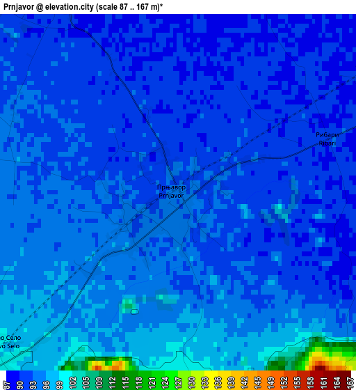
Below is the Elevation map of Prnjavor, which displays elevation range with different colors. Scale of the first map is from 87 to 167 m (285 to 548 ft) with average elevation of 94 meters (=308 ft) [note 1]
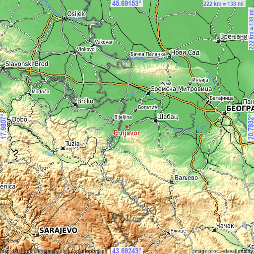
These maps also provides idea of topography and contour of this city, they are displayed at different zoom levels. More info about maps, scale and edge coordinates you can find below images.
| \ | Map #1 | Map #2 | Topo.Map |
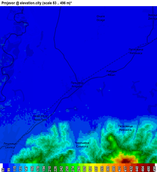
| Scale [m] | 87..167 m | 83..496 m | × |
| Scale [ft] | 285..548 ft | 272..1627 ft | × |
| Average | 94 m = 308 ft | 110.4 m = 362 ft | × |
| Width | 6.95 km = 4.3 mi | 13.89 km = 8.6 mi | 222.3 km = 138.1 mi |
| Height | 6.95 km = 4.3 mi | 13.89 km = 8.6 mi | 222.3 km = 138.1 mi |
| ↑Max Latitude | 44.731838° | 44.763048° | 45.69153° |
| Latitude at center | 44.70061° | 44.70061° | 44.70061° |
| ↓Min Latitude | 44.669366° | 44.638104° | 43.69243° |
| ← Min Longitude | 19.343005° | 19.299059° | 17.9807° |
| Longitude center | 19.38695° | 19.38695° | 19.38695° |
| →Max Longitude | 19.430895° | 19.474841° | 20.7932° |
Nearby cities:
Cities around Prnjavor sort by population:
• Badovinci elevation 90 m
9.5 km,  352°
352°
• Lešnica 108 m
8.1 km,  228°
228°
• Klenje 86 m
12.5 km,  17°
17°
• Lipolist 91 m
9 km,  91°
91°
• Jadranska Lešnica 179 m
11.8 km,  193°
193°
• Ribari 93 m
3.1 km,  71°
71°
• Donji Dobrić 140 m
10.8 km,  204°
204°
• Zminjak 87 m
9.1 km,  46°
46°
• Novo Selo 101 m
4.7 km,  224°
224°
• Čokešina 148 m
5.3 km,  177°
177°
• Joševa 155 m
12.7 km,  171°
171°
• Petkovica 129 m
5.6 km,  132°
132°
Multilingual:
 En español:
Prnjavor elevación 95 m.
 En France:
Prnjavor élévation 95 m.


Sources and notes:
- [note 1] Map square and city borders are not equal. Map elevation data is calculated only from area inside that square.
- [src 1] Elevation data from geonames database provided with same terms of usage.
- [src 2] The elevation map of Prnjavor is generated using elevation data from NASA's 3 arcsec (90m) resolution SRTM data.
- [src 3] Base (background) map © OpenStreetMap contributors tiles are generated by Geofabrik and OpenTopoMap.
Copyright & License:
This Prnjavor Elevation Map is licensed under CC BY-SA. You may reuse any part from this page, if you give a proper credit by linking to this URL:
 More info on terms of use page.