Aninoasa elevation
Aninoasa (Dâmboviţa, Comuna Aninoasa), Romania elevation is 307 meters and Aninoasa elevation in feet is 1007 ft above sea level [src 1]. Aninoasa is a seat of a second-order administrative division (feature code) with elevation that is 55 meters (180 ft) bigger than average city elevation in Romania.
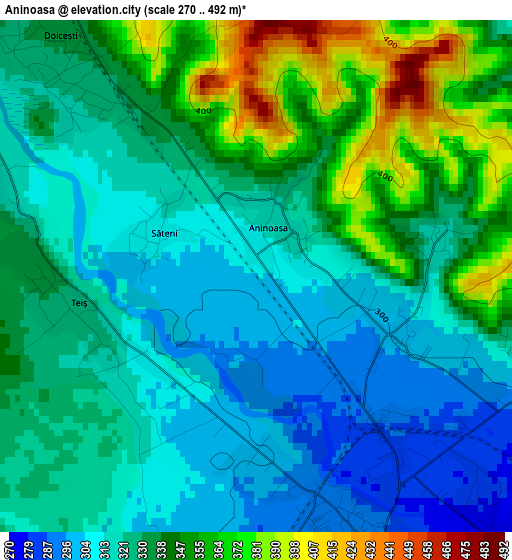
Below is the Elevation map of Aninoasa, which displays elevation range with different colors. Scale of the first map is from 270 to 492 m (886 to 1614 ft) with average elevation of 330.2 meters (=1083 ft) [note 1]
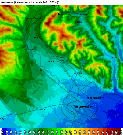
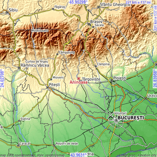
These maps also provides idea of topography and contour of this city, they are displayed at different zoom levels. More info about maps, scale and edge coordinates you can find below images.
| \ | Map #1 | Map #2 | Topo.Map |
| Scale [m] | 270..492 m | 249..523 m | × |
| Scale [ft] | 886..1614 ft | 817..1716 ft | × |
| Average | 330.2 m = 1083 ft | 335.4 m = 1100 ft | × |
| Width | 6.91 km = 4.3 mi | 13.83 km = 8.6 mi | 221.3 km = 137.5 mi |
| Height | 6.91 km = 4.3 mi | 13.83 km = 8.6 mi | 221.2 km = 137.4 mi |
| ↑Max Latitude | 44.997754° | 45.02882° | 45.95299° |
| Latitude at center | 44.96667° | 44.96667° | 44.96667° |
| ↓Min Latitude | 44.935569° | 44.904452° | 43.9631° |
| ← Min Longitude | 25.389385° | 25.345439° | 24.02708° |
| Longitude center | 25.43333° | 25.43333° | 25.43333° |
| →Max Longitude | 25.477275° | 25.521221° | 26.83958° |
Nearby cities:
Cities around Aninoasa sort by population:
• Târgovişte elevation 283 m
4.9 km,  158°
158°
• Doiceşti 317 m
3.2 km,  305°
305°
• Glodeni 325 m
6.1 km,  25°
25°
• Valea Voievozilor 272 m
5.2 km,  127°
127°
• Vulcana-Pandele 349 m
6.3 km,  329°
329°
• Teiș 327 m
2.4 km,  259°
259°
• Viforâta 302 m
2.1 km,  110°
110°
• Săteni 309 m
1.4 km,  291°
291°
• Gorgota 300 m
6 km,  79°
79°
• Gura Vulcanei 354 m
7.1 km,  335°
335°
• Lăculețe 356 m
5.8 km,  358°
358°
• Şotânga 362 m
5.6 km, 289°
Multilingual:
 En español:
Aninoasa elevación 307 m.
 En France:
Aninoasa élévation 307 m.
 Auf Deutsch:
Aninoasa höhe über dem Meeresspiegel ist 307 m.

Sources and notes:
- [note 1] Map square and city borders are not equal. Map elevation data is calculated only from area inside that square.
- [src 1] Elevation data from geonames database provided with same terms of usage.
- [src 2] The elevation map of Aninoasa is generated using elevation data from NASA's 3 arcsec (90m) resolution SRTM data.
- [src 3] Base (background) map © OpenStreetMap contributors tiles are generated by Geofabrik and OpenTopoMap.
Copyright & License:
This Aninoasa Elevation Map is licensed under CC BY-SA. You may reuse any part from this page, if you give a proper credit by linking to this URL:
 More info on terms of use page.