Ardud elevation
Ardud (Satu Mare, Oraș Ardud), Romania elevation is 129 meters and Ardud elevation in feet is 423 ft above sea level [src 1]. Ardud is a seat of a second-order administrative division (feature code) with elevation that is 123 meters (404 ft) smaller than average city elevation in Romania.
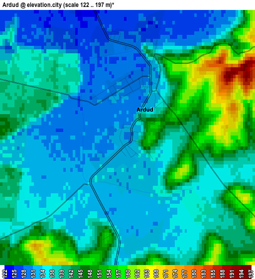
Below is the Elevation map of Ardud, which displays elevation range with different colors. Scale of the first map is from 122 to 197 m (400 to 646 ft) with average elevation of 139.3 meters (=457 ft) [note 1]
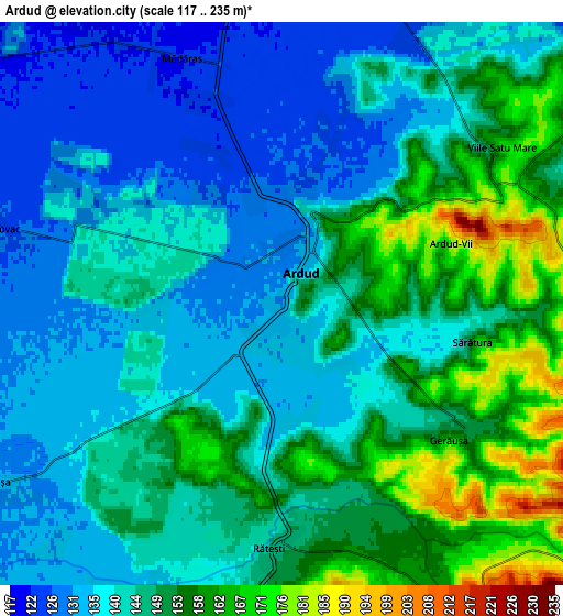
These maps also provides idea of topography and contour of this city, they are displayed at different zoom levels. More info about maps, scale and edge coordinates you can find below images.
| \ | Map #1 | Map #2 | Topo.Map |
| Scale [m] | 122..197 m | 117..235 m | × |
| Scale [ft] | 400..646 ft | 384..771 ft | × |
| Average | 139.3 m = 457 ft | 144.8 m = 475 ft | × |
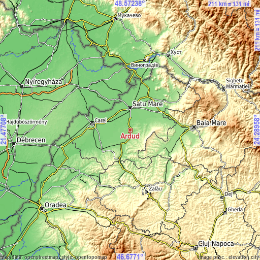
| Width | 6.59 km = 4.1 mi | 13.17 km = 8.2 mi | 210.7 km = 130.9 mi |
| Height | 6.59 km = 4.1 mi | 13.17 km = 8.2 mi | 210.7 km = 130.9 mi |
| ↑Max Latitude | 47.662935° | 47.692524° | 48.57238° |
| Latitude at center | 47.63333° | 47.63333° | 47.63333° |
| ↓Min Latitude | 47.603708° | 47.574069° | 46.6771° |
| ← Min Longitude | 22.839385° | 22.795439° | 21.47708° |
| Longitude center | 22.88333° | 22.88333° | 22.88333° |
| →Max Longitude | 22.927275° | 22.971221° | 24.28958° |
Nearby cities:
Cities around Ardud sort by population:
• Moftinu Mare elevation 118 m
16.6 km,  282°
282°
• Beltiug 166 m
9.6 km,  195°
195°
• Viile Satu Mare 162 m
6.2 km,  53°
53°
• Socond 164 m
8.9 km,  146°
146°
• Craidorolţ 124 m
13.9 km,  262°
262°
• Homorodu de Jos 150 m
15.4 km,  76°
76°
• Terebeşti 120 m
13.7 km,  294°
294°
• Sătmărel 117 m
13.1 km,  329°
329°
• Dobra 142 m
16 km, 195°
• Stâna 221 m
15.2 km,  156°
156°
• Mădăras 124 m
5.8 km,  346°
346°
• Acâş 139 m
13.4 km,  214°
214°
Multilingual:
 En español:
Ardud elevación 129 m.
 En France:
Ardud élévation 129 m.


Sources and notes:
- [note 1] Map square and city borders are not equal. Map elevation data is calculated only from area inside that square.
- [src 1] Elevation data from geonames database provided with same terms of usage.
- [src 2] The elevation map of Ardud is generated using elevation data from NASA's 3 arcsec (90m) resolution SRTM data.
- [src 3] Base (background) map © OpenStreetMap contributors tiles are generated by Geofabrik and OpenTopoMap.
Copyright & License:
This Ardud Elevation Map is licensed under CC BY-SA. You may reuse any part from this page, if you give a proper credit by linking to this URL:
 More info on terms of use page.