Borduşani elevation
Borduşani (Ialomiţa, Comuna Borduşani), Romania elevation is 19 meters and Borduşani elevation in feet is 62 ft above sea level [src 1]. Borduşani is a seat of a second-order administrative division (feature code) with elevation that is 233 meters (764 ft) smaller than average city elevation in Romania.
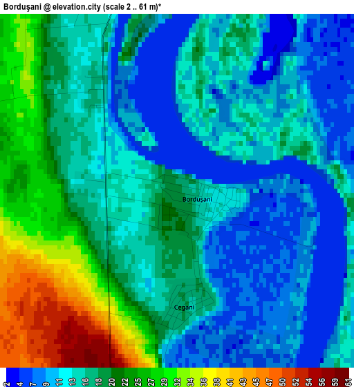
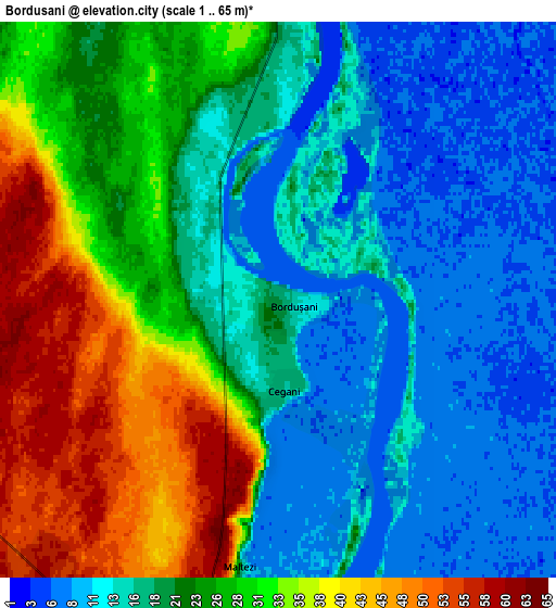
Below is the Elevation map of Borduşani, which displays elevation range with different colors. Scale of the first map is from 2 to 61 m (7 to 200 ft) with average elevation of 16.8 meters (=55 ft) [note 1]
These maps also provides idea of topography and contour of this city, they are displayed at different zoom levels. More info about maps, scale and edge coordinates you can find below images.
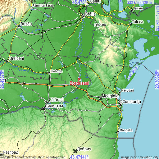
| \ | Map #1 | Map #2 | Topo.Map |
| Scale [m] | 2..61 m | 1..65 m | × |
| Scale [ft] | 7..200 ft | 3..213 ft | × |
| Average | 16.8 m = 55 ft | 22.3 m = 73 ft | × |
| Width | 6.97 km = 4.3 mi | 13.94 km = 8.7 mi | 223.1 km = 138.6 mi |
| Height | 6.97 km = 4.3 mi | 13.94 km = 8.7 mi | 223.1 km = 138.6 mi |
| ↑Max Latitude | 44.514675° | 44.546002° | 45.478° |
| Latitude at center | 44.48333° | 44.48333° | 44.48333° |
| ↓Min Latitude | 44.451969° | 44.42059° | 43.47141° |
| ← Min Longitude | 27.856055° | 27.812109° | 26.49375° |
| Longitude center | 27.9° | 27.9° | 27.9° |
| →Max Longitude | 27.943945° | 27.987891° | 29.30625° |
Nearby cities:
Cities around Borduşani sort by population:
• Feteşti elevation 59 m
12.3 km,  205°
205°
• Fetești-Gară 58 m
9.2 km,  219°
219°
• Cernavodă 15 m
19.1 km,  146°
146°
• Făcăeni 9 m
9.3 km,  0°
0°
• Seimeni 53 m
17.3 km,  130°
130°
• Vlădeni 5 m
14.9 km,  354°
354°
• Movila 61 m
17.5 km,  295°
295°
• Vlașca 42 m
10.5 km,  202°
202°
• Topalu 41 m
13.4 km,  59°
59°
• Stelnica 40 m
7.5 km,  190°
190°
• Cegani 17 m
2.3 km,  176°
176°
• Buliga 17 m
16.4 km, 211°
Multilingual:
 En español:
Borduşani elevación 19 m.
 En France:
Borduşani élévation 19 m.
 Auf Deutsch:
Borduşani höhe über dem Meeresspiegel ist 19 m.

Sources and notes:
- [note 1] Map square and city borders are not equal. Map elevation data is calculated only from area inside that square.
- [src 1] Elevation data from geonames database provided with same terms of usage.
- [src 2] The elevation map of Borduşani is generated using elevation data from NASA's 3 arcsec (90m) resolution SRTM data.
- [src 3] Base (background) map © OpenStreetMap contributors tiles are generated by Geofabrik and OpenTopoMap.
Copyright & License:
This Borduşani Elevation Map is licensed under CC BY-SA. You may reuse any part from this page, if you give a proper credit by linking to this URL:
 More info on terms of use page.