Botiz elevation
Botiz (Satu Mare, Comuna Botiz), Romania elevation is 128 meters and Botiz elevation in feet is 420 ft above sea level [src 1]. Botiz is a seat of a second-order administrative division (feature code) with elevation that is 124 meters (407 ft) smaller than average city elevation in Romania.
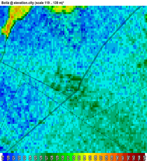
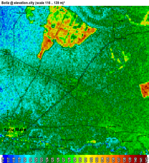
Below is the Elevation map of Botiz, which displays elevation range with different colors. Scale of the first map is from 119 to 139 m (390 to 456 ft) with average elevation of 123.4 meters (=405 ft) [note 1]
These maps also provides idea of topography and contour of this city, they are displayed at different zoom levels. More info about maps, scale and edge coordinates you can find below images.
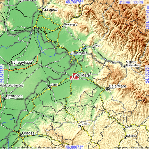
| \ | Map #1 | Map #2 | Topo.Map |
| Scale [m] | 119..139 m | 116..139 m | × |
| Scale [ft] | 390..456 ft | 381..456 ft | × |
| Average | 123.4 m = 405 ft | 123.9 m = 406 ft | × |
| Width | 6.56 km = 4.1 mi | 13.12 km = 8.2 mi | 209.9 km = 130.4 mi |
| Height | 6.56 km = 4.1 mi | 13.12 km = 8.2 mi | 209.9 km = 130.4 mi |
| ↑Max Latitude | 47.862822° | 47.892297° | 48.76875° |
| Latitude at center | 47.83333° | 47.83333° | 47.83333° |
| ↓Min Latitude | 47.803822° | 47.774296° | 46.88073° |
| ← Min Longitude | 22.906055° | 22.862109° | 21.54375° |
| Longitude center | 22.95° | 22.95° | 22.95° |
| →Max Longitude | 22.993945° | 23.037891° | 24.35625° |
Nearby cities:
Cities around Botiz sort by population:
• Satu Mare elevation 124 m
7.5 km,  239°
239°
• Livada 132 m
14.2 km,  74°
74°
• Lazuri 123 m
6.5 km,  286°
286°
• Odoreu 125 m
5.3 km,  134°
134°
• Vetiş 118 m
14.2 km,  254°
254°
• Păuleşti 123 m
6.1 km,  204°
204°
• Culciu Mic 126 m
9.7 km,  139°
139°
• Micula 125 m
7.4 km,  0°
0°
• Dorolţ 118 m
10.1 km,  280°
280°
• Drăgușeni 129 m
12.5 km,  49°
49°
• Agriș 127 m
6.6 km,  37°
37°
• Dumbrava 131 m
9.8 km,  82°
82°
Multilingual:
 En español:
Botiz elevación 128 m.
 En France:
Botiz élévation 128 m.


Sources and notes:
- [note 1] Map square and city borders are not equal. Map elevation data is calculated only from area inside that square.
- [src 1] Elevation data from geonames database provided with same terms of usage.
- [src 2] The elevation map of Botiz is generated using elevation data from NASA's 3 arcsec (90m) resolution SRTM data.
- [src 3] Base (background) map © OpenStreetMap contributors tiles are generated by Geofabrik and OpenTopoMap.
Copyright & License:
This Botiz Elevation Map is licensed under CC BY-SA. You may reuse any part from this page, if you give a proper credit by linking to this URL:
 More info on terms of use page.