Cartojani elevation
Cartojani (Giurgiu, Comuna Roata De Jos), Romania elevation is 117 meters and Cartojani elevation in feet is 384 ft above sea level [src 1]. Cartojani is a populated place (feature code) with elevation that is 135 meters (443 ft) smaller than average city elevation in Romania.
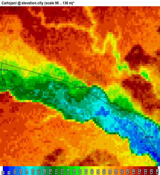
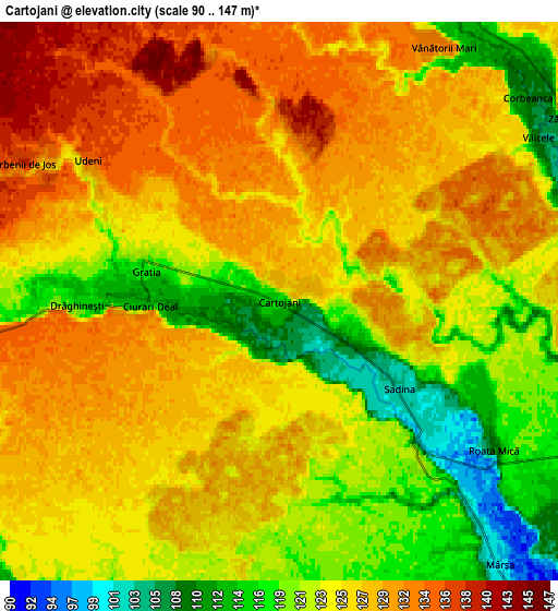
Below is the Elevation map of Cartojani, which displays elevation range with different colors. Scale of the first map is from 98 to 136 m (322 to 446 ft) with average elevation of 123.1 meters (=404 ft) [note 1]
These maps also provides idea of topography and contour of this city, they are displayed at different zoom levels. More info about maps, scale and edge coordinates you can find below images.
| \ | Map #1 | Map #2 | Topo.Map |
| Scale [m] | 98..136 m | 90..147 m | × |
| Scale [ft] | 322..446 ft | 295..482 ft | × |
| Average | 123.1 m = 404 ft | 125.1 m = 410 ft | × |
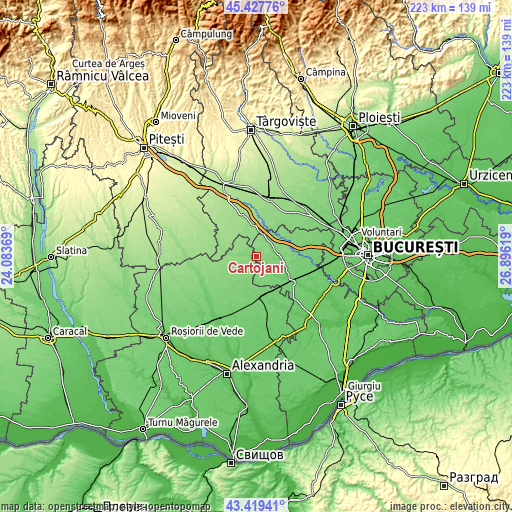
| Width | 6.98 km = 4.3 mi | 13.96 km = 8.7 mi | 223.3 km = 138.8 mi |
| Height | 6.98 km = 4.3 mi | 13.96 km = 8.7 mi | 223.3 km = 138.8 mi |
| ↑Max Latitude | 44.463582° | 44.494937° | 45.42776° |
| Latitude at center | 44.43221° | 44.43221° | 44.43221° |
| ↓Min Latitude | 44.400821° | 44.369415° | 43.41941° |
| ← Min Longitude | 25.445995° | 25.402049° | 24.08369° |
| Longitude center | 25.48994° | 25.48994° | 25.48994° |
| →Max Longitude | 25.533885° | 25.577831° | 26.89619° |
Nearby cities:
Cities around Cartojani sort by population:
• Roata de Jos elevation 107 m
4.9 km,  119°
119°
• Vânătorii Mici 112 m
8.5 km,  40°
40°
• Crevedia Mare 109 m
10.8 km,  91°
91°
• Siliştea 128 m
12.4 km,  243°
243°
• Gratia 115 m
3.2 km,  272°
272°
• Mârşa 99 m
8.4 km,  140°
140°
• Sârbeni 142 m
9.3 km,  294°
294°
• Vânătorii Mari 126 m
7.7 km,  34°
34°
• Sadina 103 m
3.9 km,  126°
126°
• Drăghinești 116 m
5.1 km, 268°
• Baciu 115 m
11.8 km,  197°
197°
• Purani 122 m
9.4 km,  213°
213°
Multilingual:
 En español:
Cartojani elevación 117 m.
 En France:
Cartojani élévation 117 m.
 Auf Deutsch:
Cartojani höhe über dem Meeresspiegel ist 117 m.

Sources and notes:
- [note 1] Map square and city borders are not equal. Map elevation data is calculated only from area inside that square.
- [src 1] Elevation data from geonames database provided with same terms of usage.
- [src 2] The elevation map of Cartojani is generated using elevation data from NASA's 3 arcsec (90m) resolution SRTM data.
- [src 3] Base (background) map © OpenStreetMap contributors tiles are generated by Geofabrik and OpenTopoMap.
Copyright & License:
This Cartojani Elevation Map is licensed under CC BY-SA. You may reuse any part from this page, if you give a proper credit by linking to this URL:
 More info on terms of use page.