Căzăneşti elevation
Căzăneşti (Ialomiţa, Oraş Cãzãneşti), Romania elevation is 36 meters and Căzăneşti elevation in feet is 118 ft above sea level [src 1]. Căzăneşti is a seat of a second-order administrative division (feature code) with elevation that is 216 meters (709 ft) smaller than average city elevation in Romania.
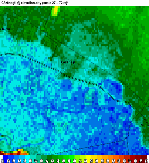
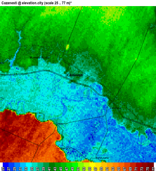
Below is the Elevation map of Căzăneşti, which displays elevation range with different colors. Scale of the first map is from 27 to 72 m (89 to 236 ft) with average elevation of 36.9 meters (=121 ft) [note 1]
These maps also provides idea of topography and contour of this city, they are displayed at different zoom levels. More info about maps, scale and edge coordinates you can find below images.
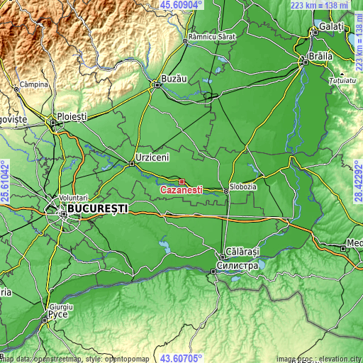
| \ | Map #1 | Map #2 | Topo.Map |
| Scale [m] | 27..72 m | 25..77 m | × |
| Scale [ft] | 89..236 ft | 82..253 ft | × |
| Average | 36.9 m = 121 ft | 43.4 m = 142 ft | × |
| Width | 6.96 km = 4.3 mi | 13.91 km = 8.6 mi | 222.6 km = 138.3 mi |
| Height | 6.96 km = 4.3 mi | 13.91 km = 8.6 mi | 222.6 km = 138.3 mi |
| ↑Max Latitude | 44.647943° | 44.679199° | 45.60904° |
| Latitude at center | 44.61667° | 44.61667° | 44.61667° |
| ↓Min Latitude | 44.58538° | 44.554074° | 43.60705° |
| ← Min Longitude | 26.972725° | 26.928779° | 25.61042° |
| Longitude center | 27.01667° | 27.01667° | 27.01667° |
| →Max Longitude | 27.060615° | 27.104561° | 28.42292° |
Nearby cities:
Cities around Căzăneşti sort by population:
• Munteni Buzău elevation 38 m
3.2 km,  305°
305°
• Cocora 49 m
13.2 km,  11°
11°
• Ciochina 34 m
5.4 km,  133°
133°
• Reviga 48 m
12.9 km,  30°
30°
• Albeşti 56 m
13.1 km,  135°
135°
• Sălcioara 62 m
14.1 km,  228°
228°
• Gheorghe Doja 37 m
13.5 km,  90°
90°
• Andrăşeşti 31 m
10.8 km,  121°
121°
• Sărățeni 45 m
7.4 km,  285°
285°
• Rași 66 m
11.6 km,  218°
218°
• Rovine 46 m
10.7 km, 34°
• Balaciu 38 m
10.7 km,  279°
279°
Multilingual:
 En español:
Căzăneşti elevación 36 m.
 En France:
Căzăneşti élévation 36 m.
 Auf Deutsch:
Căzăneşti höhe über dem Meeresspiegel ist 36 m.

Sources and notes:
- [note 1] Map square and city borders are not equal. Map elevation data is calculated only from area inside that square.
- [src 1] Elevation data from geonames database provided with same terms of usage.
- [src 2] The elevation map of Căzăneşti is generated using elevation data from NASA's 3 arcsec (90m) resolution SRTM data.
- [src 3] Base (background) map © OpenStreetMap contributors tiles are generated by Geofabrik and OpenTopoMap.
Copyright & License:
This Căzăneşti Elevation Map is licensed under CC BY-SA. You may reuse any part from this page, if you give a proper credit by linking to this URL:
 More info on terms of use page.