Câmpeni elevation
Câmpeni (Alba, Oraş Câmpeni), Romania elevation is 559 meters and Câmpeni elevation in feet is 1834 ft above sea level [src 1]. Câmpeni is a seat of a second-order administrative division (feature code) with elevation that is 307 meters (1007 ft) bigger than average city elevation in Romania.
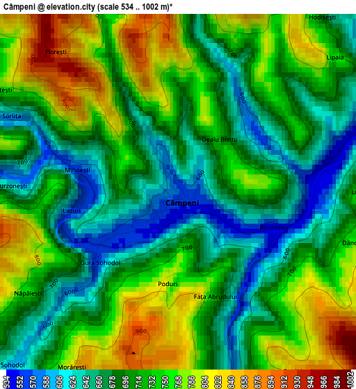
Below is the Elevation map of Câmpeni, which displays elevation range with different colors. Scale of the first map is from 534 to 1002 m (1752 to 3287 ft) with average elevation of 715.3 meters (=2347 ft) [note 1]
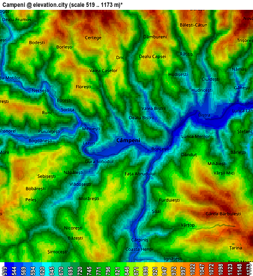
These maps also provides idea of topography and contour of this city, they are displayed at different zoom levels. More info about maps, scale and edge coordinates you can find below images.
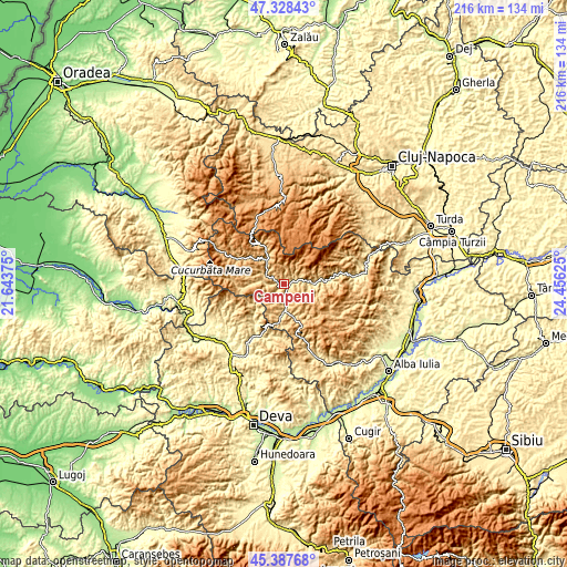
| \ | Map #1 | Map #2 | Topo.Map |
| Scale [m] | 534..1002 m | 519..1173 m | × |
| Scale [ft] | 1752..3287 ft | 1703..3848 ft | × |
| Average | 715.3 m = 2347 ft | 796.8 m = 2614 ft | × |
| Width | 6.74 km = 4.2 mi | 13.49 km = 8.4 mi | 215.8 km = 134.1 mi |
| Height | 6.74 km = 4.2 mi | 13.49 km = 8.4 mi | 215.8 km = 134.1 mi |
| ↑Max Latitude | 46.396986° | 46.427284° | 47.32843° |
| Latitude at center | 46.36667° | 46.36667° | 46.36667° |
| ↓Min Latitude | 46.336338° | 46.305988° | 45.38768° |
| ← Min Longitude | 23.006055° | 22.962109° | 21.64375° |
| Longitude center | 23.05° | 23.05° | 23.05° |
| →Max Longitude | 23.093945° | 23.137891° | 24.45625° |
Nearby cities:
Cities around Câmpeni sort by population:
• Abrud elevation 598 m
10.3 km,  174°
174°
• Bistra 545 m
4.1 km,  71°
71°
• Blideşti 1073 m
9.8 km,  139°
139°
• Lupşa 503 m
11.5 km,  90°
90°
• Albac 626 m
12.2 km,  321°
321°
• Sohodol 555 m
2 km,  232°
232°
• Roșia Montană 876 m
9.3 km, 136°
• Vadu Moţilor 705 m
7.4 km,  300°
300°
• Abrud-Sat 617 m
9.5 km, 174°
• Ciuruleasa 612 m
13 km,  185°
185°
• Poiana Vadului 873 m
13.3 km,  286°
286°
• Vidra 642 m
12.4 km,  270°
270°
Multilingual:
 En español:
Câmpeni elevación 559 m.
 En France:
Câmpeni élévation 559 m.


Sources and notes:
- [note 1] Map square and city borders are not equal. Map elevation data is calculated only from area inside that square.
- [src 1] Elevation data from geonames database provided with same terms of usage.
- [src 2] The elevation map of Câmpeni is generated using elevation data from NASA's 3 arcsec (90m) resolution SRTM data.
- [src 3] Base (background) map © OpenStreetMap contributors tiles are generated by Geofabrik and OpenTopoMap.
Copyright & License:
This Câmpeni Elevation Map is licensed under CC BY-SA. You may reuse any part from this page, if you give a proper credit by linking to this URL:
 More info on terms of use page.