Comăneşti elevation
Comăneşti (Bacău, Oraş Comãneşti), Romania elevation is 385 meters and Comăneşti elevation in feet is 1263 ft above sea level [src 1]. Comăneşti is a seat of a second-order administrative division (feature code) with elevation that is 133 meters (436 ft) bigger than average city elevation in Romania.
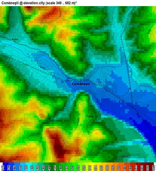
Below is the Elevation map of Comăneşti, which displays elevation range with different colors. Scale of the first map is from 349 to 682 m (1145 to 2238 ft) with average elevation of 468.4 meters (=1537 ft) [note 1]
These maps also provides idea of topography and contour of this city, they are displayed at different zoom levels. More info about maps, scale and edge coordinates you can find below images.
| \ | Map #1 | Map #2 | Topo.Map |
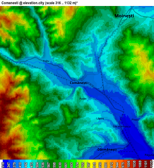
| Scale [m] | 349..682 m | 316..1132 m | × |
| Scale [ft] | 1145..2238 ft | 1037..3714 ft | × |
| Average | 468.4 m = 1537 ft | 572.3 m = 1878 ft | × |
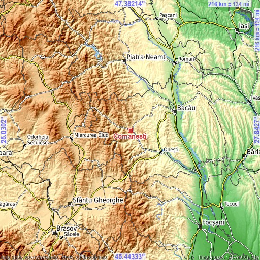
| Width | 6.74 km = 4.2 mi | 13.47 km = 8.4 mi | 215.6 km = 134 mi |
| Height | 6.74 km = 4.2 mi | 13.47 km = 8.4 mi | 215.6 km = 134 mi |
| ↑Max Latitude | 46.451635° | 46.481904° | 47.38214° |
| Latitude at center | 46.42135° | 46.42135° | 46.42135° |
| ↓Min Latitude | 46.391048° | 46.360729° | 45.44333° |
| ← Min Longitude | 26.392505° | 26.348559° | 25.0302° |
| Longitude center | 26.43645° | 26.43645° | 26.43645° |
| →Max Longitude | 26.480395° | 26.524341° | 27.8427° |
Nearby cities:
Cities around Comăneşti sort by population:
• Moineşti elevation 476 m
7.2 km,  33°
33°
• Dărmăneşti 347 m
7.1 km,  149°
149°
• Poduri 449 m
9 km,  55°
55°
• Asău 409 m
3.1 km,  295°
295°
• Vermești 409 m
3.1 km,  89°
89°
• Apa Asău 509 m
8.6 km,  329°
329°
• Lăpoș 443 m
3.7 km, 147°
• Straja 464 m
6 km,  290°
290°
• Valea Arinilor 459 m
10.2 km, 33°
• Valea Șoșii 409 m
9.8 km, 62°
• Plopu 368 m
6 km,  122°
122°
• Găzărie 400 m
9.8 km,  39°
39°
Multilingual:
 En español:
Comăneşti elevación 385 m.
 En France:
Comăneşti élévation 385 m.
 Auf Deutsch:
Comăneşti höhe über dem Meeresspiegel ist 385 m.

Sources and notes:
- [note 1] Map square and city borders are not equal. Map elevation data is calculated only from area inside that square.
- [src 1] Elevation data from geonames database provided with same terms of usage.
- [src 2] The elevation map of Comăneşti is generated using elevation data from NASA's 3 arcsec (90m) resolution SRTM data.
- [src 3] Base (background) map © OpenStreetMap contributors tiles are generated by Geofabrik and OpenTopoMap.
Copyright & License:
This Comăneşti Elevation Map is licensed under CC BY-SA. You may reuse any part from this page, if you give a proper credit by linking to this URL:
 More info on terms of use page.