Coşteiu elevation
Coşteiu (Timiş, Comuna Coşteiu), Romania elevation is 114 meters and Coşteiu elevation in feet is 374 ft above sea level [src 1]. Coşteiu is a seat of a second-order administrative division (feature code) with elevation that is 138 meters (453 ft) smaller than average city elevation in Romania.
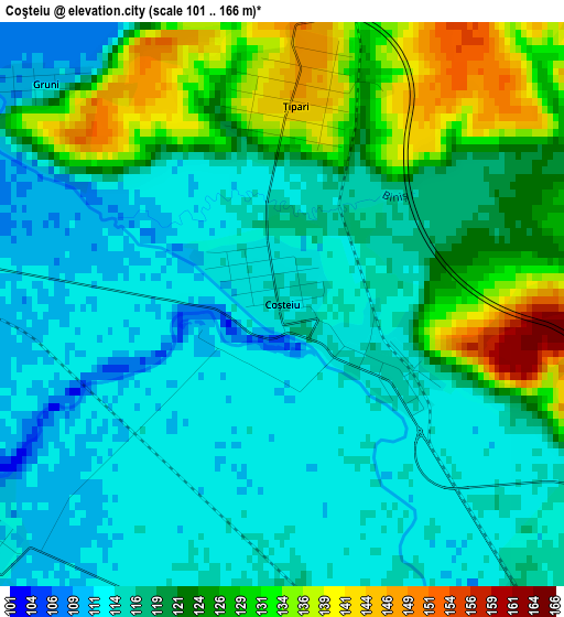
Below is the Elevation map of Coşteiu, which displays elevation range with different colors. Scale of the first map is from 101 to 166 m (331 to 545 ft) with average elevation of 119.6 meters (=392 ft) [note 1]
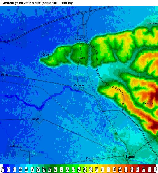
These maps also provides idea of topography and contour of this city, they are displayed at different zoom levels. More info about maps, scale and edge coordinates you can find below images.
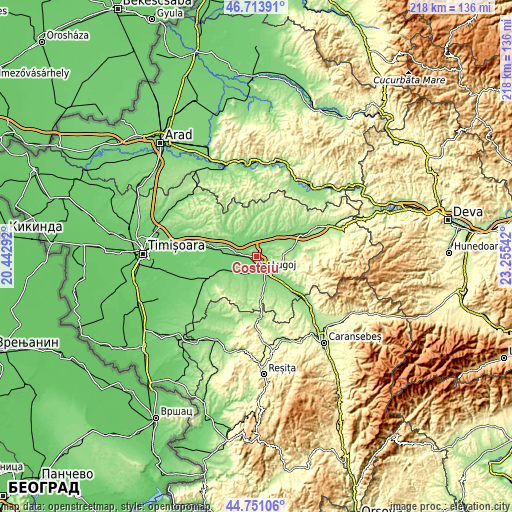
| \ | Map #1 | Map #2 | Topo.Map |
| Scale [m] | 101..166 m | 101..199 m | × |
| Scale [ft] | 331..545 ft | 331..653 ft | × |
| Average | 119.6 m = 392 ft | 120 m = 394 ft | × |
| Width | 6.82 km = 4.2 mi | 13.64 km = 8.5 mi | 218.2 km = 135.6 mi |
| Height | 6.82 km = 4.2 mi | 13.64 km = 8.5 mi | 218.2 km = 135.6 mi |
| ↑Max Latitude | 45.771771° | 45.802415° | 46.71391° |
| Latitude at center | 45.74111° | 45.74111° | 45.74111° |
| ↓Min Latitude | 45.710432° | 45.679737° | 44.75106° |
| ← Min Longitude | 21.805225° | 21.761279° | 20.44292° |
| Longitude center | 21.84917° | 21.84917° | 21.84917° |
| →Max Longitude | 21.893115° | 21.937061° | 23.25542° |
Nearby cities:
Cities around Coşteiu sort by population:
• Lugoj elevation 122 m
7.2 km,  144°
144°
• Darova Nouă 163 m
13.6 km,  208°
208°
• Belinţ 106 m
7.1 km,  282°
282°
• Bethausen 123 m
13 km,  38°
38°
• Victor Vlad Delamarina 139 m
11.7 km,  163°
163°
• Boldur 108 m
7.7 km,  227°
227°
• Balinţ 118 m
7.9 km,  2°
2°
• Bârna 213 m
15.8 km,  99°
99°
• Darova 156 m
12.5 km, 208°
• Ghizela 116 m
12.7 km,  316°
316°
• Bara 197 m
17.2 km,  5°
5°
• Secaş 167 m
16.2 km,  351°
351°
Multilingual:
 En español:
Coşteiu elevación 114 m.
 En France:
Coşteiu élévation 114 m.


Sources and notes:
- [note 1] Map square and city borders are not equal. Map elevation data is calculated only from area inside that square.
- [src 1] Elevation data from geonames database provided with same terms of usage.
- [src 2] The elevation map of Coşteiu is generated using elevation data from NASA's 3 arcsec (90m) resolution SRTM data.
- [src 3] Base (background) map © OpenStreetMap contributors tiles are generated by Geofabrik and OpenTopoMap.
Copyright & License:
This Coşteiu Elevation Map is licensed under CC BY-SA. You may reuse any part from this page, if you give a proper credit by linking to this URL:
 More info on terms of use page.